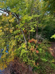
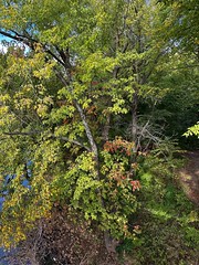
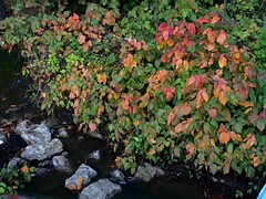
The weekend before Halloween 2011 was appropriately spent, with me spending much of Saturday visiting Neewollah up in Independence, KS with friends and then driving to Devil’s Den on Sunday. I first visited this state park in northwest Arkansas the prior November, hiking about seven miles on the main trails with a sweeping eastward view of the Lee Creek valley. For this trip I studied the various park trails and decided to concentrate on the “strenuous” Vista Point bridle trail with a brief side excursion on the Butterfield Hiking Trail to Quaill Valley.
I’m always leery of bridle trails since the animal waste and churned mud are annoying, but the Vista Point trail promised two lookouts and I recalled the panoramic view from Yellow Rock last year and hoped for something similar this time with more fall color. I found a trailhead where both hiking and bridle trails intersected the main road and gave Trixie the GPS the coordinates. We arrived around 11 a.m.
A big sign correctly warned that the many trails would be confusing without a map, a point immediately driven home when two joggers ran up from the highway asking directions. I showed them my maps and they headed off down the paved road while I perambulated up the gravel Holt Ridge road to pass the Butterfield Hiking Trail, which would periodically intersect or briefly join up with my trail throughout the day. That rare loop backpacking trail follows part of the route of the Butterfield Stage of 1858-1861.
But I ignored the blue diamond blazons of the Butterfield trail, instead seeking the far less conspicuous green horseshoe blazons of the Vista Point trail. The trail maps were unclear if the bridle trail followed the road itself or ran parallel to it and hiking the road was so fast I overshot my first target: the Holt Ridge Lookout. I turned off to parallel the road on a bridle trail, but an old sign wasn’t very helpful and I walked south along the ridge until I realized my mistake, clambered back up to the road and reversed course, then cut down again. This time I followed the bridle trails northward to where the trees finally thinned and I could see the Ellis Branch entering Lee Creek below. I shot a panorama and worked awhile to capture a shot of one of three turkey buzzards circling the area.
Then I circled back to follow the Vista Point blazons over to the east side of Holt Ridge. I saw a couple walking some yapping weiner dogs as I approached one of the old quarries where CCC boys extracted rock for the park buildings. I let the weiners run on ahead while I clambered about the boulder field of a very rough creek intersection. If there’d been water for the falls, it would have been quite nice. Resuming the trail, I descended to the edge of an 80-foot high bluff over Quaill Valley leading into the larger valley of Blackburn Creek.
Along the way I encountered two trail riders, one astride a mule and another a horse. I strode off-trail to give them clearance and they stopped to chat for a bit and then moseyed on towards the horse camp over in Lee Creek valley.
I stopped to pose at a dry streambed, wearing my orange vest in case of any happy hunters although I never heard a shot all day. My trail linked up with the Butterfield and I followed it over to the entrance to Quaill Valley. Here a large section of Mount Olive broke free and slid about 100 feet into the valley, forming a high bluff and immense rock chambers. I followed the Butterfield trail down into the valley and went over to the big bluff to give it some scale. A rock pile told of a past fall as I walked the rift, creating a hemispherical photosynth of my surroundings at a blockade.
I then climbed back up to the bridle trail, which made a rough climb so it could run along the edge of the bluff. A tree had grown up several stories from the floor below to where I could grasp a limb and make the entire tree rock back and forth. Farther along the bluff I plopped down at a scenic spot to enjoy my QuikTrip turkey sandwich.
Not much farther was the wide eponymous Vista Point itself, which was a disappointment since the trees below had grown so high they blocked the view of the Blackburn Creek valley. I saw few flowers along the trail all day except for asters. A break in the trees finally afforded a small panorama of the ridge beyond and in the far distance I could see the top of a house poking up out of the fall colors.
The trail turned into an old road and I passed tall trees on my trek circling Mount Olive back toward the car. A side road caught my eye and although Trixie did not know about it, my MotionX app’s terrain map showed it led down the mountainside all of the way to Blackburn Creek. That I wanted to see.
So I began the descent down the very rocky road. It was just as well that Trixie did not show the road, as it was thoroughly washed out in spots, although I was surprised to see two trucks back in the woods along the passable old roads this day.
I descended 440 feet to finally reach the creek bed where the drought had stilled its flow into large pools. I decided the long climb back out of this hole would be worthwhile as the creek bed was quite scenic. Downstream I found a large rock which resembled a bed, and stretched out on my bedrock to relax before climbing back up.
I then sweated my way back up to the road and followed it to Highway 74 where I followed a side trail past a memento left on a tree by a forest princess to what I presume were the foundation stones for the old Mount Olive School. Not wanting to return to the car quite yet, I followed the bridle trail back to the southwest to climb Mount Olive and then followed the Butterfield Trail back to the highway.
I’d stretched the trail out to a 10.5 mile hike with my little sidetrips and was ready to head home. Big I-540 shot me northward through the hills past Fayetteville and along Highway 412 into the setting sun.


Pingback: The Trails at Devil’s Den & Crystal Bridges « MEADOR.ORG
Pingback: 11 Miles at Pea Ridge « MEADOR.ORG