Cross Timbers

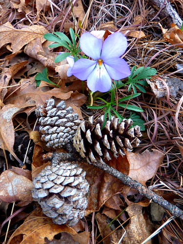
Cross Timbers (click image for slideshow)

I’ve lived all my life amidst the Cross Timbers, the boundary between the eastern forests and the treeless Great Plains. The coarse and sandy soil has limited nutrients and is covered in post oak and blackjack oak trees. Before modern clearing, prairie fires helped create a thick underbrush of grape vines and green briars amidst the stunted oaks, making the narrow band of timber a formidable barrier. Here is how Washington Irving described it in A Tour on the Prairies in 1835:

The Cross Timber is about forty miles in breadth, and stretches over a rough country of rolling hills, covered with scattered tracts of post-oak and black-jack; with some intervening valleys, which, at proper seasons, would afford good pasturage. It is very much cut up by deep ravines, which, in the rainy seasons, are the beds of temporary streams, tributary to the main rivers, and these are called “branches.” The whole tract may present a pleasant aspect in the fresh time of the year, when the ground is covered with herbage; when the trees are in their green leaf, and the glens are enlivened by running streams. Unfortunately, we entered it too late in the season The herbage was parched; the foliage of the scrubby forests was withered; the whole woodland prospect, as far as the eye could reach, had a brown and arid hue. The fires made on the prairies by the Indian hunters, had frequently penetrated these forests, sweeping in light transient flames along the dry grass, scorching and calcining the lower twigs and branches of the trees, and leaving them black and hard, so as to tear the flesh of man and horse that had to scramble through them. I shall not easily forget the mortal toil, and the vexations of flesh and spirit, that we underwent occasionally, in our wanderings through the Cross Timber. It was like struggling through forests of cast iron.

The Cross Timbers

We presume this timberland is called the Cross Timbers because it runs north and south while all of the major streams and rivers in the area flow west to east. So it was a band of timber to be crossed on your way between the great prairie grasslands and smaller grasslands bounding up against the eastern forests.

My elementary school years in Bethany, Oklahoma were on the western edge of the cross timbers. My parents and I were members of the aptly named Western Oaks Christian Church, and our own three-lot property had 70 trees growing in the sandy soil, almost all blackjacks. One was huge, but most of them were narrow with that distinctively dark blocky bark which could really scrape when you were trying to learn to ride a bicycle amidst them. I spent many hours playing with my friend Gene Freeman amidst immense piles of their leaves each fall.

My adult years in Bartlesville place me on the eastern edge of this timberland and today I ventured to its northern edge at Cross Timbers State Park on Toronto Lake in the Chautauqua Hills of southeastern Kansas, a two hour drive from my home. At the end of 2010 Betty Henderson and I trekked at Fall River Lake, only ten miles southwest. The three trails at Cross Timbers were far better, albeit more expensive since there was a $4.20 day use fee charged per vehicle. Sometimes you get what you pay for. It was a hot windy day reaching into the mid 80s, unusual weather for early April.

Oddly there is no good highway to the lake, so one veers north off US 400 on a narrow shoulderless asphalt road for nine miles, passing through the tiny burg of Coyville, which has fewer than 100 people. Eventually the road turns into the improved state highway 105 around the eastern and northern edges of the lake. The dam is on the southeast edge of the lake and I pulled in at nearby Woodson Cove to hike 1.3 miles on the Overlook Trail.

Overlook Trail

I was alone on the trail, although there were several fishermen on the shores of the lake. Right after the trailhead I was led down into a deep sandstone ravine. I could tell the lake was low as I climbed up to find the path covered in thick carpets of moss and lichen. Below me a fisherman and his buckets were on the shore of the inlet near Woodson Cove. Buckled sandstone plates were telltale indicators of the soil conditions creating this haven for scrub oaks.

I crossed a trashy ravine – no human pollution, thankfully, just forest remains. I was now on the far side of the inlet, and climbed to a headland to find a large driftwood tree. From one angle it resembled an immense wishbone, with its roots reminding of some alien skull on a garish scifi pulp magazine. Perhaps I was just hungry and delusional. Soon I was at the dam overlook, the mossy green trail providing a soft cushion to my footfalls. I loved the moss on the trails, although I’m most fond of long strands of moss hanging from trees. Throughout my childhood my folks had a vacation home on a high bluff above Table Rock Lake, and behind one of the homes there you could stroll among mossy trees to a magnificent lonely view of the lake. The silence hung heavily whenever I snuck over there and I shall always remember the eerie beauty of dusk amongst those trees.

The Crumbling Wall?

Back on the Overlook Trail, I was now at the far end of the initial ravine, although in my mind I was still a teenager amongst the mossy trees of Table Rock. A sandstone bluff in the here and now caught my attention, shifting my imagination to the Clue in the Crumbling Wall and The Mystery at the Moss-Covered Mansion. But unlike Nancy Drew I don’t have titian hair, nor much hair up top for that matter, and there also weren’t any clues or treasures other than nature’s little presents like the tiny flowers strewn hither and thither. Yes, as a child I read Nancy Drew after I’d exhausted all of the Hardy Boys books…and Trixie Belden and the Dana Girls and The Three Investigators and…well, anything I could get my hands on.

Soon I was driving to the northeast edge of the lake, turning off south to Toronto Point just before entering Toronto itself, a run-down little town of less than 300 souls. But the internet reports the air is clean and its cost of living is 34% lower than the national average and, best of all, it has a nice lake with good trails.

I had ignored warning signs at Woodson Cove about needing a day use permit since there was no pay station down there and it was so isolated. But Toronto Point has campgrounds, ball courts, and more. And it has a manned pay station where a nice lady gave me a small paper permit to tape onto my car windshield. Nearby was a stone marker and sign for the Doyle “Bud” Niemeyer memorial, adjacent to the Ancient Trees trailhead. In 1982 scientists from the University of Arkansas Tree-Ring Lab analyzed 26 post oaks in this area, and the 1.2 mile trail winds among 14 of the old growth trees.

Ancient Trees Trail

Tree Dating Back to 1740

The first old-growth remnant dated back to 1751. The redbuds above me and tiny delicate flowers below me were far more attractive, however. I circled around to a mossy ledge overlooking the exposed mud and drowned trees of the bottomland, exposed by the dry weather. I passed another old dead tree, dating back to 1752, then the decaying stump of another dating back to 1727. I was beginning to wonder if any old growth trees were still living when I came across a large healthy specimen dating back to 1740.

A small bluff provided a shelter where someone had built a fire, and I shot a panorama of the driftwood-strewn bottomland. I squeezed past of troop of girls on the trail, who were listening intently to a leader whose words I could not catch. I spied an odd-looking combination of a fallen tree and its straight-branching supporter, and decided to pose. The lake finally was visible, with trees sticking out of the low water. The driftwood-strewn shore lifted toward some trees, with at least one welcoming the spring.

Next to the trees was a picnic table where I enjoyed the berry bread turkey sandwich I’d bought at QuikTrip in Bartlesville and the last of a fizzy Orange Fresca. Later on the hike, I’d have to choke down a warm G2 Fruit Punch drink and vowed to only pack water next time. On my return to the car I would see layers of redbud branches above, conjoined twins beside the trail, and finish with a beautiful isolated redbud tree.

Chautauqua Hills Trail

It was time to tackle the big trail nearby. The Chautauqua Hills hiking and biking trail circumnavigates a long inlet stream with shorter blue and yellow segments connecting to a red segment which can stretch a hike to 11 miles. I knew I would not venture all the way over to Coyote Road for the 11 mile stretch, but figured I would do all of the blue and yellow segments and much of the red, turning about at the final loop. That worked out to a 7.1 mile hike.

A long bridge was made unnecessary by the low water with the trail heading northeast, the stump-filled inlet on my right. I forded streams, admiring some sculpted sandstone crossing slabs. Mossy steps led up to a grassland area with telephone poles and trees on the horizon. The trail re-entered the woods and the inlet had narrowed to an active stream. I saw a large tree felled by beavers and examined their toothwork. I forded the stream at the far northeast corner of the park, and began moving down the other side of the inlet stream. Soon it was cutting quite prettily through sandstone beds and the trail would rise to high bluffs.

Golden Grass

Then it veered to cross grass which glowed a golden orange against the dark Cross Timber trees in the background. The mown sections of this trail were somewhat reminiscent of the less attractive Casner Creek trail at Fall River Lake. I had passed the end of the yellow segment and was on the less travelled red segment, choosing to follow the side edging toward the inlet. Here the trail faded out and I wandered down the shoreline, spotting the trail bridge across the way which I had traversed earlier.

This section of trail would punish me a bit for wearing shorts on this hot day, but thankfully no ticks were yet out. Amidst all of the bark and mud, the few tiny flowers were bright and welcoming. Finally I could see the open choppy waters of the lake beside me and ventured down to the rocky shore. Spiders were everywhere, scuttling across the rocks out of sight wherever I trod. Clearly I would not be sitting down here to relax! Even the driftwood had spiders crawling about it, but they did not venture near the splashing water.

Toronto Lake

Turkey vultures were riding the wind gusts as I climbed up at an opening in the rocky shore back up to the trail. A roll of barbed wire on a nearby fence made it clear I was at the edge of the park as I strolled back along the red trail. I ventured across the prairie, following the trail ruts over the gentle slopes. Soon I was returning shore of the inlet, passing a tree losing its bark and posing on a stone stranded in the dry streambed.

I reached the stump-strewn inlet, with a couple of fishermen braving the stumps and the troop of girls I’d passed on the Ancient Trees trails were over here now launching inflatable boats.

I’d trekked 9.6 miles in the heat and eagerly drove into Toronto, hoping to step into a convenience store for a cold drink. But the town was too small, so I set out for home and by the time I reached Independence I was eager for a dipped cone at the Dairy Queen, but it was closed for remodeling. Thankfully there was a Braum’s ice cream store nearby which offered a restorative chocolate shake. I’m tired of the bare trees and soil of winter and it was strange to see more of the same in the blustery heat of this spring day. We need more April showers for May flowers.

Click here for a slideshow from this day hike

Posted in day hike, photos, travel | Leave a comment

Paying for Digital Ink

The ink-stained wretches must be paid. The shift of classified ads to craigslist and the lower revenues of online advertising make a free online newspaper unsustainable with the level of reporting I demand. I skim four papers each day: the Tulsa World, the New York Times, and USA Today each morning on the iPad and the print edition of Bartlesville’s Examiner-Enterprise in the evening. My morning reads have been free for several years, but that came to an end this month.

New York Times

The Gray Lady went behind a paywall this week. She wants $260 per year for iPad and website access or $450 per year for full digital access. That’s way too high for the use I make of the paper, and I wasn’t tempted by their half-off price for the first half-year to registered online users like me. And they only allow you to view 20 articles per month for free on their website.

But there are still decent workarounds. They give you free access to selected top stories on their iPad app. And they still offer Twitter feeds for their sections – and you can read articles through those tweets for free. So I subsribed to the nytimestech twitter feed on my iPad’s Flipboard app. So I still have free access…for now.

USA Today & The Daily

USA Today has very lightweight stories, but I do skim them on the iPad after I’ve exhausted the few I can see on the New York Times workarounds and the wire stories in the Tulsa World. But if USA Today ever costs me money, I’ll drop it. Similarly, I took advantage of two free weeks of the new The Daily newspaper on the iPad, but it was as lightweight as USA Today and far more cumbersome to browse.

Tulsa World

For years I subscribed to the daily print edition of this decent regional paper, later switching to the Thursday through Sunday Weekender package. But once I could view the stories easily online at tulsaworld.com and, even better, with mobile.tulsaworld.com on my iPad and iPhone, I cancelled the subscription. No more papers to recycle or throw away, no more ink-stained hands, just a quick scan of headlines and a dive into what interested me. They have a fancy e-edition replica with fancy navigation, but I prefer the quick links and text of their mobile website.

But they’ve now switched to a parsimonious 10 free online articles per month, and I read their paper far more than the New York Times. The Tulsa World has a variety of new digital subscription plans. Notably the only digital plan cheaper than a printed-paper-with-online-access plan is subscribing to the daily edition on a Kindle device (not a Kindle app on an iPhone or iPad, etc.) for $9/month. I tried it out for a few days via their 14-day free trial, but the daily Kindle edition wasn’t published by my morning reading time of 6:10 a.m. and browsing through stories was slow, although not as cumbersome as I had feared.

I could have paid $12/month for the Sunday print edition and received full digital access with that, but I did not want to waste more paper, gas, and ink on a huge Sunday paper I would skim and then toss. So I bit the bullet and paid for a year of full digital access for $15/month or $180 for the year. I presume the cheapest full-digital-only plan costs 25% more than full-digital-with-a-Sunday-printed-paper because they are trying to preserve their print technology and delivery infrastructure’s economies of scale. But paying more for less is annoying.

Examiner-Enterprise

The little local Examiner-Enterprise is similarly weighted toward its print option, making you pay extra for digital access and pay more for digital-only than for a printed paper. But it is so clueless that its webpage has only one subscription ad buried in its outdated design. Worse, the ad just gives you a form to print out, fill in by hand, and send in by snail mail…or you can telephone them. Welcome to the 20th century!

So I still get a printed Examiner-Enterprise each day (albeit there is no Saturday paper) and paid extra for access to their digital edition. I only use that option for two things. First, when I stop the paper for a vacation I no longer ask them to send me an accumulated stack of papers, instead browsing the digital replicas. Second, I sometimes capture the digital version of a story for my archives rather than clipping the printed page.

There are only two reasons I still get the E-E in print form. First, an elderly neighbor asked me to save up the papers each week and give them to her so she can scan the obituaries and old stories. Second, their website is terrible and their e-editions too cumbersome. When those reasons go away, I’ll pay extra if needed to get rid of the print version – I’d much rather skim news stories on the iPad, just as I’d rather read books on my Kindle.

I hope each of these newspapers survives the transition to the digital world, but I do wish they would make the transition easier and less punitive. Reading a newspaper is as dated as dialing a phone and taping a show.

Posted in technology, web link | Leave a comment

Over Winding Stair Mountain

On Winding Stair Mountain (click image for slideshow)

On the first Sunday of April 2011 I awoke at the Best Western Traders Inn in Poteau, had a quick continental breakfast, and drove over to Talimena State Park for a 6.6 mile loop hike across the western end of Winding Stair Mountain. This miles-long ridge in the Ouachita mountains extends east-west across LeFlore county with the Talimena Skyline Drive, Oklahoma Highway 1, riding the ridgeline.

Tiny Talimena State Park is just south of the western terminus of the Skyline Drive. I parked at the trailhead at 8 a.m., noting I was at Mile 0 of the 223 mile-long Ouachita Trail, which I’ve hiked at Queen Wilhelmina State Park in Arkansas and encountered at the Haw Creek Falls. I would take it, marked by its blue blazes, for the first two miles, then turn north onto the Old Military Road trail, thus avoiding the less-than-inviting “Dead Man Gap” eight miles in.

The old military wagon road was built in 1832 by army soldiers to connect Fort Smith in Arkansas to Fort Towson in what is now Oklahoma. They were paid about 15 cents per day with a gill, or half cup, of whiskey for their troubles. But we can’t feel too sorry for them – the tragedy of the road was its use in the forced relocation of the Choctaw Indians from Mississippi. There were almost 20,000 Choctaw before removal, of which 12,500 moved to Indian Territory while 2,500 died along their Trail of Tears with five or six thousand remaining in Mississippi. In the Civil War the road was used by the Confederacy, which controlled Fort Towson. Parts of the road, such as the remnant here on Winding Stair Mountain, remain in use but most of it is gone.

Small flowers decorated the path here and there as I passed the white tree blazes for the Old Military Road Trail. A small campsite was perched above a deep creek ravine. Up on the other side of the ravine the trees cleared to provide a vista looking southwest. I could tell the trail was ascending to the ridgeline, and soon I was crossing the Talimena Skyline Drive to the Old Military Road historical pullout. I’ve driven over the zebra stripes here many times, little suspecting I was crossing a wagon road dating back to 1832. The trail thus far was merely a trail, but on the north side of the Skyline Drive I would find the old military roadbed still intact with several long rock walls.

Historical signs gave information about the old military road and the origins of the Skyline Drive, and there were two more permanent historical markers from 1959 and 1975. On the north side of the ridgeline the trail was quite different, being wider with rock retaining walls and you could envisage wagons winding their way down the mountain. The walls were in surprisingly good shape, making me wonder how much repair work must have been done. Looking beyond a splash of dogwood I could see the rock walls of the roadbed winding their way onward. A turn in the road had a stream culvert, followed by a very pretty section of road strewn with pine cones amidst little flowers.

I then reached where the Choctaw Nation Trail joins the military road, heading north and east to Holson Valley. I turned east here so the Choctaw Nation Trail, formerly called the Indian Nation Trail, would take me south back up over the mountain so I could return to the park. The trees still carry the yellow blazes of the Indian Nation Trail, but now there are orange signs noting its new name. After a section of trail with a half dozen zigs and zags of switchbacks, I reached the ridgeline and recrossed the Talimena Skyline Drive, which has no trailhead parking or signage for the Choctaw Nation Trail. EveryTrail would later tell me that I’d ascended 400 feet to cross the Skyline Drive on the Old Military Road, then descended over 300 feet before ascending back up 600 feet to cross the Skyline Drive on the Choctaw Nation Trail at an altitude of 1700 feet since the Winding Stair Mountain rises as it runs eastward from the park. A black butterfly posed for me as I descended the mountain.

I reached another small campsite and gratefully sat on a log for an early lunch. A bit farther I reached the first of several intersections with the Ouachita Trail, sticking with the Choctaw Nation Trail with its occasional flower. A burned tree looked like it was a victim of a killer contrail in the background. Soon I reached a forest road where the Choctaw Nation Trail turned east while I would turn west back toward Talimena State Park. As I reached the park, a sign about the big Knuckle Rock in the trail indicated mountain bikers had found a fun spot. I never saw another hiker on this warm Sunday morning.

I washed up and changed my shirt and shoes for the drive home. I opted to take scenic Highway 82 north to Stigler, admiring the sweeping views. Stopping for a late lunch at El Chico, I was well fortified for an afternoon of laundry and blogging. Some day I may return to hike more of the Old Military Road trail north from the Skyline Drive to Holson Valley in my continuing quest to seek out all of the best trails of the region.

I’m indebted to Charlie Williams’s OuachitaMaps.com for making this loop known to me. He has a fantastic collection of GPS-based hiking maps you can view online and order in rainproof printed versions.

Click here to view this hike at EveryTrail

Click here for a slideshow from this day hike

Posted in day hike, photos, travel | 1 Comment

Bushwhack at Coon Creek Lake

Spring Flowers at Coon Creek Lake (click image for slideshow)

April opened with a sunny weekend, but I had a job fair to work at until 1 p.m. on Saturday. So once that was wrapped up I headed south, stopping in at the Spaghetti Warehouse in Tulsa for a late lunch and then driving down to Robbers Cave State Park.

The main goal of this trip is to hike on the Old Military Road trail in the Ouachitas across the Talimena Skyline Drive. But driving 3.5 hours out and back plus a long hike in the mountains was too much for a Sunday. So I booked a hotel room in Poteau and headed down to Robbers Cave to squeeze in a hike in the remains of the day, for a short drive the next morning to Talimena State Park.

I’ve hiked all of the main trails at Robbers Cave, but the park is circumnavigated by a multi-use trail and on my latest trip there I’d visited the tiny CCC lake on Coon Creek but had not visited the larger Coon Creek Lake I’d spotted below the cabins in the south end of the park. I knew I did not have time to hike all of the way around it and back up to the Belle Star Lodge, so despite temperatures in the low 80s which had me wearing a wicking T-shirt, I wore jeans for some inevitable bushwhacking.

I located a gravel road leading to the lake, parking before spotting the lake and hoofing it back out to the highway so I could cross to the other side of Coon Creek and attempt to locate the multi-use trail with its distinctive multi-color blazes. Rather than walk a long ways down the shoulderless highway until I found the trail crossing, I opted to bushwhack uphill and go cross country until I intersected the trail.

The steep climb was the first real test of one of my new trekking poles. I had purchased two Swiss Gear poles with cork handles and flip-up lights for $34 in June 2009. The poles were fine, although I never made use of the somewhat annoying lights, which I had thought might be useful if I were out on a trail at dusk. But I liked the cork handles and shock absorbing spring. However, one had to extend and then twist the telescoping poles to lock them and, as I’d been warned online, they sometimes malfunctioned and had to be wormed about to work again. So I wanted to try something else in new poles.

One of my cheap poles snapped on my latest sojourn at Petit Jean State Park, so it was time to invest in something better. I read reviews online and opted for Leki Corklite Aergon trekking poles with speed locks. They are quite light, have cork handles but no shock absorber, and when you extend a telescoping pole you just snap a plastic lock to tighten, much like quick release nuts on a bicycle. These suckers set me back $120, so I sure hoped they worked. I took along one pole today and it worked well, being noticeably lighter than the old Swiss Gears. The snow baskets fell off my Swiss Gears soon after their first use, while the ones on the Lekis are tight. But the baskets make it impossible to slip the pole through a belt loop for portage, so I’ll probably strip them off.

500 miles of trails since June 2009 had worn out my hiking boots, so I purchased some on sale at the Bass Pro Shop a couple of weeks ago. They had worked fine on an 8 mile loop on the Pathfinder Parkway, and they were comfortable although I suspect they look more clunky than my old pair. Most importantly, they offered a sure grip on the rocks today as I forded Coon Creek.

So I was sporting new trail interfaces as I bushwhacked through the woods until I stumbled across the multi-use trail. This section is barely used, so the blazes were faint and trees had grown up in the trail bed, making one very dependent on the frequent, if faded, blazes to follow the trail. Eventually it joined with the yellow bridle trail and became clearer.

I followed it around until I spied Coon Creek Lake below. I knew I had limited time and needed to find a way to ford Coon Creek to bushwhack back to the car, so I did not pause long but followed the multi-use trail’s high path above the lake’s eastern shore until I saw the lake had petered out into a stretch of Coon Creek above the big lake but below the small CCC lake I’d visited previously. I then bushwhacked down to the creek and happily found an easy ford of large boulders.

Bushwhacking uphill quickly brought me to a narrow forest road which allowed me to head back down the other side of the creek back toward the lake. I had heard two fellows chattering across the water earlier on the hike and soon heard them below me, near an abandoned cable mechanism of some sort. It carried something out and over the water at some point, but now is a rusted heap. But I did get a shot of some rusted ratchets and a pawl, reminding me of the rusty trike I found on the Elk River trail up in Kansas.

I then bushwhacked along the brushy lake shore until I reached the main road and followed it past a group fishing out on pier in the lake. Above me I heard voices and spotted the cabins I’d visited last time, perched high above the lake. While the park’s Lake Carlton is fully developed with facilities, its large Lake Wayne Wallace has few facilities, as does Coon Creek Lake.

I walked across the rock-and-earth dam to get a panorama of the lake, with red buds providing splashes of color in the trees and low flowers signifying spring and attracting the attention of insects as well as mammals like me.

As I walked back toward the entrance to the lake area, I passed a marker which indicated that Coon Creek Lake was constructed in 1964 as the Fourche Maline Creek Watershed Project’s Floodwater Retention Lake Number 4. And I thought Coon Creek Lake was being pretty literal – the bureaucrats did it one better.

The sun was getting lower in the sky as I walked toward the car around 7 p.m. and sure enough, a park ranger waved as he drove into the area, preparing to shoo everyone out of this day use area.

I was tired but happy as I drove over to Poteau. I bought a couple of albums by jazz pianist Ramsey Lewis last week, and was listening to his version of Delilah, with its somber bookends, as I headed eastward for some junky fast food at Myers Drive-In, a former Sonic which looks a bit worn and says it is five years younger than me. Well, even though I only hiked 2.8 miles today, it had started for me with insomnia at 4 a.m. and I looked a bit worn out myself. I was glad to check in at the hotel for a shower and some blogging.

Up and at ‘em early tomorrow, hopefully, for a warm hike looping about a mountain on the Talimena Skyline Drive.

Click here for a slideshow from this day hike

Posted in day hike, photos, travel | Leave a comment

Beware Broadband Ripoffs

We used to rent our phones...

My students would likely be shocked, but for years most Americans had only AT&T or “Ma Bell” for telephone service, and one thing the monopoly required was that you use only their telephones on the lines. And I mean that literally – we had telephones manufactured by Ma Bell’s own Western Electric company, and they were never sold to customers. Instead we paid monthly lease charges for them. I remember what an innovation it was when we could pay to get Trimline push-button phones to replace the old dial sets.

Eventually you had a push-button option...

The lease charges over the years meant we were paying for the telephone multiple times over, with millions of extra dollars going to the phone company monopoly. Supposedly this helped subsidize basic phone service and kept its price low, with the same excuse given for the high long-distance charges of that era.

But by the early 1980s all that changed. The Bell monopoly was broken up by governmental decree and consumers could buy any phone they liked and hook it up to the network. My parents bought their Trimline phones outright and used them for some time before replacing them with more modern units. But, distressingly enough, many people never did shuck their rental phones and to this day some consumers are still paying ridiculous monthly lease charges for an ancient Western Electric phone, over 25 years after that became a silly thing to do.

AT&T of course does not bother to remind these people they are wasting money. Consumers have to learn that companies do not serve customers’ interests, but exist to provide shareholder returns and generate profits. So AT&T keeps renting telephones and has also been known to leave unaware customers for years on woefully outdated long-distance calling plans which are ridiculously overpriced compared to not only their competitors but also to AT&Ts own newer plans.

I considered myself a savvier consumer who would not fall prey to such schemes. I subscribe to the online version of Consumer Reports, I keep up with technological changes and innovations, I don’t buy warranty extensions and upgrades already covered by my credit card, etc. But I recently discovered I was acting a bit like a poor old grandpa still renting his telephone. The culprit wasn’t the telephone company this time – it was the cable company.

Long-time readers know that I cut off my cable television service at the start of 2008. But I retained high-speed internet service, paying $53/month to CableOne for a 5 megabit/second download speed rather than the cheaper and slower 3 megabit/second service. I merrily paid my cable bill each month, presuming that their standard charge was $53/month for 5 megabit/second service. But then I was listening to a technology podcast and they mentioned that 10 megabit/second service is fairly common these days.

I was paying full price for half speed...

Hmm…I wondered how much CableOne charged for that level of service. So I went to their website and was surprised to see that they consider a 5 megabit/second download speed their “Standard” service these days, pricing it at $49/month. And they offer their “Premium” 10 megabit/second service for $53/month. What? I’m paying $53/month and getting half the speed (and lower download caps, etc.) that other customers receive?

It was the monopoly game once again – they of course never bothered to tell me I was paying too much for too little. So I called the cable company and politely inquired about this issue. They made no fuss, but also offered no apology, and promptly upgraded me from the old 5 Mbps “Residential Plus” service at $53/month to the new 10 Mbps “Premium” service for the same price.

After they tweaked my settings, I rebooted my cable modem and ran speed tests at speedtest.net and dslreports.com and confirmed that my download broadband throughput had indeed doubled, and the upload throughput was way up too. Now there is less excuse for stuttering streaming video and I can download more data without being throttled back for hitting their daily download cap. But for lord-knows-how-long I was paying full price for half speed, and that burns.

So check your own cable or DSL internet bill against what the company offers for regular customers online (not first-time subscriber or bundled plans, but the regular charges). You may find you are on an older plan and thus being gouged compared to later customers. If so, call up the company and politely demand to be upgraded. And please don’t make the call on a rented Western Electric phone.

Posted in technology | 4 Comments