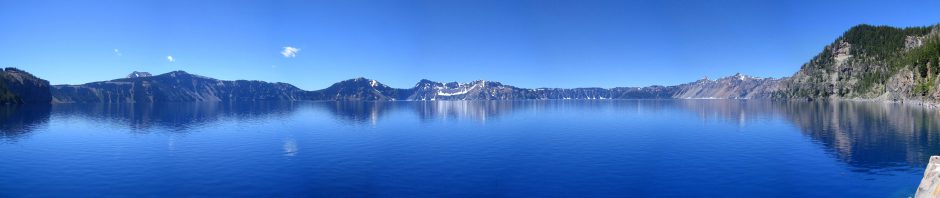
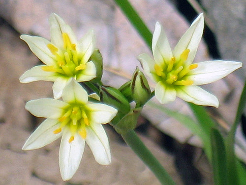
Click image for slideshow
I took a short hike on a sunny, warm, and windy Easter Sunday afternoon along the Skull Hollow Nature Trail at the Hawthorn Bluffs area off Oologah Lake.
Click image for slideshow
I took a short hike on a sunny, warm, and windy Easter Sunday afternoon along the Skull Hollow Nature Trail at the Hawthorn Bluffs area off Oologah Lake.
Here’s a new video of the iPad from PC Magazine, and they’ve posted a full review as well.
I haven’t pre-ordered a unit as of yet – I’ve been waiting for reviewers to get their hands on them. But the more I see videos of this thing, the more excited I become. I’ve been waiting for an instant-on large-scale web browser I can carry about the house and on the road, and while my netbook comes close, it lacks the simplicity and elegance of the iPad. That touchscreen interface is so much better than my netbook’s scroll pad and cursor keys. While the iPad’s lack of Adobe Flash support is irksome, it will support YouTube and now there is news that Netflix will likely offer its Watch Instantly service as an iPad app.
I’ll be waiting for the WiFi+3G version of the iPad that debuts in about a month. I want to be able to take the unit out on the road, given my proclivity for day hikes. I’ll either buy the 32 GB or 64 GB version…and that means about $800 or more to get the unit and accessories. I’m glad I sold off a bunch a books to Powell’s last month and am on the verge of selling off my CD collection. I’ll need every penny.
Apple never could get me to buy a Mac, as my workday is in the Windows world and Macs are so pricey compared to Windows PCs. I’m quite happy with my Windows 7 netbook for blogging on the road and I use my Windows 7 desktop for much of my web browsing and productivity work. But in addition to novels I read a bunch of long-form web articles these days, which I save via Instapaper. I haven’t found the ideal hardware for that – each of my current options has its drawbacks:
Trade-Offs When Reading Long-Form Web Articles
The iPad offers Apple’s elegant fit-and-finish and superior interface design at a price I can just barely afford, and I’m intrigued by its simplified instant-on nature. It will be interesting to see how it overlaps with the functionality of my netbook, iPhone, and Kindle. With a Kindle app on the iPad, it may render my Kindle obsolete unless the electronic ink on the Kindle is still much easier on my eyes than the iPad’s display. And I don’t know how feasible it will be to use the iPad on my trips – can I easily upload my photos to it, edit them, and post them to Flickr and simultaneously compose a blog entry? I doubt it, so I’ll probably still rely on my netbook for that sort of functionality. And the iPad may feel too big to carry into restaurants and the like. But I am certain it will revolutionize my around-the-house web surfing.
[4/4/2010 UPDATE: The reviews and another road trip where I used my iPhone and netbook without ever opening the cover of my Kindle convinced me to pre-order the 64 GB 3G version along with a camera adapter, case, and dock. That will set me back almost $1,000.]
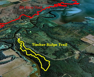
Click image for a slideshow
Today I hiked my last new trail at Elk City Lake, the Timber Ridge trail west of the lake at the Card Creek area. The 2.3 mile trail loops along a north-south ridge and offers views westward over Card Creek, which feeds into the Elk River. You can see my previous route along the Elk River Trail in my Google Earth map of today’s hike.
The trees were still bare and this hike offered only a few short bluffs compared to the long chain of impressive bluffs along the Elk River Trail. I did spot one unusual rock shaped like a scoop, and posed in group of trees where the blue trail blaze was evident. Eventually the trail wound around to a high rocky observation point providing a panoramic view of Card Creek. Turkey vultures flew by from time to time across a cloudy sky punctuated with the occasional sunburst.
The trail was too short to satisfy my hiking urge for the day, so I drove around to the east side of the lake, hoping to hike part of the Table Mound Trail, but the Scenic Overlook was gated off and I didn’t feel like paying a day use fee to hike for an hour or so at the open campground. So I drove over to Independence, KS to revisit my childhood.
My family spent Thanksgiving in Independence most years and made regular visits to relatives there. So in the late 1960s and early 1970s I often visited the Ralph Mitchell Zoo at Riverside Park in Independence. My strongest memories were of the lion statues at the park entrances, how the adjoining cemetery had a stone fence that seemed to go on forever, and climbing up and down steep steps into a hollow where they had cages built into the sides of the hollow with big cats and other large mammals.
I’ve visited the zoo a couple of times since I moved to Bartlesville in 1989, and today I relocated most of the memorable childhood elements. It was a bit depressing, however, since the Zoo is not the thriving establishment it was back in my youth. Back in the day it had lions, leopards, pumas, and crocodiles when meat was a cheap food source and there few federal restrictions. Today it has mainly small animals, many of which are grazers. The park’s depression-era lion statues are still there and, like the buffalo statues around Bartlesville, have anatomically correct testicles if you view them from the wrong end. I was discreet and shot the mane end instead and drove over to the zoo.
There I found good old Santa Fe Engine Number 1050 and Monkey Island. The island was the birthplace in 1952 of Miss Able, a rhesus monkey who in 1959 was shot 300 miles into space on the nose of a Jupiter rocket at a speed of 10,000 miles per hour. But in my youth the island had spider monkeys and these days capuchins roam the 1932 castle and lounge in its windows. The moat featured a swan which eagerly swam after me hoping in vain for a treat.
A nearby pond had a fountain with swans and African geese. There were a few other animals on display, including a sad little donkey. But when I strode down the trail into the hollow I found its cages, heavily reworked years ago, sitting vacant. And at the end of the hollow I found those steep stone steps leading up into Kiddy Land. They were steep even for my adult legs – no wonder they stuck in my memory as a little boy.
Now that I’ve completed all of the hiking trails at Elk City I will be back on the prowl for new trails to traverse. In a couple of months school will be out and I expect I’ll be spending a week in Arkansas on that quest, although before then I may try for a day hike at Greenleaf State Park near Muskogee, which is only a two hour drive from home and has an Ankle Express Trail that sounds promising.
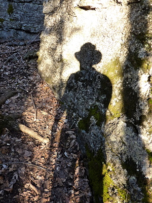
Click image for the photos
Today was my last day hike of Spring Break, as the forecast says we’ll have several inches of snow on the first official day of spring. How rude!
This day, however, was the sunniest and warmest of the break and perfect for a day hike. I set off to Elk City Lake, which I reminisced about in an earlier post when I discovered the Table Mound Trail along the eastern shore of the lake. Well, there is another incredible trail there which also carries National Recreation Trail honors – the 15-mile Elk River Trail. It runs from the western end of the dam along the northern shore of the lake and then along the bluffs above the north bank of the Elk River all the way over to highway 160 near the eponymous Elk City.
This trail was so long it took me three afternoons to finish it via three looping round trips from its three trailheads. I hiked the eastern three miles on February 27, the western four miles on March 7, and finished off the central section today in my longest day hike to date. The entire trail is most impressive, zipping up and down the magnificent limestone bluffs, but I confess I found the two ends the most enjoyable. Today’s central section had few unique features, although it was an enjoyable slog.
I drove to the trailhead at the never-finished Oak Ridge Day Use Area and set out rather late – it was 2:15 pm. Even with the recent transition to Daylight Savings Time, that meant I would need to be quick about things today to get it done in the light. There would be no snack breaks or long photo sessions on this hike.
The central trailhead is the most obscure and the log book bore that out – no one had signed it over the past month, although no doubt others had been there and not bothered to register. I scrawled my signature and headed east to finish out the big section of trail there back towards the lake. I passed one family camping out and finally reached where I’d been on my first hike on the trail back on Feb. 27, which turned out to be 5.91 miles from the central trailhead. I then wheeled about and retraced my steps. Passing the family’s campsite, one inquired how far I’d gone. When I said I’d gone six miles from the trailhead and was now going back out six miles, they commented on how I must be in splendid shape. I was too vain to point out that I compensate for my long day hikes with abominable eating habits, and too modest to inform them that 12 miles would not be my stopping point this day.
You see, when I’d turned around on my hike from the west end on March 7, I had not yet reached that central trailhead. And on an aerial map it looked like a small gap to be closed. I wanted to be able to honestly say I’d walked every bit of the trail – twice. So I tramped on past my car westward, only to discover to my chagrin that the trail wound about quite a bit, making it another 1.33 miles to fully close that gap. I had quickened my pace as sunset was approaching, so when I encountered two adult scouting-types on the trail they seemed rather startled to see me traipsing quickly by. Soon I found their associated camp of youngsters, who were quite polite but then one blurted that I wasn’t supposed to see them. So I don’t know if their campout was against some rule or other, but it certainly didn’t bother me. I had a gap to close and the light was fading.
Finally I closed the gap and could wheel about again and return to the car. The youngsters politely cheered me on as I zipped by in the dusk towards my car. I managed to reach it at 7:45 pm before the light was gone, although the sun had set ten minutes earlier. My feet cried out since this was the longest day hike I’d ever taken. My prior record was about 13 miles at Eagle Creek in Oregon in 6.75 hours last July, whereas today I’d made 14.5 miles in 5.5 hours. Whew! I really let my iPhone GPS flog me onward today to ensure I hiked the whole trail. And they say technology makes us lazy!
Here are the slideshows from each of my Eagle River Trail hikes:
Eastern Section, 3.10 miles (6.2 miles round trip), 2/27/2010
Western Section, 4.18 miles (8.36 miles round trip), 3/7/2010
Central Section, 7.25 miles (14.5 miles round trip), 3/18/2010