In my previous post I discussed GPS enhancements for my day hikes. I’ve now built three fly-throughs of recent hikes, with linked photos, in Google Earth. The results are very nice, but it takes more time and effort than I would prefer. I decided to try out some new GPS hiking apps on my iPhone 4 and see what nifty things I could make with them. At the same time, I would try adding geolocation data to the photos I took with my regular camera with two different GPX file sync programs.
 MotionX
Up to now, I’ve always used MotionX GPS. It has many features and I’ve gotten used to its quirks, but it does have some drawbacks. Its photo placemarks are not integrated with its tracks, and its user interface is needlessly complicated and noisy. I especially dislike how I have to manually rename tracks and its method for pre-downloading map tiles is quite cumbersome.
Today it was unusually warm and windy for the end of the calendar year, with a high temperature of 71 degrees Fahrenheit and winds of over 20 miles per hour. I decided to try out some new hiking apps while on a day hike with fellow science teacher Betty Henderson at Fall River Lake in southeastern Kansas.
I drove north into Kansas, picked up Betty in Caney, and we drove on northward to Fall River Lake to hike the Casner Creek, Post Oak, Catclaw, and Bluestem Trails. I knew the scenery would be subdued and thus it was a great time to try the new iPhone hiking apps: EveryTrail Pro and AccuTerra Unlimited.
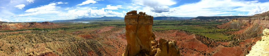
 Using EveryTrail Pro on Casner Creek
We first drove over to the Fredonia Bay area, paid the day use fee, and took the Casner Creek trail loop, which winds 1.5 miles across a grassland. It was not a pretty hiking area this time of year, but I used the EveryTrail Pro app to track our progress and periodically hit the camera button on its tracking screen to take a representative photo. At some places I also composed a shot with my “real” camera.
A few days beforehand I had taken the time to download the terrain maps in the app for the area since I suspected there would be no data service out at the lake. That was indeed the case, but I was disappointed to find that I had to zoom pretty far out on the app’s map to see the terrain map I had previously downloaded – so far out that it wasn’t of much use.
At the end of the day I reviewed the track and the photos linked to it, adding a caption to each one and then telling it to upload everything to the EveryTrail website. That went fine until I hit the first photo upload and the app gave me an “Out of RAM” error. Later I tried again, probably not having my TomTom GPS navigation app running this time, and the photos uploaded successfully.
 What I like about EveryTrail Pro is the map it creates on its website using the track and photos you upload. It defaults to an interactive Google map satellite view of the hiking track with photo placemarks which the map automagically scrolls through, popping up the image matching each placemark. You can change to other types of maps, zoom around, and so forth. You can scroll along the photo thumbnails below the map to see where they are on the route and click them to see a larger image. A “statistics” button shows you an elevation and speed graph in a window you can relocate, and if you scroll along the graph you see the corresponding points on the track. You can download the map to Google Earth and also export a GPX file. All very nice and, best of all, very automated!
 Using AccuTerra Unlimited on the Post Oak, Catclaw, and Bluestem Trails
Betty and I then drove over to the lake for some shots, had a sandwich lunch, and set out on the linked trails in the Quarry Bay area northeast of the dam. This time I tracked our progress with the AccuTerra Unlimited app, snapping photos along the way with the iPhone’s camera app, since I had not noticed a camera icon in the AccuTerra app. It turns out you have to “Track” button on the screen to get the Camera button to appear for photos. So none of the photos I took along the way created placemarks in the AccuTerra app. So I wound up only testing its tracking feature, not its ability to create photo placemarks.
I had also pre-loaded terrain maps in this app beforehand, being careful to download both the larger-scale and smaller-scale versions for the lake area. This app did show a more useful terrain map during the hike, although it doesn’t represent your progress as a tracking line but instead shows a series of placement dots as you go around. When you are done it shows a regular tracking line.
This app has less intuitive controls – I’ve already mentioned how it doesn’t show a camera icon on the tracking map, and after the hike I had trouble finding out how to access my stored track. I discovered you hit “Map View” and then pick “Library” to see your saved track. It has a “walking tour” that recreates your path, but it doesn’t seem to have an interrupt, so it makes you sit through the entire trip, which is annoying. I emailed the track to myself, which sent me a temporary link (good for a month) to view the hike with Google Maps in my browser. That gave me a map which I could then easily export to Google Earth via a KMZ file.
Using the Generated Tracks
 I loaded the GPX file from EveryTrail Pro and the KMZ file from AccuTerra Unlimited (via Google Maps) into Google Earth, where I created my typical sort of static trail map. So either app could generate the same sort of data I’ve previously extracted from the MotionX app. I then downloaded the pictures from my “real” camera so I could try adding geolocation data to them using the GPX and KMZ files from today’s hikes.
 I first tried using the GeoSetter program to sync my own photos to the GPX file info created by EveryTrail Pro, but although it said it found the GPS data, it did not write it into the picture files. That program is so complicated I may have had something set wrong. It had no luck at all with the data from AccuTerra Unlimited. The KMZ and KML files I exported from Google Earth did not work, nor did a GPX file I created using a free KML-to-GPX conversion utility I found online.
![]() A friend from my grade school days, Dale Blue, had indicated via Facebook that he uses the GPicSync program to sync photos with GPS tracks, so I downloaded that program. Once I got the UTC time code set right, it worked great with the GPX file generated by EveryTrail pro, not only inserting coordinates into the pictures but also creating a nice Google Earth track with linked photo placemarks. That’s great, although the placemarks did not have the proper photo links for use on a website. It would still take a lot of manual work to post a photo tour. And GPicSync also had no luck with the files I had created from the AccuTerra Pro app’s data.
A friend from my grade school days, Dale Blue, had indicated via Facebook that he uses the GPicSync program to sync photos with GPS tracks, so I downloaded that program. Once I got the UTC time code set right, it worked great with the GPX file generated by EveryTrail pro, not only inserting coordinates into the pictures but also creating a nice Google Earth track with linked photo placemarks. That’s great, although the placemarks did not have the proper photo links for use on a website. It would still take a lot of manual work to post a photo tour. And GPicSync also had no luck with the files I had created from the AccuTerra Pro app’s data.
My Verdict
Even though I liked its terrain map better during the hike, I’m not going to bother with the AccuTerra Unlimited app since the data I got from it was far less useful. I am impressed with EveryTrail Pro, however, for how it generates an interactive Google Map with photo placemarks and speed/elevation graphs. That’s definitely more than MotionX can do at this point, and I’m going to try out EveryTrail Pro some more and see if I can improve its terrain mapping or just live with it. And I’ll use EveryTrail Pro’s GPX files with GPicSync to add geolocation data to the photos I take with my regular camera.
THE WINNERS:
EveryTrail Pro for its easy creation of interactive trail maps
GPicSync for adding geolocation data to existing photos![]()


Pingback: Warm and Windy Day at Fall River Lake « MEADOR.ORG
Have you been able to test more the every trail app? i have accuterra and have been a little disappointed lately. Thanks for the input.
Yes, I’ve used EveryTrail on some more hikes. Take a look with this link:
http://www.everytrail.com/profile.php?user_id=244458
While my iPhone pictures linked at EveryTrail don’t hold a candle to the edited ones taken with my Panasonic Lumix camera, they do show the locations and I still like the online trail map and more which the EveryTrail app generates.
I still prefer the interface, maps, and audio progress indicator on the MotionX GPS app, but only EveryTrail generates such a nice online summary.