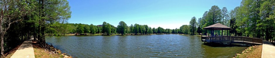

Lake McMurtry (click image for slideshow)
It was a sunny spring Saturday and, having been cooped up the previous weekend with rain and a facility planning project, I was looking for a new and dry place to hike. Rain chances in the area were 20% or more, worsening to the east and south. So I consulted my Oklahoma Hiking Trails book and found that Lake McMurtry, eight miles northwest of Stillwater, had a number of hiking and biking trails maintained by a local bike club, the Red Dirt Pedalers. Nearby Lake Carl Blackwell is larger and also has trails, but they are primarily equestrian and bikes leave far fewer droppings. And the rain chance was only 10% out that way. So a little after noon I pulled up at the ranger station on the west side of the lake, which has two of the four lake trails, paid the $6 day use fee, and followed the ranger’s advice that the orange trail was more challenging and scenic than the blue trail.
At the trailhead there was one trail biker gearing up. The weather was sunny 70s with a breeze so he was in the usual tight biking outfit and the “helmit” the sign “reccomended” for bikers, while I had on old black jeans, a wicking T-shirt, and my Tilley hat. I doused my calves, boots, socks, pant cuffs, and arms liberally with Cutter Backwoods insect repellent since I knew ticks were out and about. Backwoods Off is easier to find in stores around here, but Consumer Reports had tipped me off to the superior Cutter product. Cutter isn’t as greasy as Backwoods Off, works well, and has no strong scent. I also put some sunblock on since I’d be out for several hours to complete the 7.6 mile hike. I got started before the biker, but of course I soon heard him wheeling up behind me and stepped aside to let him pass, exchanging greetings and good wishes.
Soon I had a nice view of one of the large inlets on the west side of the lake. Traipsing northward, I startled a turtle into retreating into his mobile home. The entire trail was well maintained and marked with both signposts, quarter-mile markers, and ribbons. Thankfully it has several large loops so you don’t have to run over your own tracks too much. The area was more wooded than I had thought it might be, although the soil was sandy and the landscape rolled gently along with occasional steeper creek runs. The trail ran by a few primitive campsites with limited access and views of the lake and then followed a gravel road for a bit to cross an inlet.
For the first couple of hours I heard steady gunshots from a gun range just west of the lake. I was grateful when the shooters eventually gave up and allowed the landscape to quiet down. When the trail turned east toward the lake from the gravel road, I skirted the edge of a rough grassy meadow and saw the biker had already completed the main loop and was heading back my way. Through the day I would be passed by four or five more bikers and one runner, and most of them looked like cowboys. OSU college student Cowboys, that is.
The trail ducked back into the trees and then ran along the shore of the inlet I’d skirted earlier. I passed what looked like a tree blasted and burned by lightning and reached the tip of a peninsula, with a strong breeze blowing southwest across the lake to cool me down. The rocks along the shore were nicely eroded and the breeze was welcome.
I was shooting with my new Panasonic Lumix DMC-ZS10 camera, an upgrade from my ZS3. The zoom has increased to 16x, the megapixels to 14, the colors are more saturated, and the camera’s speed is noticeably better. But the real attractions were the built-in GPS and having a new camera without a scratched screen or the light smudge that had started appearing in the ZS3’s photos. I left the camera’s GPS running throughout the hike and did not notice much battery drain. It takes awhile for any device to get a GPS lock, so I’ll leave the camera’s GPS running when I know I’ll be shooting multiple photos. It was great having GPS coordinates already in the photos when uploading them to Flickr – that will save me oodles of time for future posts. I stuck with using the Everytrail app on my iPhone to track and upload my trip to the web for an interactive map with iPhone photos.
I wanted to check out the movie mode, so I shot a mossy rock in the water which the waves had brought to life. I then paused for a snack and managed to tip my sealed Diet Crush bottle over and watched it roll off the rocky bank down into the water below. Drat! I managed to fish it out and dry it off, only to be disappointed by the taste. Ew, I’ll stick with regular Crush from now on. So when the bottle tipped over again, uncapped this time, and poured orange soda across the rock, I let it flow and shot a video of its progress.
It was time to move on, and I walked north up the peninsula on the well-marked trail. Here and there were tiny blue flowers amidst the grass. The trail made a fun switchback along a stream and a portion resembled a toboggan run. The trail finally began to loop back southward and I came across the remains of an old automobile beside the trail with seats reduced to springs. It looked like it had been driven right into the ground. Soon I was back at the trailhead.
My TomTom GPS app had led me past the Stillwater airport on the way over from Bartlesville, but for the return trip routed me west then north up to Perry, where I stopped to see its CCC Lake.


Pingback: A Loop at Lake Carl Blackwell « MEADOR.ORG
Glad I found your posts! I belong to a ladies hiking group, The Ok Hiker Chicks, and your blog as been helpful. We’ve hiked Roman Nose, Witchitas, Lake Thunderbird. A great in town hike is Stinchcomb and we’ve done that one several times. I’m heading to either Carl Backwell or Lake McMurtry Tom to check it out for the rest of the ladies. Thanks gain or posting!
(I also se the Ok Hiking Trails book)