October 19, 2012
The second day of Fall Break I awoke in Maumelle after a rough night of heartburn, feeling a tad queasy at breakfast. I suspected the pizza I’d had the previous night did not agree with me and I might be paying for it later in the day.
Rocky Valley Trail

Pinnacle Mountain (click image for slideshow)
But I felt well enough to drive over to Pinnacle Mountain State Park and hike the Rocky Valley Trail and take the East Quarry spur off of it to form a 3.5 mile hike. My first stop, adjacent to the parking lot, was an overlook of the Arkansas River. I could see Pinnacle Mountain bulging up to the east, with a bird flying overhead.
While at the viewpoint two older gentlemen from Great Britain walked up, saying this was their last day of a two-week stay in Arkansas, tramping about “without the wives”. I asked if they had been to Petit Jean, my favorite Arkansas park, and they had and they waxed enthusiastically over the Clinton Presidential Library in Little Rock and about a wonderful couple they had met in Hot Springs who had been married 64 years and were still active.
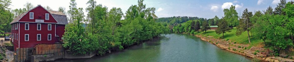
After our chat we parted with them heading to the parking lot, I believe, while I set off down the Rocky Valley Trail. Adjacent to me was a large abandoned quarry, with a pool below outfitted with paddleboats. This was where sandstone was quarried in the 1960s for the McClelland-Kerr Arkansas River Navigation System.
East Quarry Trail

East Quarry Trail Overlook
The trail wandered down to the Maumelle River and I took the East Quarry spur over to the other abandoned quarry. It had some large prickly pear cacti and I walked along the rock face a bit and then climbed up it to another river overlook with a sweeping view of the Maumelle River to the left about to merge with the wide Arkansas to the right. I could see Pinnacle Mountain above the Maumelle as well.
I followed a trail along the top of the quarry ridge to the H.L. Dickinson Overlook, crafted by the Pine Bluff Sand & Gravel Company when it donated the 40-acre quarry site to the state in 1975. I had a nice view of Pinnacle Mountain and other smaller peaks. I wandered on along the quarry ridge to where the trail ended at a warning sign to proceed no farther.
Backtracking I passed a tree decked in autumn red leaves and peered down a crack in one set of boulders to find a cache of quartz crystals. I returned to finish the Rocky Valley Trail loop, passing a butterfly along the way. I sidetracked to follow an old road to the top of the West Quarry.
Back at the parking lot I found the eastern terminus of the 223-mile Ouachita Trail. I have previously hiked a bit of its western terminus at Talimena State Park over in Oklahoma and five miles of it from Queen Wilhelmina State Park to the Oklahoma-Arkansas border. But today I wanted to climb to the top of Pinnacle Mountain, so I left the Ouachita Trailhead behind and drove a few miles west to the West Summit Trail.
West Summit Trail

Atop Pinnacle Mountain
The West Summit Trail climbed 750 feet to the top of Pinnacle Mountain and the sign isn’t kidding when it warned the trail is steep and strenuous. There is an even more challenging East Summit Trail, which is steeper and requires hands-and-feet scrambling, versus the upright walking along the western slope.
My stomach was churning, my muscles ached, and I knew I would be facing a rough night with what was likely minor food poisoning. But I made this trip specifically so I could climb Pinnacle Mountain, and felt I could make it up the West Summit Trail and return along it this afternoon before my symptoms worsened, likely preventing me from hiking the following day.
The trail soon became a long series of stone stairs, only occasionally interrupted by uphill gravel slopes. Along the way the vista south opened up for a view of what I term Antenna Ridge, festooned with communication towers. The trail became much rougher with large uneven boulders. I crossed a boulder field and the trail grew even steeper.
My aches and rumbles kept my pace down and I was amused at younger folks scrambling past until an elderly gentleman with amazingly youthful-looking and firm legs, displayed by immodest biking shorts, zipped by me. He complimented my hiking poles, saying they were the best out there, and then hurried on up. I would see him descend and re-ascend the mountain several times on my journey, which was a humbling experience.
I finally reached the summit, a long ridge of boulders with hikers gazing out in all directions. Pinnacle Mountain is an uplift of Jackfork Sandstone, exposed by 275 million years of erosion. It is a peak along a miles-long ridge running east-west, a lower portion of which I’d followed on the Rocky Valley Trail earlier in the day. I had a magnificent view of Lake Maumelle to the north with the Arkansas River winding past to the east. The eastern slope of Pinnacle Mountain was a major source of rock when they built the Lake Maumelle Dam back in the 1950s.
A party ahead of me on the ridge had a young African American lady who became lost in peals of laughter, much to everyone’s amusement. I think she was probably nervous from the treacherous climb and imposing view, but she was a good sport about it. On the far end of the ledge a woman was seated, gazing out eastward across the terrain. The buildings of Little Rock peeked out above one of the distant ridges.
I posed on top of the mountain and then made my way back down, pausing above a boulder field for another shot of Lake Maumelle and later grabbing a shot of a caterpillar along the trailside. By the time I’d finished the 1.5 mile round trip I was more than ready to head back to my hotel.
As predicted, what followed was a very rough 18 hours of gastroenteritis. I would not be fit to leave the hotel until 2 p.m. the following afternoon, when I would head out to see the Arkansas Art Center and Riverfront Market area in downtown Little Rock.
Click here for a slideshow from this day hike


