Rough Canyon Reflections

Lake Carlton (click image for slideshow)

A year ago I first hiked Rough Canyon at Robbers Cave and opted to return after being confined to the Pathfinder Parkway by rain the previous two weekends. I reached the cave area by 10:45 a.m. and opted to reverse my prior route, heading toward the canyon alongside Wicked Fork Creek (Fourche Maline). Soon I was climbing the hillside, following the blue blazes until I reached the tiny canyon. I clambered down by a small waterfall for lunch on a moss-covered slab, enjoying the peaceful surroundings after a hectic week of meetings and much guided study at school.

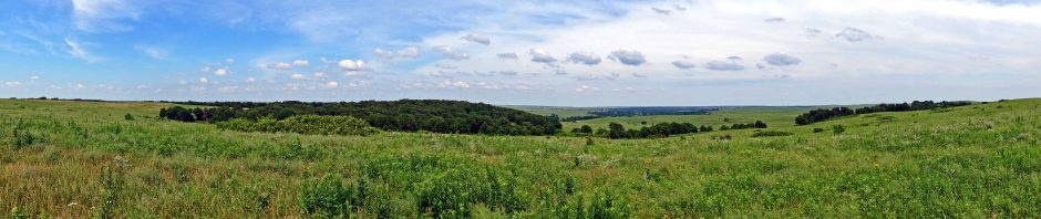
Then I ventured on along the side of the canyon, pausing now and then to clamber down for a better view of the creek bed. Tumbled boulders earned the little canyon its name and I was even glad for the recent rains since they had nourished the pools. I stopped for a self-portrait and found a leaf bowl in the stream, passing more beauty spots and then reaching higher side walls which prompted me to shoot a panorama and note the reflections.

I soon reached the junction with the Cattail Pond Trail and took that loop. The pond was still and quiet. I found the trail turn just past the dam was still overgrown and hard to locate; one had to keep a sharp eye out for the double blue blazes. As I approached the canyon I bushwhacked a bit, as I did the last time I was on this part of the loop, finally returning to ford the creek atop a stone slab.

I looped myself on the Rough Canyon Trail for a bit and then followed the blue blazes past the Cattail Pond turnoff I’d taken previously to head onward to Lost Lake. As happened a year ago, a great blue heron flapped away as I approached, with me unable to capture it in my camera.

It wasn’t long before I was back at the cave area, which for once had few visitors milling about. I took a shot of a tree or two or three rising amidst the stones. As I passed the Devil’s Slide I saw a family negotiating the challenge. Better them than me!

I’d hiked 5.5 miles and still had a few hours of daylight left. So I drove to the other end of the park so I could hike up the mountain trail from the Deep Ford camping area northwards to Lake Carlton. After ascending the mountainside the mountain trail turns right but a road, marked with a blaze of a white ring and orange dots encircling a tree, led left. I decided to take the road less travelled and found it soon curved and made a beeline for the park boundary. When it reached the barbed wire fence it turned north and paralleled the boundary down into a ravine. On the other side the road was gone, but the blazes continued. So I struggled up the hillside, pausing repeatedly to locate the next blaze and head for it.

It was a steep climb to the crest of the mountain and there were stone formations which resembled little building foundations. I was now much higher than the other side of the Fourche Maline valley, but the trees only provided a filtered view. I came across what more resembled a walking club than a walking stick, propped up against one blazed tree. I could see Lake Carlton below and, glancing at my watch, decided it was time to head back. Rather than repeat my course I decided I’d bushwhack down the steep mountainside until I reached the park’s mountain trail somewhere below me. The next time I visit the park I need to stop in and get a bridle trail map so I can continue my explorations. I wish they’d post the darn things online…maybe I can find one someone has posted.

The descent was fun although made more difficult since I’d abandoned my trekking poles after carrying them, but not using them, on the first long hike. I hoped I would not encounter any bad bluffs and there was only one spot where the leaf-covered hillside was so steep I had to just plant my butt down and slide. Some briers caught my left hand a bit, but the slide was successful. When I got home I noticed my jeans gave evidence of my supine hiking method and required some extra scrubbing.

I finally found the mountain trail running along the lake shore and returned southward. The reflections on the lake were gorgeous, particularly with the curving invisible dam over which the water flows. Across the way a campsite was being flipped over and duplicated. I walked around the inlet for the southwest ravine I’d crossed earlier on the boundary trail, startling a murder of crows who complained loudly as I noted how the reflections of the trees were more beautiful than the trees themselves. I wanted to dive into that beautiful world below.

The park restaurant was doubled by the calm clear lake and the trail led down to the dam, which was creating a huge perfect mirror. The last time I saw such startling reflections was at Crater Lake in Oregon back in 2006, so I was very glad I had made this outing. I wrapped up the 2.7 mile loop and set course for dinner in McAlester.

Although it was tempting to stop at Pete’s Place in Krebs for an Italian meal, I knew the immense portions meant leftovers I could not take with me. So I dined at the Patrón Mexican Grill, seated by a disrobing woman who refused to look at me. The moon was low in the sky and deep orange as I left town but my attempt to zoom in only yielded a blurry image.

As I passed through Tulsa I saw huge columns of vapor rising from the refineries on both sides of the highway, prompting me to drive over to Southwest Boulevard and walk out on the 11th Street Bridge platform to view the vapors, which reminded me of the pits of Isengard. HollyFrontier now owns what were once the Sunoco and Sinclair refineries and I drove over to the Sinclair for a better view of its flare, for which my video cannot do justice.

Winter Break arrives in a week-and-a-half, and I’m hopeful the weather will allow me to hike at Tom Steed Reservoir in the Wichita Mountains. I’d like to get 16 miles in before New Year’s so I can again break the 300 mile mark in day hikes for this calendar year.

Click here for a slideshow from this day hike

Posted in day hike, photos, travel | Leave a comment

Waiting For That Day

Davenport Cemetery (click image for slideshow)

Today was miserably overcast and windy – thoroughly uninviting for a day hike on my return home from Thanksgiving. I decided to shun the turnpike and get my kicks on Route 66 from OKC to Tulsa. As I was approaching Davenport a line of trees beside the road drew my eye into the local cemetery where tombstones led over to a lovely stone chapel which was built in 1939 by the WPA.

After some Tulsa entertainment I was heading home when the iPhone shuffled up an old song by George Michael in his more reflective solo phase before the worst of his scandals. I’m always a sucker for songs about lost love, and Waiting For That Day is a favorite. I thoroughly enjoy his mashup of the chords and rhythm from the Rolling Stones’ You Can’t Always Get What You Want with the often-sampled Funky Drummer. This was George’s first single to not break the top ten in the U.S., but it’s a top song for me.

So every day I see you in some other face
They crack a smile, talk awhile
And try to take your place
Oh my memory serves me far too well

I just sit here on this mountain thinking to myself
You’re a fool boy
Why don’t you go down
Find somebody
Find somebody else
My memory serves me far too well

It’s not as though we just broke up
It’s not as though it was yesterday, yeah
But something I just can’t explain
Something in me needs this pain
I know I’ll never see your face again

Oo oo oo
Oo oo oo now
C’mon now

Oo oo oo
Oo oo oo
I’ve got to be strong now

Now everybody’s talking about this new decade
Like you say the magic numbers
Then just say goodbye to
The stupid mistakes you made
Oh my memory serves me far too well

Don’t you know that
The years will come and go
Some of us will change our lives
Some of us still have nothing to show
Nothing baby, nothing baby
But memories, but memories

And if these wounds
They are self-inflicted
I don’t really know
How my poor heart could have protected me
But if I have to carry this pain
If you will not share the blame
I deserve to see your face again

Oo oo oo
Oo oo oo now
C’mon now
Oo oo oo
Oo oo oo
You don’t have to be so strong now
Come back, come back, come back, come back
Come back, come back, come back

Oh, come back to me darling
I will make it worth your while
Come on back to your baby
I miss your kiss
I miss your smile
Seems to me the peace I search to find there
Ain’t going to be mine until you say you will
Don’t you keep me waiting for that day
Oo oo oo
Oo oo oo now
I know, I know, I know
You hear these words that I say
Oo oo oo
Oo oo oo now

I know, I know, I know

You can’t always get what you want
Oh, come back, come back, come back
Come back, come back, come back

I also very much like Waiting (Reprise) which speaks pretty clearly about George’s inner turmoil at the time.

There ain’t no point in moving on
‘Til you’ve got somewhere to go
And the road that I have walked upon
Well it filled my pockets
And emptied out my soul

All those insecurities
That have held me down for so long
I can’t say I’ve found a cure for these
But at least I know them
So they’re not so strong

You look for your dreams in heaven
But what the hell are you supposed to do
When they come true?

Well there’s one year of my life in these songs
And some of them are about you
Now I know there’s no way I can right those wrongs
Believe me
I would not lie, you’ve hurt my pride
And I guess there’s a road without you

But you once said
There’s a way back for every man
So here I am
Don’t people change,
Here I am
Is it too late to try again,
Here I am

Don’t wait too long, lest you be buried with your feelings.

Posted in music, photos, video | 2 Comments

The National Weather Center and Lake Dirtybird

National Weather Center (click image for slideshow)

Thursday’s Thanksgiving 2011 would be at my folks’ in Oklahoma City, so I searched for a nearby trail I could hike before arriving Wednesday evening, when I would be taking them out for a much-belated dinner to celebrate their 50th wedding anniversary.

I lived in Norman, just south of Oklahoma City, from 1984 to 1988 while I earned my bachelor’s degree at the University of Oklahoma. While there I had driven out to Lake Thunderbird, but I’d never spent any meaningful time there. We always called it Lake Dirtybird because the red dirt in this cross timbers area of the state makes the water anything but clear, and I only noticed at the time that the lake was often packed with jet skis and boats plying the muddy waters. My Oklahoma Hiking Trails book showed that one could rack up plenty of miles on the Clear Bay bike trails on the southeastern shore of the lake.

I mentioned this destination on Facebook and Daphne Thompson, who as Daphne Fontenot was a student in my physics course way back when I first started teaching in 1989-90, suggested I drop by the National Weather Center just a few miles west of the lake. She is a meteorologist whose work at OU included storm chasing before she took some time off to raise her kids, and she now does educational outreach for the big weather center’s government branch.

So the next morning I drove through fog to Tulsa and along parts of the Turner Turnpike. The skies were clear as I turned away from the monstrous new Devon Tower being constructed in downtown Oklahoma City and I was soon in south Norman, pulling up to the big National Weather Center building. It was completed in 2006 and adorned with an observation lounge and a huge UHF antenna, which Daphne later told me is a backup link to the National Hurricane Center in Florida.

Daphne met me when I signed in and I was charmed to see how she still looks so much like she did as a student. I have not fared nearly so well! She took me to the immense atrium where she showed off their nifty Science on a Sphere display. Then she took me up to the observation deck where I could look out miles across the plain on the warm sunny day – no fog was left although there was some haze.

Our next stop was the always-manned Storm Prediction Center, origin of all of the severe weather watches across the lower 48 states. One of the meteorologists was looking at a website with a big Devon graphic, making me wonder if that tower is so big it now has its own weather system.

Nearby is the Norman National Weather Service Forecast Center, which serves the western and central portion of our state. It has a bank of wall displays which includes the three major network broadcast channels so that the meteorologists can verify their warnings are being displayed and see the weather field reports the news channels produce. A couple of actors on one channel were smooching away, but the meteorologist nearby was having none of that soap opera.

I greatly enjoyed the tour and the chance to meet Daphne in person again after all of these years. It is such a treat to see the contributions former students like her are making.

I then drove east to hike at the inappropriately named Clear Bay area of Lake Thunderbird State Park. I can’t imagine Dirtybird has ever had a clear bay! At the nearby trailhead there was a big trail map which was far more accurate than the one I’d seen online. I would walk portions of the green, red, yellow, and blue trails this day.

The trails were dirt ruts leading through the sandy soil of the cross timbers oak trees. Sometimes the bikes had ground down a deep wide groove. There was only a bit of color left on the mostly denuded trees, and I was grateful when the winding trails finally approached the lake’s south shore, breaking the monotony.

The trail then led back into the woods for an eventual return to the lake. I was tired of the winding monotony of the bike trails, so I followed an old road north to the restaurant on the south shore, which was closed for the season. I took park roads over to an open camping area, looking for the Clear Bay hiking trail. Unable to locate it, I headed south on the park road until I found a side trail which led over to the hiking trail and crossed a dry stream on a bridge that looked to me like it had been built of oversized Lincoln Logs.

I reached the Nature Center and went out on a nearby fishing dock, stranded by the receding waters of the lake, and then followed the park road back to the bike trailhead, having walked 8.25 miles. I had few photographs from the hike, but at least I got some exercise to prepare me for the evening dinner and Mom’s cooking on Thanksgiving Day, for which I am always thankful.

Click here for a slideshow from this day trip

Posted in day hike, photos, travel | Leave a comment

Natural Falls and the Grounds of Gilcrease

Gilcrease (click image for slideshow)

On this overcast November day gun-toting hunters across Oklahoma began deer season, so I knew I should hike at a state park to avoid the fate of Bambi’s mom. I perused my Oklahoma and Kansas maps for a destination not too far away and opted for Natural Falls State Park on US 412 near the Arkansas border. I’d been there once before but had not hiked the small trail system.

Breakfast was a sausage and egg McMuffin and the clouds east of US 75 were quite beautiful as I made my way south, a drive to Tulsa and then east on US 412 which was all too familiar after recent runs to Devil’s Den and Hawksbill Crag. So I tried changing it up by following “Scenic” 412 rather than taking the Cherokee Turnpike, but all I gained was 15 minutes more driving time since that drive was anything but scenic. I pulled into Natural Falls State Park for my hike. The park is unusual in that they charge $4 for day use. Perhaps it is a reminder that this was once a private park and the area is known to locals as Dripping Springs. The state took over the operation a few decades ago and already had a Dripping Springs State Park, so they opted for the rather boring new moniker. I greatly prefer the original.

Near the parking area was a rather ungainly fountain and I climbed down to a remembered overlook where I could tell that the main 77 foot fall was only a drip today but the smaller lower falls were running well. I walked down for a closer look and shot some video.

Then I clambered back up past the crumbling rocks to cross the high bridge for the Ghost Coon Trail. The bridge had annoying high side rails making photography difficult and bless their hearts, they tried to make a trail over there but the track is easily lost and the several of the signs are too small and obscure to be of much help. The ghostly trail ran by the sides of the creek with odd outcroppings and then sauntered around some open fields with an ugly burn pile.

I was relieved to be rid of the Ghost Coon Trail and transfer back to the Dripping Springs Trail, which led down to a low dam creating a fishing area. I crossed the creek on some loose rocks to transfer to the Fox Den Trail, which was my favorite by far. It was quite steep and tricky in spots and led down to a large overhang where a now-dry stream had carved out a channel in a high bluff.

I trail climbed up the hill and wandered past the camping area, taking a side trail that turned out to lead right back down to the bluff overhang. I returned up top and crossed over to the Bear Trail, which led back down to the falls. Along the way I passed some children with “Bad Dad”, my name for their father, who was always yelling at his kids about this and that. He evidently had gotten mixed up and lost the trail, for he was leading a small boy on a log over a stream and yelling at him for being justifiably frightened. That kid may never like day hiking!

I clambered back up past the high bridge and returned to my car. I’d hiked 3.5 miles and it wasn’t yet noon. So I raced back down the Cherokee Turnpike for a tasty lunch at El Chico in Tulsa and then drove over to the northwest edge of town and through the gates to explore the grounds of the Gilcrease Museum.

I’ve been to the museum many times but had never properly explored its environs. I first admired Above It All, a huge sculpture by Sandy Scott of an eagle about to land. Then I descended into Stuart Park and walked over to the pondside gazebo with its nifty supports. A big turtle was perched on a log out in the pond and I wondered if it was just another sculpture until it slipped into the water. Across the way was Large Heron Pair by Walter T. Matia. They looked even better with the gazebo as a backdrop.

Farther into the park I found Twins by Forest Hart, a bit much on this first day of deer season. I shot Plains Grizzly by Jim Agius as a silhouette against the cloudy sky. I liked how Frontier Woman by Jay O’Meilia was interesting from the back with her round hat, and wondered what she was thinking.

The sky was filled with cotton clouds as I tromped past the developed portion of the park to a large clearing where I found an old abandoned road leading up the hillside past large sandstone bluffs and boulders. It dropped me onto an abandoned driveway leading out onto Newton Street west of the museum. I walked back onto the grounds to visit Crisita by Doug Hyde and admire her slim profile from multiple angles. I’m not a fan of the Gilcrease home, but found an angle on it that made it seem less awful than it is.

I passed the interesting white tree trunk sculpture with the Gilcrease mausoleum in the background. On the rear of the mausoleum I found his epitaph:

At the feet of the rolling Osage Hills will I work and think until my troubled and worn body shall be called.

A bit of a gloomy gus, but he did go broke in the 1950s and Tulsa citizens ponied up $2.25 million for his extensive collection of artworks and artifacts of the American West, and the epitaph reminds me that he moved to this hilltop site after his attempt at a museum in San Antonio flopped. Gilcrease died in 1962 but had dedicated oil properties to repay the bond, which was finally accomplished by 1985.

The cloudy skies provided a dramatic backdrop for Simón Bolívar by Silvestre Chacén. It is somewhat out of place at Gilcrease, but I like it anyway. More in spirit with the collection is Strength of the Maker by Denny Haskew. I love the different tones in the bronze and the dramatic pose which conveys the strain against the bow.

The overcast day was bookended with pretty skies, this time the clouds and sun posing on the west side of US 75 as I headed home. Next week I hope to spend Black Friday not at the stores but hiking in southwestern Oklahoma, making use of my parents’ hospitality in Oklahoma City.

Click here for a slideshow from these day hikes

Posted in day hike, photos, travel, video | Leave a comment

Blowing the Bugle at Osage Hills

Sand Creek (click image for slideshow)

I last walked the Bugle Trail at Osage Hills State Park about three months ago and decided to spend a warm overcast Sunday afternoon blowing it up. By that I mean that I repeatedly strayed off the trail, taking roads and bushwhacks and unofficial trails to expand it, visiting a few places I’d never been before and finding a few recently cut alternate trails.

I parked near the park office and took the Tower Trail up the hill to the observation tower where I surveyed the empty picnic grounds, closed for the winter. I then deviated onto the old road along the park boundary heading straight north to the remains of the CCC camp, passing the husk of a tree and enjoying the fall colors before the rest of the leaves let go. At the CCC camp chimney I turned west rather than east and followed a gravel road around to the oil well and then bushwhacking from there past a small dry feeder fall over to the shore of Lookout Lake. As I bushwhacked along the western shore I passed a tree which had grown so it looked like its base had melted over the rocks and at another small feeder fall a tree looked like it was propping up the rock beds.

I bushwhacked my way along the southern shore over to the dam and followed the Lookout Lake road until I reached the pipeline right-of-way and followed it southwest and then bushwhacked up the ridge until I could see the various park buildings hidden on the private drive. I then bushwhacked down to the dry creek leading south from Lookout Lake through the big CCC stone culvert. I made my way over to the big culvert, walking through it and then posing to provide scale.

I then walked along the creek bed, winding past both ends of the bike trails and following the dryer-than-normal bed almost all of the way to Sand Creek itself. I then had to scramble my way up the steep muddy bank, fighting a nasty thorny vine which left several souvenir cuts on my right hand. I was very glad to finally make it up to the flat field near the bike trails and found a new dirt trail which led from behind the metal building over to the previously known “wrong way” trail leading down the east bank of a side creek toward Sand Creek itself. It was clear some bikes had been taking this new cutoff.

I followed the dry creek bed down to the park’s “other bluffs”, lying along the north shore of Sand Creek where it makes its sharp bend. Then I returned to the regular Lake Trail and followed it south onto the Cabin Trail. As I passed the lagoon I was surprised to see another new dirt trail to the west, paralleling the regular trail southward. This trail would eventually cross the real one and I followed it, recognizing this portion as a bushwhacking trail I’d discovered previously that led into the picnic area north of the pool. I’m not sure why these trails have been cleared for easy passage, but I welcomed the variation.

Nature called as I walked through the picnic area. Since the new restrooms were closed for the season, I crossed the road to the big old CCC restroom with its huge rock overhangs, now sadly stripped and abandoned. After marking my territory I took the Falls Trail down to the dried-out main falls area and then climbed up the Cabin Trail, passing the lovely stone stairs leading upward to the cabins. I crossed over to the Creek Trail and was glad the overcast briefly parted for a sliver of blue sky as I made my way to the main bluffs on Sand Creek.

I stretched out, doffed my Tilley hat, and enjoyed my snacks, assessing the minor damage from my earlier bushwhack and admiring the creek. Then I bushwhacked across a side creek over to the Creek Trail Loop, following it clockwise and enjoying the peaceful solitude of the trees sprouting from the yellowed groundcover. When the trail began to head east, I bushwhacked my way north up the side of the ridge to the big boulders I recalled along the upper edge from an earlier struggle through this undeveloped portion of the park. From the top I could look out westward across the valley carved by Sand Creek and see a neighboring cattle operation.

I struggled eastward along the park’s fence line, looking mournfully across the barbed wire at the easy going on the neighboring property’s fenceline path. But I resisted the temptation to cross for most of the way, even negotiating a steep dropoff, but took a brief excursion across the wire for a bit when the going got too tough. Back on the proper side I finally reached a large fire ring and knew I must be approaching the camping area. I was finally rewarded for my bushwhacks by spotting some deer across the line, with one pausing to stare me down.

I returned to the car, having hiked 6.7 miles and satisfied that I’d blown out the Bugle Trail far enough. This bushwhacker was more than ready for a hot shower!

Click here for a slideshow from this day hike

Posted in day hike, photos, travel | Leave a comment