A Bit of Darkness Brightens My Day

The 1960s were the Golden Age of children’s movie musicals with the likes of Mary Poppins, The Sound of Music, and Chitty Chitty Bang Bang. All three were choreographed by Marc Breaux and Dee Dee Wood, who got their break into film when Dick Van Dyke, who had never trained as a dancer but had worked with them on an Andy Williams TV special, recommended them to Walt Disney for Mary Poppins.

Besides the choreographers and Van Dyke, Mary Poppins and Chitty Chitty Bang Bang also have in common music and lyrics by brothers Robert and Richard Sherman. All three of these common elements are on full display in the justly famous Step in Time from Mary Poppins and the similar Me Old Bamboo from Chitty Chitty Bang Bang.

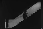
But my focus here is how a bit of darkness and melancholy makes the happy parts of a musical that much brighter. I love how Bert foreshadows the arrival of Mary Poppins:

Although not used in the Scary Mary parody, it would work there. And the bit about “what’s to happen all happened before” echoes the first line in Disney’s Peter Pan, “All this has happened before. And all this will happen again.” That line had a far more ominous meaning in the re-imagined Battlestar Galactica, something made clear, if only by the title, in this ominous video mashup.

Walt Disney’s favorite song from Poppins was the melancholy Feed the Birds, and he insisted on bringing character actress Jane Darwell, who had played Ma Joad in The Grapes of Wrath, in from the old folks home to play the bird lady in what would be her final film role.

Think how much brighter Let’s Go Fly a Kite is because it is preceded by Feed the Birds. The sad song, based on one of the disparate tales in the original Mary Poppins books, provided Walt Disney and the Sherman brothers with the story arc needed to make the film not only successful but meaningful: Mary had come to teach not only the children, but also the parents, about the importance of family and charity.

Chitty Chitty Bang Bang has the cloying Hushabye Mountain to provide its melancholy note:

But this later film lacks the character development and meaningful story arc which makes Mary Poppins more successful and treasured. Its zany adventures don’t allow the characters to grow, and need I point out how the relationship between Potts and Scrumptious is pathetic when compared to the powerful love story of Captain Von Trapp and Maria in The Sound of Music?

Rodgers and Hammerstein knew the importance of melancholy, of course, and equipped The Sound of Music with Edelweiss:

But even cloyingly sad songs have power. Listen to Hushabye Mountain removed from its context as performed by jazz singer Stacey Kent:

Can you see how a bit of darkness brightens my day?

Posted in movie, music | Leave a comment

Way Down Yonder in the Indian Nation

I attended a fun performance by Hot Club of Cowtown at OK Mozart today. Living this close to Tulsa, Bob Wills style Western Swing is pretty classic, if not classical.

I loved hearing some of my favorite Bob Wills tunes, such as Stay All Night (Stay a Little Longer), and it was an unexpected treat to hear Roly Poly as an encore. Elana James was burning the horsehair strings off her bow, Jake Erwin was slapping that bass, and Whit Smith was great on the guitar. They harmonized well to boot.

Their rendition of Oklahoma Hills reminded me of one of the great songs about the Sooner State. The music is by Woody Guthrie, the lyrics are by Jack Guthrie, and my favorite recording of it is by Gentleman Jim Reeves.

I’d say there’s no better song for life here in the Osage Hills.

Oklahoma Hills

Many a month has come and gone
Since I’ve wandered from my home
In those Oklahoma Hills
Where I was born
Many a page of life has turned
Many a lesson I have learned
And I feel like in those hills
I still belong

Way down yonder in the Indian nation
Ridin’ my pony on the reservation
In the Oklahoma Hills where I was born
Way down yonder in the Indian nation
A cowboy’s life is my occupation
In the Oklahoma Hills where I was born

But as I sit here today
Many miles I am away
From the place I rode my pony
Through the draw
Where the oak and black-jack trees
Kiss the playful prairie breeze
And I feel back in those hills
Where I belong

Now as I turn life a page
To the land of the great Osage
In those Oklahoma hills
Where I was born
Where the black oil rolls and flows
And the snow white cotton grows
And I feel like in those hills
Where I belong

I also greatly admire an instrumental version of the song by Jim Hendricks.

Posted in music | 1 Comment

Wildflower Lane

On Wildflower Lane (click image for slideshow)

On my day hikes on Black Friday 2010 I’d been unable to take the Rock Creek Trail near Veterans Lake in the Chickasaw National Recreation Area (which is still Platt to me). Three major projects had been underway at the time: rehabilitating the dam, a north shore trail for the lake, and removal of eastern red cedars in the area. I would see all of these improvements up close on a hot Saturday in early June, hiking over six miles on the Rock Creek Trail and another three miles around the shores of the lake.

I found the north trailhead near the lake and set off on what would prove to be a trek strewn with wildflowers, which I’ll struggle to identify. They were a clear contrast to the organized horticulture of Woodward Park on the previous day. First up were Black-eyed Susans with their distinctive conical centers. Trail 1 led south past an embankment and above Rock Creek and then rose to the rocky top of the embankment. Patches of coneflowers and phlox attracted butterflies, a tree made the sign of four, and there was thelesperma and a trail toad.

Beebalm and and thistle attracted more butterflies and there were some more unusual offerings, including yellow flowers sticking their tongues out at me. I passed fading oxeye daisies and followed what I termed Wildflower Lane southward until I turned off to explore what may have once been Gilsonite, an asphalt mining area with trace remnants of old roads of the same material. Throughout this area were the remnants of destroyed eastern red cedars. I reversed course and returned northward, taking the eastward Trail 3 to return to the trailhead.

I passed more thistle and the trail paralleled a streambed groove in the prairie into which a big conglomerate boulder had fallen. More flowers reminding me of hungry mouths gaped at me and I passed one last stand of wildflowers as I approached the improved spillway of Veterans Lake. I finished my wildflower trek with a contrasting cactus.

I decided to next circumnavigate the lake so I could see the new north trail. The primary feature was a shelter stuck out on a projecting peninsula. The sunny walk along the wide concrete path was not inspiring, lacking the wildflowers and softer footfalls of the Rock Creek trail.

By then it was past noon and I was starving, having been too hot on the trail to stomach the typical turkey sandwich. So I cooled off in the car and drove to Sulphur’s Sonic for lunch. A quarter-pound hot dog, tater tots, cherry limeade, and chocolate shake restored my energy so I could drive south along old Highway 77 across the Arbuckle Mountains to Turner Falls.

The Arbuckles are the ancient worn-down roots, or anticline, of a mountain range that is hundreds of millions of years old. I well remember visiting its tombstone topography, due to eroded strata tilted on end, during a geology field trip when I was at OU.

Today I-35 blasts through the shallow roots of the range, but back in the 1920s George Ramsey of Ardmore initiated a project to build the first highway across the Arbuckles, which was done using prison labor from the Oklahoma State Penitentiary in McAlester. The road features tilted strata as you climb hairpin curves to a panoramic overlook of Turner Falls.

Named after pioneer Mazeppa Turner, this has been a recreation spot since 1868 and is operated by the city of Davis. Back in junior high or high school my friend Jeff and I camped with his family at Turner Falls. We swam in the pools, strolled along Honey Creek, and clambered about the hillsides. For some reason one of my clearest memories is of Jeff playing Wizard of Wor there: I was hopeless at video games, but he could advance far enough to earn a bonus warrior, and I loved how the crude voice synthesizer would have the Wizard taunt, “Another warrior for my babies to devour.” The park’s odd ruins of Collings Castle, built by OU’s education dean back in the 1930s, are fun to explore and featured at Abandoned Oklahoma.

From my vantage point at the overlook I could see folks wading above the falls, Collings Castle sticking out above the trees, and I shot a jiggly video of the area. I know one of my just-graduated students is working at Turner Falls this summer, and I wished I had brought a swimsuit so I could take a refreshing splash in Honey Creek. But, like any water park, Turner Falls is best suited to group activity, so I put off a nostalgic return for a future day with friends.

Click here for a slideshow from this day hike

Posted in day hike, photos, travel, video | Leave a comment

A June Stroll Through Woodward Park

Woodward Park (click image for slideshow)

Echoing part of my winter day last January, on a hot Friday afternoon in early June I had the Chatsworth at Kilkenny’s and then roamed lovely Woodward Park in Tulsa, admiring the flowers. I’d originally planned to see a movie, but opted to stroll in the sunshine.

The most beautiful park in Tulsa, now adorning the Maple Ridge neighborhood in the northeast quadrant, began as Perryman’s Pasture and was originally criticized for being so far out of town that only wagon trails led to it. Tulsa bought the 45 acres, which was part of Helen Woodward’s allotment from the Creek nation, for $4,500 back in 1909. The rock gardens on the north end are in constant use by photographers.

The roses in their own renowned garden were slowly wilting, but the lily pads by the classic Lord & Burnham conservatory were thriving. Inside, a lad sweltered in the humidity. It was too uncomfortable in there to linger long, so I did not identify the names of the plants with odd orange petals resembling the blades of a fan, a red tongue with an inverted yellow uvula, a profusion of pink-veined petals, and a petal pool.

I retreated outside to walk through the three acre arboretum, surrounded by palatial homes, and then explored the newer Linnaeus Teaching Gardens, which are valued at over a million dollars. Impressive supertunias and pink hydrangeas in the entry garden were followed by Rosalind Cook’s portrayal of Carl himself, offering a friendly greeting. The shaded outdoor classroom offered shelter from the blazing sky. I walked through the cooling water garden, pursued by koi.

Then I strolled north across the lawns past the squirrels and Cook’s Poems and Promises to the sounds of a harp, watching a young cowboy and his friends explore the rock gardens. I crossed the bridge and passed the steps, which on this hot day contrasted sharply to their appearance in the January snow.

I made the right choice – Woodward Park beats the bijou any day.

Click here for a slideshow from this stroll

Posted in photos, travel | 1 Comment

Sam’s Throne

Sam's Throne (click image for slideshow)

I got off to a later start on Sunday morning, recovering from a late night of photo editing. So I did not arrive at Sam’s Throne, a popular Ozark National Forest location in the Boston Mountains for rock climbers, until around 10 a.m. I was surprised by the drive along Highway 123 south of Mt. Judea, which was extremely steep with sharp turns and 10 mi/h switchbacks. Clearly this was an old forest road they had not improved to highway standards, and later I verified it was a gravel road until 1997. But at least it was paved and had guard rails!

Sam’s Throne itself was only announced by a simple wooden sign at the entrance and there were none of the typical trailhead maps. I’d guess that climbing enthusiasts are responsible for marking and maintaining the trails and reportedly there are about a hundred climbing routes around the bluffs. I would spend the morning hiking around the base and then up on the rim of the bluffs north of the throne itself, a slightly lower sandstone capped mount to the southeast. They say buffalo herder and farmer Sam Davis lived in the valleys of Newton County in the 1820s and would climb up to the rock and preach fire and brimstone sermons, motivated by anger at losing a sister he believed kidnapped by Indians.

I did not drive past the gate into the camping area, so I began the hike without finding the yellow blazed trail mentioned in my guide book. I just took a random trail down the hillside from the first campsite, quickly landing on the edge of the long bluffs for my first glimpse of the throne and a panoramic view to the west. The trail soon led down through a tumble in the bluff to its base. I soon encountered two teenagers examining the bluff face, looking for a place to climb.

I marched onward along the base, passing a large pedestal and noticing that I was already perspiring heavily in the heat and humidity as I clambered along the trail, passing overhangs and a small cave formed by a split in the bluff. I passed towering projections and trees, eventually realizing that I must have missed the turn to head along the ridge to the throne itself. Why, oh why, can’t these trails have better signage? The trail became much rougher and less used, but I wasn’t in the mood to backtrack and try to locate the unremarkable trail I needed. Instead I just clambered on, challenged by the ever-rougher base trail. Once I spotted two climbers with gear prepping overhead for a descent.

A narrow vault towering several stories in the side of the bluff was a welcome cool spot where I could escape the sun’s rays and have a drink while I pondered what to do. I decided to continue on until I found an easy way to the top of the bluff. By now I knew I was on the eastern side of the bluff. I spotted a climber’s chain left in the rock face and passed more caves until I finally found a way up top.

It was cooler, more scenic, and far easier going on the upper rim trail. I could look southwest down the east valley and shot a panorama. I was ready for a break and up ahead saw a promising promontory. It afforded a view back of the bluff edge I’d been strolling along and a shaded rock where I could sit and enjoy the turkey sandwich and cookie I’d bought the day before at the Neighbor’s Mill Bakery. I clambered out against a tree for a self-portrait, and shot the tree against the background forest.

Then I strolled on around the bluff until Sam’s Throne hove into view. There was no way I was clambering back down the bluff to make it over there in the heat and humidity. Part of the bluff had a peculiar cobbled form which I figured must be fun for climbers. I could look up the west valley now with its farmland bottom and shot another panorama.

I encircled the bluff top with all available trails and then returned to my car tuckered out by the weather and earlier rough trails even though I’d gone less than three miles. My next goal was what promised to be a better-marked hike at Round Top Mountain just south of Jasper, where I’d had lunch yesterday. But when I drove down the steep grade toward Jasper I found the entrance to Round Top Mountain blocked off. Just as Lost Valley had been closed due to flood damage, so was Round Top Mountain.

That cinched it – I was calling it a day. I drove back to a not-so-scenic viewpoint and cleaned up and then drove down into Jasper and ordered the same pizza I had yesterday. It was just as delicious and gave me the energy for the long drive home, passing one particularly pretty mountainside home near Jasper. While I enjoyed the superior scenery on these latest hikes, I think I’ll avoid the humid heat of Arkansas for the remainder of my summer break, concentrating on less humid areas of Oklahoma in June and heading to New Mexico and Colorado in July.

Click here for a slideshow from this day hike

Posted in day hike, photos, travel | Leave a comment