Redwoods Trip IV: Crescent City

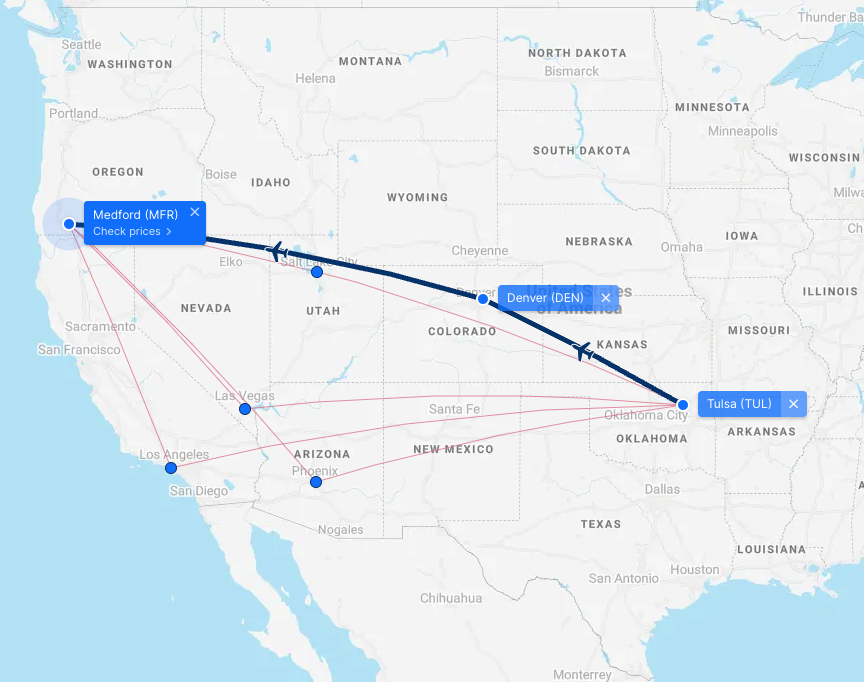
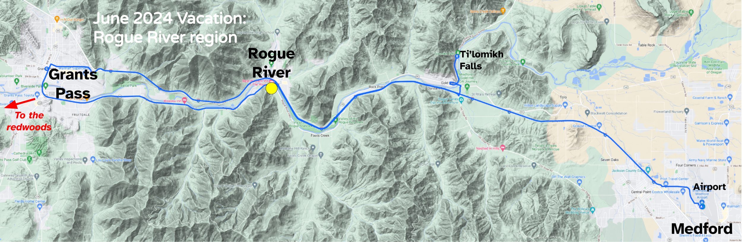
June 4-5, 2024 | Photo Album

Crescent City is on the Pacific coast of far northern California, less than 20 miles from the border with Oregon. It was incorporated in 1854 as a county seat and is the only incorporated city in Del Norte County. Named for the crescent-shaped stretch of sandy beach south of it, the city’s population in 2020 was 6,673.

That population includes over 1,700 inmates at Pelican Bay State Prison. The city is the headquarters for Redwood National Park, and its harbor is home for commercial fishing vessels. A pretty feature that I remembered from my visit in 2006 is the Battery Point Light.

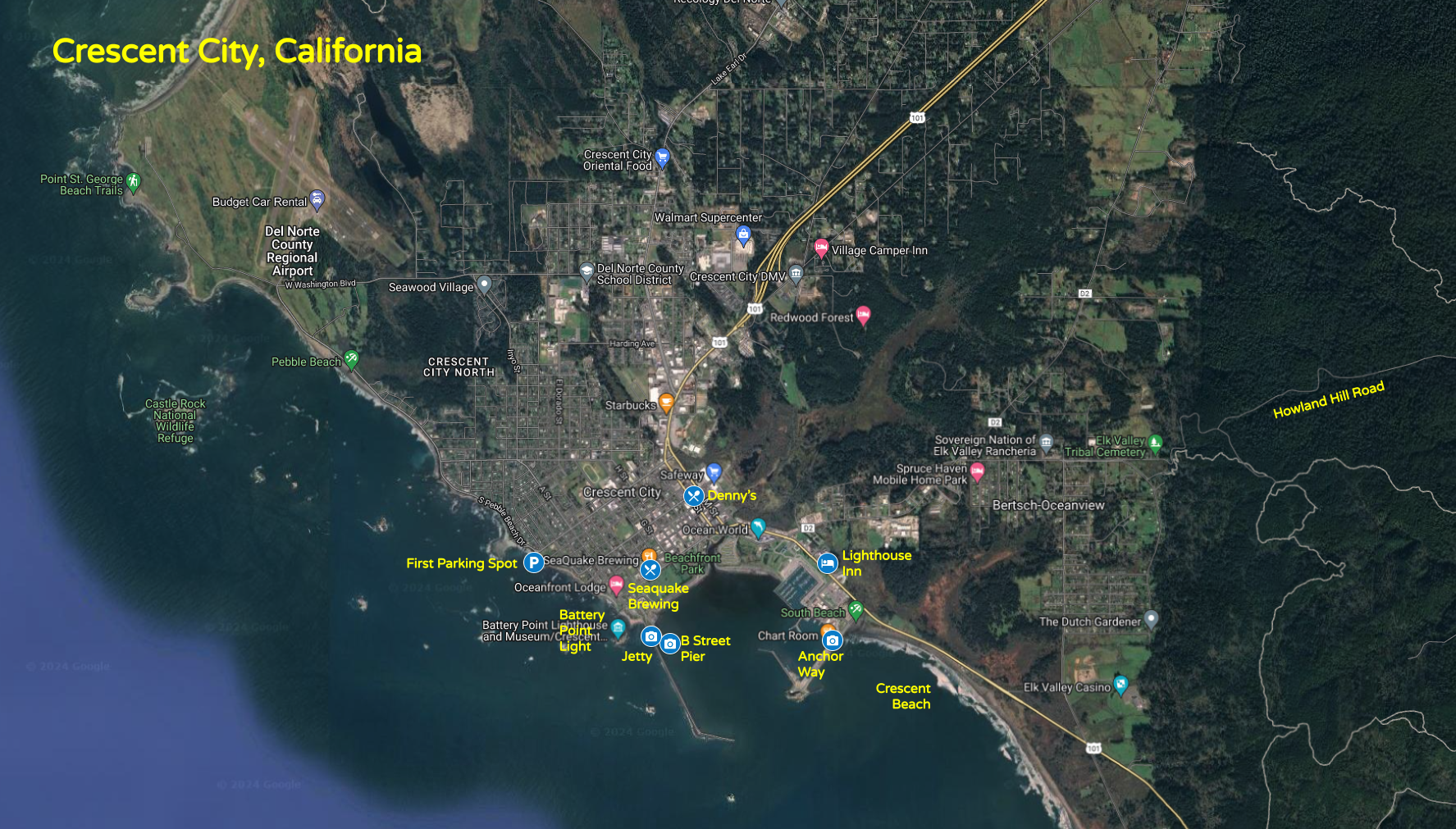
Once we exited the redwoods along Howland Hill Road, I drove directly to a parking area west of downtown a bit north of the Battery Point Light.

Battery Point in perspective
Battery Point Light viewed from the northwest

We had a panoramic view of the Pacific Ocean.

I then drove to park by the Light and the B Street Pier, which was finished in 1989, replacing an earlier pier that was burned. The lighthouse was constructed in 1856 as one of the first on the California coast and the eleventh on the entire Pacific coast. The lighthouse was automated in 1953.

Battery Point lighthouse closeup
Battery Point Light

The Light was closed, but we walked out on the pier, enjoying the seabirds perched on the poles.

Birds at the pier
B Street Pier at Crescent City

I loved the harbor sounds at the end of the pier, including the foghorn which is a different one than was here on my prior visit in 2006.

The foghorn device is on a 50-foot tower with a housing and baffles to muffle the sound blast toward the city. It sounds every 10 seconds and helps mariners on a coastline known for heavy fog. Listening to the sounds of the harbor reminded me of a sound effects record my parents had back in the 1960s.

The harbor sounds on a sound effects record that fascinated me in my youth in landlocked Oklahoma

Wendy had picked out Good Harvest Cafe near the Lighthouse Inn, where we would be staying the night, as a likely spot for lunch. However, they were understaffed, and we gave up on getting a seat. I drove to a restaurant I had noticed on our drive, SeaQuake Brewing. There we enjoyed prompt and courteous service. Wendy had tasty grilled shrimp tacos, and I enjoyed fresh Pacific rockfish and fries.

Then we checked into the Lighthouse Inn. It was okay, although it was the least glamorous of all of the places we stayed at on the vacation. We ventured back out to the harbor, where I parked on Anchor Way. On one side was the harbor, with sea lions lounging on floating piers.

Sea Lions
Sea lions at the Crescent City harbor, with the stone jetty in the background

On the other side was open ocean, with a few wanna-be surfers at the northern end of Crescent Beach.

I drove Wendy around to a thrift store at the harbor. I was a bit concerned when I saw three cats scurry inside as she entered, and she soon exited, reporting that the place was filthy with cats everywhere and the distinctive odor of their urine was overwhelming. We love cats, but we aren’t crazy.

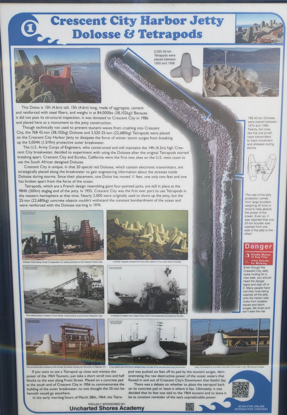
We had dinner at the local Denny’s, and we drove back out to the harbor at sunset. I decided to brave only the very first part of the jetty, which extends way out but is dangerous because rogue waves can and have swept people away.

Battery Point Sunset
Battery Point Light sunset

The jetty had over 3,500 25-ton concrete tetrapods installed after 1954 to shore it up, but they couldn’t withstand the ocean bombardment. So in 1974 they started adding 768 42-ton dolosse. One sees dolosse here and there in the city so that folks can examine them without having to walk out on the dangerous jetty.

Information on the tetrapods and dolosse that shore up the Crescent City breakwater/jetty

The cold wind off the harbor was too much for Wendy, who sheltered in the SUV. She decided she should purchase a jacket, as nothing she had brought was warm enough for the cold and windy coast, but the local Wal-Mart was closing as we pulled in at almost 9 p.m.

Fog
A foggy morning in Crescent City harbor

So the next morning, when it was still quite foggy, we tried the Wal-Mart, Tractor Supply Company, and Big 5 Sporting Goods, but none had a suitable jacket. So I drove her up the coast about 20 miles to Brookings, Oregon where there was a Fred Meyer store.

June 2024 Vacation - Redwoods- Crescent City Map

We had encountered those in Oregon on our honeymoon, shopping at one in Astoria. Fred Meyer began selling coffee from a horse-drawn cart at farms and lumber camps in Oregon in the early 20th century. In 1922, he opened his first store in Portland, which operated on a one-stop principle with meat, produce, cheese, and other goods. His stores grew ever more expansive and comprehensive, and now average 150,000 square feet with over 225,000 items. They have groceries, health and beauty supplies, clothing, home products, electronics, and more, in an environment that is more upscale. and pricier, than Wal-Mart.

Wendy found a jacket she liked at the store in Brookings, and the helpful cashier gave her a price break on it despite us not having Fred Meyer cards. We had a lousy lunch at a nearby Mexican restaurant, walking off the experience at Azalea Park.

Azalea Park in Brookings
We enjoyed a brief walk at Azalea Park in Brookings, Oregon

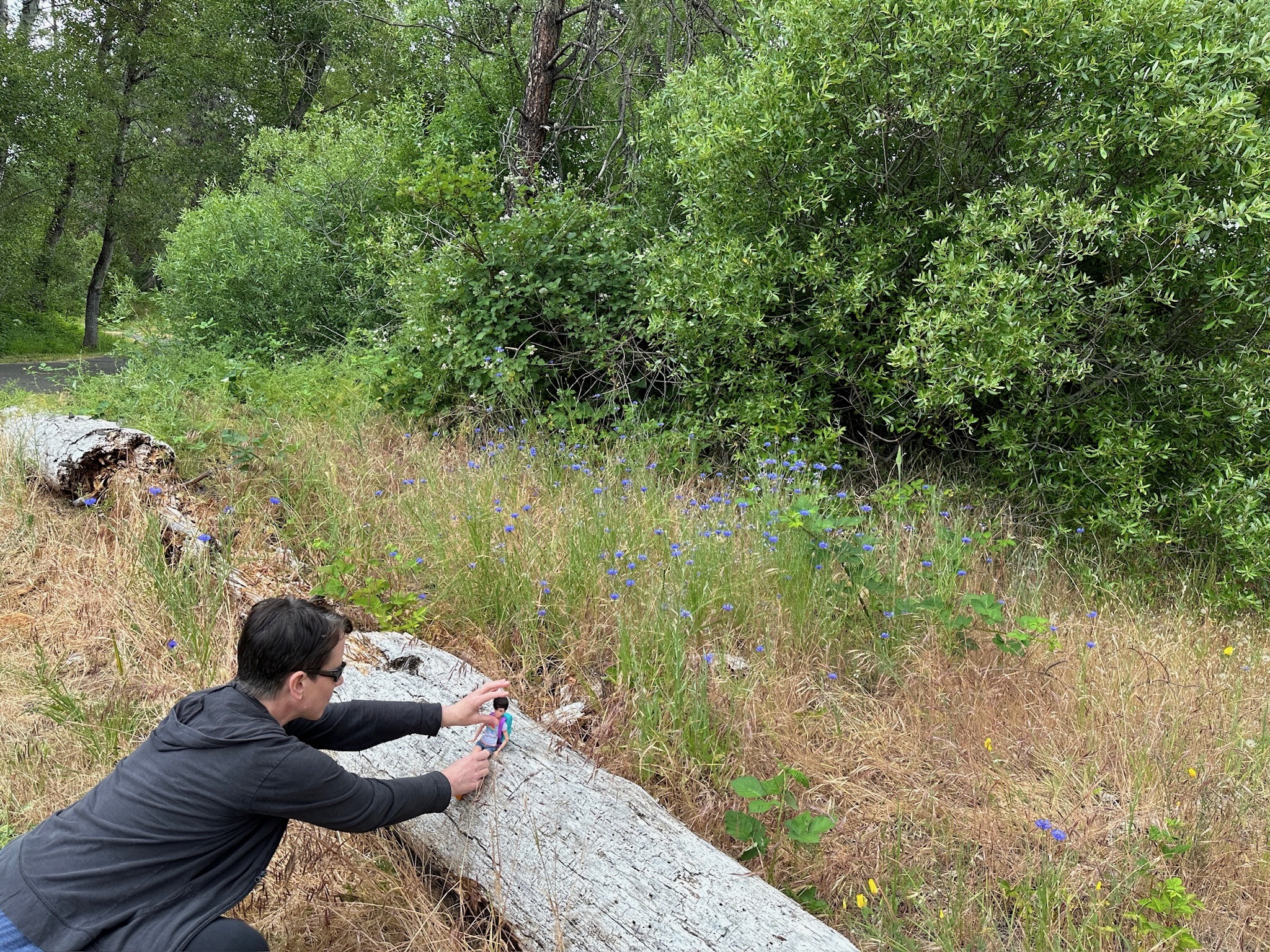
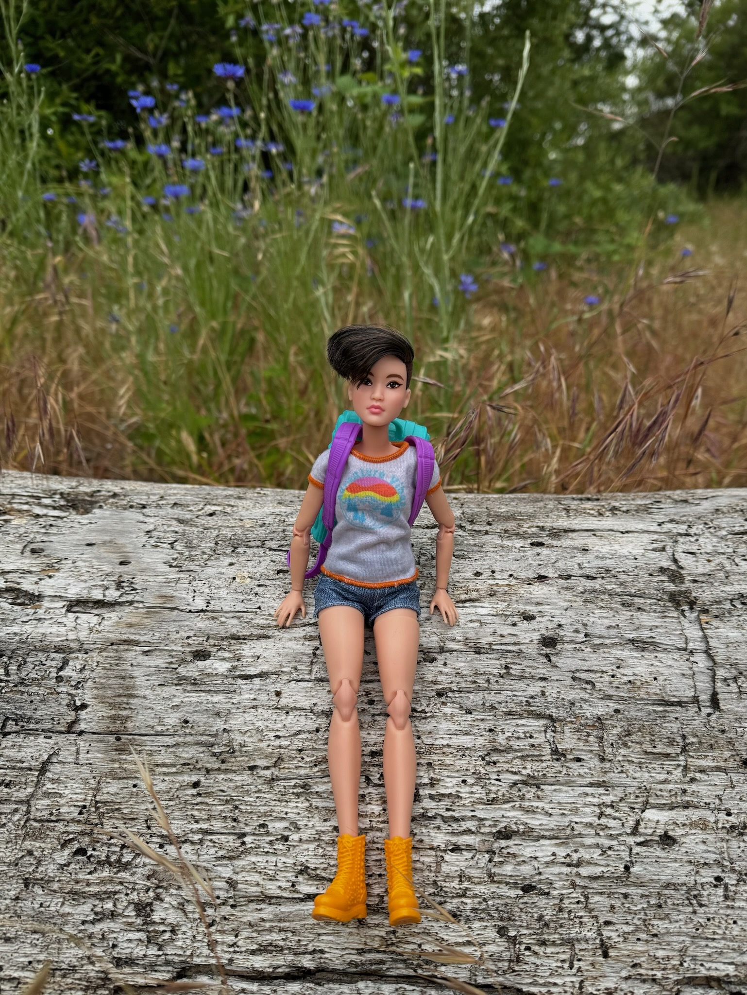
Then we drove south back down the coast on Highway 101 through Crescent City and beyond. We stopped at Wilson Creek Beach about 10 miles south of Crescent City, where Wendy again posed her Barbie.

Barbie pose at Wilson Creek Beach
Wendy's Barbie at Wilson Creek Beach

I shot some video of the forbidding ocean.

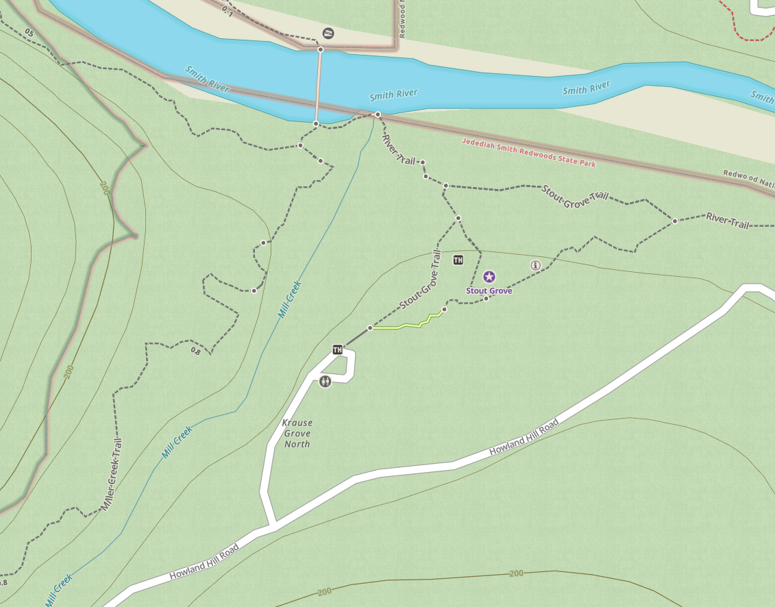
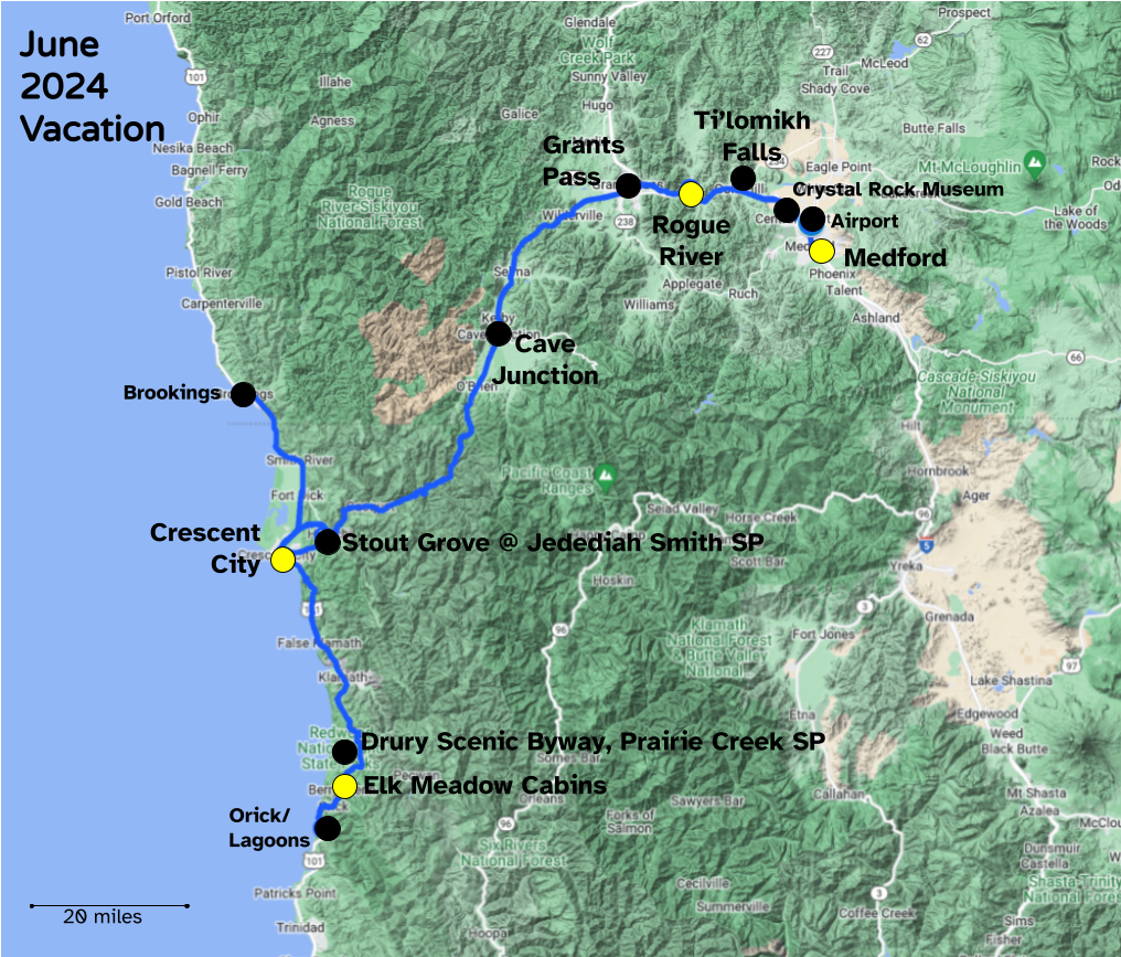
From there it was a short drive to the Newton B. Drury Scenic Parkway in Prairie Creek Redwoods State Park, where we would again walk among giants.

Photo Album | < Redwoods III | Redwoods V >

Posted in photos, travel, video | Leave a comment

Redwoods Trip III: Stout Grove

June 4, 2024 | Photo Album

We got around early on our third morning of the vacation so that we could reach the Stout Grove of redwoods before it became crowded.

The Stout Memorial Grove is in the heart of Jedediah Smith Redwoods State Park in northern California. The 44-acre grove has many 300-foot tall trees. It was donated to the Save the Redwoods League in 1929 by Clara W. Stout, the widow of lumberman Frank D. Stout, in memory of her late husband.

I remembered from my visit in 2006 that to reach the grove from the east, before you reach Hiouchi you have to exit the Redwoods Highway onto the long, winding, narrow, and mostly unpaved Howland Hill Road. I remembered it had frequent turnouts, so I wasn’t too concerned about taking our large rented GMC Yukon Denali SUV on it so long as we beat the crowds.

Map of Stout Grove
Stout Grove trailhead traffic on Tuesdays

Google Maps told me that visits to the trailhead pick up after 10 a.m. So we headed out at 6:15 a.m. from Rogue River and made it, after a few restroom stops, to the trailhead just before 9 a.m.

There were only a few vehicles at the trailhead when we pulled in, but by the time we left about an hour later, all of the parking spaces were taken with some vehicles parking in pullouts along the branch road off Howland Hill Road.

We walked the Stout Grove trail loop in less than an hour

The weather was perfect, sunny but cool and comfortable, as we walked the loop.

Stout Grove

Wendy was a bit surprised at seeing redwoods so early in our trip.

Wendy at Stout Grove

She told me it had been a 40-year-wait for her to get to see them.

Wendy at Stout Grove

Wendy got a shot of me inside the same tree I had ducked into back in 2006. This time the camera wasn’t sitting on a nearby log, which had caused a severe list.

She had fun posing Barbie by one of the huge trees, and it took a video to provide scale.

Wendy posing Barbie
Wendy poses Barbie by one of the immense trees at Stout Grove

We ourselves were dwarfed by the giants. Pictures of the redwoods can be tricky. If you don’t have a person in the shot, your sense of scale tends to be WAY off.

I remembered the diagonal fallen trees at one point along the loop, and this time was glad to have Wendy pose to provide scale that was lacking in my shot from 2006.

There were lots of photographers along the loop, shooting the trees in the morning light.

Photographer
One of several photographers we saw along the loop

Wendy had me pose by one of the fallen giants.

Granger at Stout Grove

A ranger was on hand to take photos, and shared with us how there were scorch marks on one of the big trees, yet there was no record of a fire in that area for over four hundred years, illustrating their immense age. The tallest tree in the grove is 342 feet high.

Wendy and Granger at Stout Grove

Since we had no problems navigating the first part of the six-mile Howland Hill Road, I opted to take it the rest of the way to Crescent City on the coast. It was once a stage coach road linking the Pacific Ocean harbor of Crescent City with mines in southern Oregon and weaves among the immense trees.

Road into Redwoods
Howland Hill Road

The road was surveyed by J.S. Howard in 1881 and in 1887 the Del Norte Board of Supervisors hired brothers Nels and Soren O. Christensen to build it. Redwood slabs or puncheon were added to the road in 1888 and 1892 during the “plank road” era.

Roads were often paved with redwood planks in segments in the redwood forests or where the soil was soft. Otherwise, wagon wheels dug beneath the surface of the powdery forest soil and became stuck. The road was graded and then the planks, called “puncheon,” were laid on top with dirt solidly packed between. The road was excellent as long as the packing remained in place. Winter rain, however, often washed dirt away, and water collected under the puncheon. As the vehicles drove over them, muddy water squirted up. In summer, dust on these roads was thick, with clouds trailing the stages through the woods. Vegetation along the sides was coated for months with a thick layer of road dust, and passengers often arrived at their destination coated in dust.

Howland Hill Road Map

One stage coach made the roundtrip between Gasquet and Crescent City every day, while another carried mail. Wagons hauling equipment to mining areas often were pulled up Howland Hill with six-horse teams.

Sunset Telephone Company ran a line parallel to the road in 1897, and the first car drove over the road in 1904. Jack Williams, a resident of Grants Pass, purchased a “White Steamer” and took delivery of it in Crescent City where it was unloaded from a ship. He managed to get over Howland Hill Road, but the rest of the journey was too much for his car. The trip almost shook the car to pieces, and it had to be hauled home on a springless lumber wagon to be repaired at a blacksmith shop.

Even today, US 199 from Gasquet to Idlewild is quite narrow and winding, with me glad to have had lane guidance for the GMC Yukon Denali while traversing it. I was patient with a guy hauling a recreational travel trailer; negotiating that combination around the narrow curves would be nerve-wracking.

US Route 199

In 1916, the Board of Supervisors hired contractors to improve Howland Hill Road for cars and remove the puncheon from it. The road was in active use for about 40 years as a link between Crescent City to Gasquet on the Smith River.

The Redwood Highway, now US 199, opened in 1926, bypassing Howland Hill Road, so Howland Hill has seen only minimal improvement since then. Thus it is one of the few popular scenic roads that still retain the feeling and character of travel on a dirt road from the 1920s.

Stout Grove was the first one donated along Howland Hill Road in 1929. The last of the redwood groves along the route was purchased and donated to the State of California in 1949 with funds raised by the Garden Club of America, the Daughters of the American Revolution, and thousands of other donors for a memorial grove for fallen soldiers of World War II.

I enjoyed driving the rest of Howland Hill Road into Crescent City, where we would have time to enjoy the seashore before heading south to more redwoods.

Photo Album | < Redwoods Part II | Redwoods Part IV >

Posted in day hike, history, photos, travel, video | Leave a comment

Redwoods Trip II: Rogue River

June 2-3, 2024 | Photo Album

We flew from Tulsa to Medford, Oregon by way of Denver. Our flights were easy and went well. The Rogue Valley International-Medford Airport is relatively small, with a 110,000 square foot terminal building that served over one million passengers in 2018. For comparison, Tulsa International Airport serves over three million passengers per year, and the immense Denver International Airport served almost 78 million passengers in 2023.

Wendy enjoyed the enchiladas she was served on the flight from Denver to Medford, while I was unimpressed with my brisket and the Dark Chocolate + Sea Salt Crisps by Undercover Snacks, but we had great service on all of our flights.

We loaded our rented GMC Yukon Denali SUV and headed along Interstate 5 to Rogue River, a town of 2,400 along the eponymous river which is known for salmon runs, whitewater rafting, and rugged scenery.

We exited the interstate and crossed the river on the Depot Street Bridge of 2006 to check into the Best Western Inn at the Rogue for a couple of nights. Dinner was at BeeGees Diner in the town across the river, where we were entertained by recordings like Red River Rock by Johnny & The Hurricanes.

Rogue River
Depot Street Bridge across the Rogue River; our hotel was the larger building with a dark roof; the town was on the opposite side of the river

After filling up on diner food, we returned to the river to walk along the Rogue River Greenway Trail, which is tucked between Interstate 5 and the north bank of the Rogue River. Organizers hope to eventually use it to link Grants Pass to Central Point just north of Medford.

The walk was most welcome after two flights and a meal. Wendy had fun posing her Barbie along the trail.

Bear Hotel warehouse in Grants Pass

The next morning we returned to BeeGees Diner for breakfast, including an immense cinnamon roll. We drove west along state highway 99 to Grants Pass, which is similar in size to Bartlesville. While Bartlesville has over 30 fiberglass buffalo statues scattered across town and decorated by various groups, Grants Pass has a collection of various fiberglass bears that are stored in winter at a “Bear Hotel” warehouse and deployed on the downtown sidewalks in summer.

We strolled around the historic district, enjoying a Halloween bear, Carmen Bearanda, and the Circus Ring Master.

The Redwoods Hotel, also known as the Redwood Towers, is a historic six-story hotel building in Grants Pass. Built in 1926 of reinforced concrete with cast concrete ornamentation on its front facade, it was built as an expansion of the adjacent 3-story brick Josephine Hotel and originally contained 45 hotel rooms with retail space on its first floor. The old Josephine Hotel was completely gutted by fire in 1975 and was razed. After the fire, the owners of the Redwoods Hotel made the decision to convert its upper floors to office space. Artist John Michener created a trompe l’oeil mural on one side wall, remembering the Hotel Josephine.

Redwoods Hotel
Redwoods Hotel trompe l’oeil mural

We were in town too early for most businesses to be open, but Wendy did get to check a thrift store for Barbies, and we picked up some supplies at a Safeway store before returning to our hotel via the interstate. I was fatigued in the early afternoon, which I blame on Metoprolol slowing my heart rate. I’m hoping that a third blood pressure medication I am now on might eventually enable me to stop taking Metoprolol.

I wasn’t going to let my fatigue rob us of the chance to see the Rogue River up close, so later in the afternoon we ventured eastward along the interstate to Gold Pass to walk at Ti’lomikh Falls on the Rogue.

Near Ti'lomikh Falls on the Rogue River
Near Ti’lomikh Falls

They are a series of whitewater cascades popular with rafters. The Takelma people, meaning “People of the River”, once had a village there. They were relocated to a distant federal reservation in 1856, with their homelands taken over by miners and settlers.

That halted their annual Salmon Ceremonies, but Frances Harvey Johnson (1844-1934) had participated in the ceremonies as a child and at age 89 accompanied linguist John Harrington on a field trip to her homelands. She showed him where their village had been, and the “Story Chair” next to the falls where generations of Takelma tribal elders had awaited the arrival of the Chinook salmon. In recent years, Steve and Mary Kiesling co-hosted revived Salmon Ceremonies on their property by the falls and created a scenic overlook by the falls.

There was an eight-foot-high concrete dam spanning the Rogue River there from the 1940s until 2008, creating the second greatest barrier to fish passage in the Rogue River basin. Migrating salmon passed into a diversion canal, where some were trapped or injured. Thankfully the City of Gold Hill constructed a new municipal water supply, allowing for the removal of the dam. In 2010, a higher barrier dam farther upriver was also removed.

We enjoyed walking along the west bank of the river by the falls.

Ti'lomikh Falls on the Rogue River

Then we drove over to the scenic overlook on the opposite side of the river.

Ti'lomikh Falls from the scenic overlook
Ti’lomikh falls from the scenic overlook on the east side of the river

We spent a second night at Rogue River, planning to rise early on the next morning to head to the redwoods in nearby California.

Photo Album | < Redwoods Trip I | Redwoods Trip III >

Posted in day hike, photos, travel, video | Leave a comment

Redwoods Trip I: The Plan

Wendy wanted to see the redwoods. So for our annual June vacation, I looked into returning to northernmost coastal California, where 18 years earlier I had walked among the tallest trees on Earth.

There are actually three distinct redwood species: the Dawn Redwood Metasequoia glyptostroboides, the Giant Sequoia Sequoiadendron giganteum, and the Coast Redwood Sequoia sempervirens.

Source

The Dawn Redwood was thought to have been extinct for millions of years until it was rediscovered in 1944 by a forester in the Sichuan-Hubei region of China. The Giant Sequoias can grow to be truly massive, reaching up to 314 feet high and 30 feet in diameter. They are found in over 70 groves along the western slopes of California’s Sierra Nevada mountain range.

The groves of Giant Sequoias are on the western slope of the Sierra Nevadas in central California, while the Coastal Redwoods are found along its northern coastline

I focused on the Coast Redwoods, which are the tallest in the world, reaching up to 379 feet in height and 26 feet or more in diameter. They are kept continually damp by heavy winter rains and fog from the Pacific Ocean, but June and July are often sunny and pleasant in the Pacific Northwest.

Since Wendy hates crowds, I immediately discarded visiting Muir Woods near San Francisco or Big Basin 70 miles north of the metropolis, a location used in one of my favorite films, Hitchcock’s Vertigo.

In Vertigo, Kim Novak and Jimmy Stewart were dwarfed by the Father of the Forest, a Giant Sequoia at Big Basin; Source

We needed something far more remote, yet still impressive, so I figured I should take her to Jedediah Smith Redwoods State Park near Crescent City, California and the Prairie Creek Redwoods State Park farther south, which I had visited in July 2006.

Jedediah Smith Redwoods State Park
Taken in July 2006 on a hike in Jedediah Smith Redwoods State Park; Flickr

However, back in 2006 I was on my own, happily bouncing down the coast of Oregon and into northern California, staying in 10 different hotels over two full weeks. Wendy wouldn’t enjoy that sort of trip. Instead, we needed to fly in close to the trees and spend most of our time in a rental cabin near the state parks.

So I booked us plane tickets from Tulsa to Medford, Oregon and booked a hotel in nearby Rogue River, from which we could drive to Jedediah Smith to see its Stout Grove and then spend a night in nearby Crescent City. I had fond memories of the beautiful Battery Point lighthouse there.

Battery Point Sunset
Battery Point lighthouse in Crescent City, California in July 2006

Then we could drive south to stay a few days at Elk Meadow Cabins and enjoy walks at Prairie Creek, before returning to Medford to fly home.

Knowing that flying to the Pacific Northwest from Oklahoma can be tiring, inevitably having to switch planes in Denver and always having the possibility of flight delays for mechanical issues or weather, I opted to bookend the trip with stays near the airport in Medford. To decrease the cost of the plane tickets, I extended our stay by one day in Medford to get a cheaper return flight on a Monday rather than a Sunday. So our vacation would consist of a week in the Pacific Northwest with flight days tacked onto each end.

As for transportation out west, I searched the rental possibilities at Medford and settled on the cheapest option of requesting a mini-van from Budget. We actually ended up with a full-size luxury SUV, as described in a previous post.

I have my 2006 trip budget for reference, so I thought I would compare the costs then, adjusted for inflation, to what I paid this time around. My solo coach-class round-trip plane tickets back in 2006 had cost $1,640 in 2024 dollars, so I didn’t mind paying $3,378 for two first-class tickets for this vacation. Our 8-day vehicle rental was $667 compared to $881 in 2024 dollars to rent a Ford Taurus for two weeks back in 2006. My hotel rooms back in 2006 had averaged $185 per night in 2024 dollars, while the multi-bedroom cabin and some hotel suites for our 2024 trip would boost our average nightly lodging to just over $250.

It was all good value for the money, as we had no issues on our flights, which were comfortable, I enjoyed driving the vehicle, and we had no problematic hotel rooms, with the cabin at Elk Meadow and then a Hilton Homewood suite we stayed at for a couple of nights in Medford being particularly peaceful and comfortable.

I will close with a map of our vacation, with details of the trip to follow in six subsequent posts over the coming week.

Redwoods Trip II >

Posted in photos, travel | Leave a comment

COVID 2: Electric Boogaloo

I have long subscribed to my “Law of Conservation of Happiness” where good news is balanced by bad news to keep things on an even keel.

We had a great vacation in early June 2024 to southwestern Oregon and the northern coast of California to see the redwoods. A trip that far away meant flying, and the previous time I had flown on a plane, in June 2023 for a conference in Philadelphia, I sat in coach on a return flight by a big guy with an obvious respiratory infection. I had no mask handy, so I endured it and unsurprisingly fell ill and was sick for the following week. It didn’t test as COVID, but it wasn’t fun.

Almost a year later, Wendy and I were flying first class, so I wouldn’t be crammed up against someone who was sick, but of course COVID aerosols could still spread through the plane and the airport restrooms, security checkpoints, and gate areas were high-risk. Since we were visiting more progressive areas of the country, we did see some folks in the airports and hotels, servers at restaurants, etc. who chose to mask up to reduce their risk of infection.

Sources: TMA & KWTX

A properly fitted N95, KN95, or KF94 mask is indeed worthwhile if you want to significantly reduce your chance of infection in high-risk environments. If you want all of the nuances about masks, read this.

Anyway, we took our chances, enjoyed our trip, and returned on a Monday night. I felt fine until Wednesday afternoon, when I started getting a stuffy nose and clogged sinuses.

Wednesday night I was feverish and slept quite poorly. On Thursday I took ibuprofen for a headache and body aches, and I began periodic nasal irrigation with my NeilMed Sinus Rinse bottle to clear my sinuses. I had continued thermal regulation issues, stuffy sinuses, both nasal congestion and a runny nose, aches, and fatigue on Thursday and Friday, which I treated with ibuprofen, sinus rinses, pseudoephedrine by day, and diphenhydramine at night. A cough developed on Saturday.

Since on Sunday I was planning to take my 87-year-old mother out for lunch, on Saturday I pulled out one of our remaining COVID tests and ran it, even though it expired in February. In less than a minute, it showed my sample as positive.

There is no reason for an expired test to give a false positive, while a breakdown of its components might give a false negative. So I am confident that I have been infected with COVID for the second time; my first round with it was in November 2022.

So I sure do wish I had masked up throughout our times in the airports and on the planes, although I can’t be certain those environments were where I was infected.

Now what?

The CDC’s COVID infection protocol was originally to isolate for ten days, with quarantines for close contacts. By the time I contracted COVID in November 2022, that had been shortened to five days , if no fever for 24 hours without fever-reducing medications, to be followed by distancing and masking precautions for another five days.

Back in 2022, my isolation overlapped into a week of vacation days. I chose the conservative route, isolating until I no longer tested positive on a rapid test. That was not until 14 days after my symptoms began, and 8 days after first testing positive.

These days, the CDC has simplified its recommendation to be the same for any respiratory illness:

Source

I may or may not be at the Go about normal activities, taking adding precautions phase by Tuesday, six days after my symptoms began. I hope to work remotely, but later in the week I will have to go in to do a few things that require my physical presence. I’ll be wearing a KF94 mask whenever I am around others, and I’ll be running the air purifier in my office at top speed.

COVID hospitalizations peaked with the Omicron surge in the winter of 2021-2022, but are now at an all-time low thanks to seasonal factors and protection via vaccines and prior infection; Source

The changes in the CDC guidance reflected how the hospitalization and mortality rates for COVID plummeted once vaccines were available, and particularly after the Omicron surge in the winter of 2021-2022. I had received the Pfizer vaccine in February and March 2021 with an October 2021 booster, and a Moderna vaccine in April and October 2022. I had an updated Moderna booster in October 2023.

The virus continues to mutate, so vaccine protection against infection wanes after a few months, while it still defends well against hospitalization and death. Actual infection with COVID usually protects you against reinfection for a few months.

I likely had the Omicron BA.4 or BA.5 variant back in November 2022, and currently the widely circulating variants include KP.3, KP.2, and LB.1. My symptoms this time are slightly less severe than with my first COVID infection, but the experience is another reminder for me of the consequences when I let down my guard in high-risk environments, even when the seasonal infection rate is low.

I’ll be flying again near the end of the month to attend a conference in Denver. My chance of getting reinfected by COVID will be very low for about four months, so I won’t be worried. But I do plan on wearing a KF94 mask while in the airports and on board the planes. And on future trips involving air travel, I plan to do the same. Masking while in those high-risk environments is a minor inconvenience compared to a week or more of unpleasant symptoms from various respiratory infections, including nasty old COVID.

Posted in pandemic | Leave a comment