My Po Toe

October 17-19, 2014
Balloon Burner

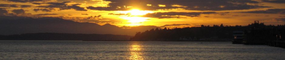
Wendy and I spent the first day of Fall Break 2014 relaxing, although she was more productive than I was, since she worked on her triptych inspired by the exterior of the Kimo theater in Albuquerque from our visit there in early July. On Friday afternoon we drove south to Poteau for a two-night stay focused on a hike on the Winding Stairs Trail in the Albert Pike area a couple of hours southeast of there in the Ouachitas of southeastern Arkansas.

I’ve been to Poteau many times since I began my day hikes in earnest over five years ago. The etymology is French for “post”, although this was the first time I heard a terrible story about the origin of its name. Wendy was laughing as she shared:

Poteau and the Poteau River got their name from an old Indian who stumped his toe and exclaimed, “MY PO TOE!”

Puh-leeze!

Poteau Balloon Festival

Balloon Burner

I did manage to surprise Wendy, who knew we were going to stay in Poteau but had no idea their annual Balloon Festival was going on. We drove straight to a lot adjacent to the fairgrounds and paid $5 for our wristbands. A couple of balloons were taking off as we walked in, with two more inflating. A long line of folks had formed, all of them waiting for the balloons to begin bounding up and down on tethers, carrying thrill-seekers up into the air. Later we would see the line had dwindled and tried to pay $10 each for a ride, but it was growing too dark for the lifts, so we had to forego that. The darkness, however, brought the balloon glow, with six balloons’ burners making them blink brightly in the night.

As we entered the festival, on one side of the road a huge monster truck, the Mean Machine, was bouncing riders about a field.

Farther along, a small carnival was underway, and we could see and hear a motocross rally over in the grandstand. Wendy and I walked over to the motocross, attracted by a cyclist doing high leaps across the field using big ramps. I was hoping to use my new iPhone 6’s Slo-Mo feature to video the high jumps, but they were done with those by the time we reached the stands, so I had to settle for slo-mo of kids popping wheelies and their leader doing low jumps off one end of the big ramp.

As we looked out over the carnival from the grandstand, Wendy confessed she had never been on a carnival ride, other than perhaps the train at Bartlesville’s Kiddie Park. I grinned broadly, pointing out different rides we might try. The tame ones she might consider included a dragon roller coaster, Tornado whirling ride, and the Tropical Swinger. That last one was her first choice, after which we braved the Tornado.

We had a lot of fun at the little festival, but worked up an appetite. We drove downtown to Warehouse Willy’s, where the wait was long, and our tummies were growling before we dined. My ribeye steak was excellent.

Winding Stairs Trail

On Saturday we fueled up the car, passing by what Wendy termed a downtown Dementor along the way. It scared us so much we drove 120 miles southeast into the Cossatot Mountains of Arkansas to reach the Albert Pike Recreation Area’s Winding Stairs Trail. I hiked that trail four years ago, noting the tremendous beauty of the Little Missouri River after fording it a couple of miles from the trailhead. I hoped we might be able to reach that area on this trip, but knew it was a long ways in, and the water level on the Little Missouri might block us, given that Wendy had not ever forded a river before. It turned out the water was up enough that we turned back at that ford for this trip.

Winding Stairs Trail Tracks

We travelled south from Poteau, passing Heavener and the Talimena Skyline Drive before turning east to run along the south edge of the Ouachitas before turning north to reach the Cossatot Mountains. The roads in Arkansas to the trailhead were nearly deserted, as was the locked-up Albert Pike day use area, but we found about two dozen vehicles parked at the trailhead located a couple of miles up the steep and winding gravel road from the day use area. Not far from the trailhead, Wendy pointed out a tree limb beside the trail that resembled a striking snake.

Blaylock Creek

Four years onward from the disastrous flood of June 2010, the Forest Service has almost abandoned Albert Pike as litigation over the deaths there continues. That includes not rebuilding the much-needed bridge over Blaylock Creek. The water was up, and I deeply regretted forgetting to bring our trekking poles along on the trip. Wendy and I found some downed branches we used for poles, but neither of us was successful in negotiating the rocks across the creek without dunking our boots and pant legs. On the far side, Wendy stripped off her boots and wrung out her socks, but I just squished along.

High Above the Little Missouri

About 3/4 mile from the trailhead, we had to make a steep ascent and descent over a 3/10 mile stretch. The trail then levelled out, with us passing a large white mushroom with which Wendy practiced her putting skills, whacking at it with a long stick. The Little Missouri became visible far below us to the east, and I posed in my wet boots and pants.

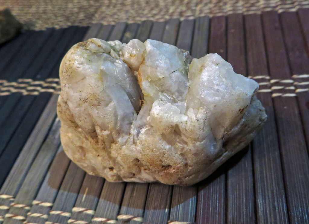
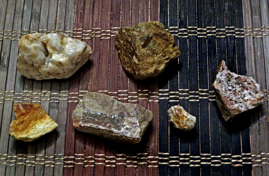
Wendy was on the hunt for rocks with crystals throughout our hike and spotted a set of mushrooms with a millipede on top. I was preoccupied, as usual, with vistas, enjoying the long views above the Little Missouri as the trail turned and slowly descended. As we approached the river ford, across the shimmering water I spied a couple of fishermen.

Trail View of the Little Missouri

Wendy and I were hungry by the time we reached the river ford, so we clambered along to a side stream where four years earlier I had noted how the cut rocks looked like stacked blocks. It was wetter this time, with a larger stream of water running down the rock steps. We ate lunch, and upstream I found a nice waterfall and pool. I shot a slo-mo video of the falls with my iPhone and admired the long corkscrew root of a tree embedded in the side of the wall.

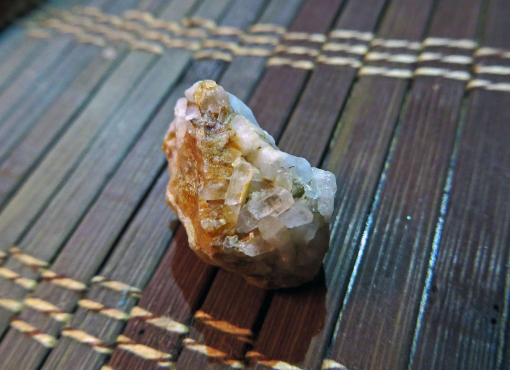
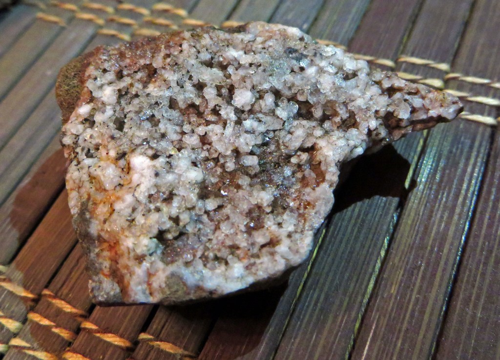
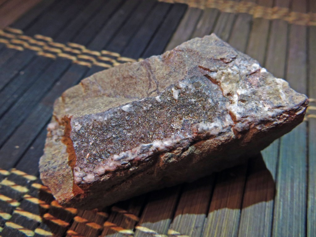
Meanwhile, Wendy had been finding rocks with embedded shiny mineral deposits. After our trip, she cleaned the rocks, and I got shots of them.

After our lunch, we could have forded the Little Missouri, but the water was so deep that we would have had to take off our boots and socks. So we turned back, enjoying the views up the Little Missouri as we went back up the hillside.

To Ford You Must Wade

At one of several trailside campsites I found a side trail leading down to the water. The bedding planes were tilted entirely vertical there, exposing many layers of sedimentary rock we could easily break off. They made wonderful skipping stones; I could get six or more skips out of some of them.

Break Yourself Off a Skipping Stone

Wendy spotted some more sparkling mineral deposits and later along the trail spotted some mushrooms growing inside a rotting log.

We managed to immerse our boots again when fording Blaylock Creek, prompting Wendy to haul a few big rocks from the shore out into the stream to try and build some stepping stones for later hikers. I assisted a bit, and then we squished our way back to the car. We were grateful to shuck our soaked boots and socks.

I decided to take a different route back to Poteau, allowing Trixie the GPS Navigatrix to lead us along gravel forest roads north out of Albert Pike. She led us far off to the east for some reason, which meant a long slow drive, but it was scenic with one high glimpse of mountains beyond.

We finally rolled into Poteau to change clothes and clean up before a late dinner at Mazzio’s. Our long hike made the pizza quite tasty.

Cavanal Mountain Hill

Cavanal Erupts

The local chamber of commerce bills Cavanal Hill on the outskirts of Poteau as the world’s highest hill, claiming that at 1,999 feet it is just a foot short of mountain status. That is a bit of marketing hooey, but I do like how Cavanal bulks up outside of town, and I remember well how clouds above it four years ago made it resemble a smoking volcano.

Surprisingly, I’d never driven up the hill despite visiting Poteau many times. So the morning after our big hike Wendy and I wound our way up Witteville Drive, named after the old coal mining operation on Cavanal in the early 1900s. The first road up the hill was built by a Poteau man, Sam Sorrels, following about the same six-mile route as the present Witteville Drive. Back in the day, Mr. Sorrels walked and showed the bulldozer operator where he wanted the road built.

The top of Cavanal Hill is now festooned with broadcast antennas, but there is a shelter park amidst them which offers a panoramic view southeast over the town. I laughed at the shoes someone had tossed over a high wire, and Wendy and I exchanged photos with another couple in front of a rock heralding the hill’s supposed height.

Atop the Supposed Highest Hill

The drive back down the hill provided a lovely panorama north and east.

Panorama Descending Cavanal Hill

We drove back to Bartlesville, where I inserted some boot dryers my mother gave me into Wendy’s boots and laid both pairs of boots out to dry in the backyard, complemented by roses from the bushes Wendy had planted by my patio. We enjoyed our latest outing to southeast Oklahoma and southwest Arkansas and look forward to many happy returns.

Drying out our boots

Click here for a slideshow from this trip

Posted in day hike, photos, travel, video | Leave a comment

A Break on the Red Loop

October 12, 2014

My weekend was virtually consumed by the composition of complex documents to help the district’s teachers with new state appraisal requirements. But Wendy and I took a break on Sunday afternoon to enjoy the 3.26 mile Red Bike Loop at Osage Hills State Park.

Fungi Family

We passed the new Osage Trail blazes which redirected the route westward. Wendy noticed an unusual growth high up on one of the trees, and I asked her to pose to provide scale. A flower she picked had a little critter on board, and when we reached the grotto pool we took a break. I was drinking water instead of my usual trail Fanta, enjoying the rippling little pools of water as a thin stream poured across the rocks.

Natural Steps

One of the original red metal Osage Trail markers was still in place and we wound our way up the hillside. On the downslope, Wendy noticed several bunches of small mushrooms.

Fungi Family

I am very grateful that Fall Break has arrived, and Wendy and I will head out on Friday for Poteau for some hiking in southeastern Oklahoma and/or southwestern Arkansas.

Click here for a slideshow from this day hike

Posted in day hike, photos, travel | Leave a comment

Roaring River Wrap-Up

October 4, 2014

Wendy and I needed an escape from the stress of work. We had both been working into the night, week after week, to do all that needed doing in our teaching and school-related duties. We’d seen little of each other this work week, as I spent three days at workshops in Tulsa while she had special education training and meetings. So we were both anxious to get out on the trail for some much-needed exercise and stress relief.

Roaring River State Park in Missouri is where I fell in love with hiking, and its Saturday forecast called for sunny weather with a high around 60 degrees Fahrenheit. Perfect! In April 2013 we hiked two miles there on the most impressive short trails: Deer Leap and Devil’s Kitchen. A year later, we walked a 4.5-mile loop on the Firetower Trail. That left three trails Wendy had not experienced, and I knew how to link them so I could readily meet or exceed her demand for a real work-out. So we left Bartlesville around 9:30 on Saturday morning, heading out for what would be a 5.85-mile hike along the Pibern, Eagle’s Nest, and Springhouse Trails.

Wendy on the Pibern Trail Bridge

We reached the park’s Emory Melton Inn by 12:30 p.m. A fun new addition to the Inn were some huge lounging bears. Wendy and I enjoyed our now-traditional lunch beside the windows overlooking the forested knobs of the countryside. I had a French Dip while Wendy had a Frisco Melt. The food was good, but we were feeling it as we clambered down the hillside to the park store for trail drinks and then walked across the very narrow Highway F bridge across Dry Hollow to Campground 1. We walked west through the campground to the south trailhead of the Pibern Trail near the entrance to the Paradise Valley RV Park off Dry Hollow.

Pibern Trail

Wendy on the Pibern Trail Bridge

The Pibern Trail was built by the CCC in the 1930s as they were harvesting construction material. It climbs up the western slope above Campground 1 to track northward below a tall bluff carved by the usually-dry rocky streambed that tracks northward all of the way alongside Campground 1 and onward toward Cassville. Back in December 2011 I bushwhacked way up that streambed clear out of the park.

Wendy posed on a small bridge, and we followed the trail northward along the bluff. A short side trail led to a small cleft in the bluff, and some trees had distinct fungal growths. The trail climbed to approach some of the most impressive sections of bluff before turning about.

All along this hike, Wendy was searching for rocks with embedded crystals, recalling the beautiful find she made back in April on the trail near Onyx Cave a few miles away from Roaring River. She found a rock with some nice crystal ribbons and a rock with a screw-shaped fossil imprint.

Nice Bluffs Along the Pibern Trail

The trail turns back south at an area of tilted and fallen slabs which I call TumbleTown, descending steeply beside a waterway to reach the rocky streambed below. Wendy took a snapshot of me in front of TumbleTown, and I did the same for a couple who had made the arduous ascent to reach us.

Streambed at north end of Pibern Trail

Down in the rocky streambed, I took a panorama with my new iPhone 6, which I’d been using for some of the snapshots along the trail. The trail briefly followed the streambed before re-asserting itself on slightly higher ground to the west for a beautiful walk through the trees. We were singing as we walked along the sunlight-dappled path.

We passed a tree with several bumps and a birdhouse, and reached the north end of the trail at the very end of the road for Campground 1. I don’t like the long walk along the asphalt road beside the campsites, preferring to just follow the dry but very rocky and bumpy streambed. That provides nice views of the carved and forested bluff as you traverse rocky and leafy ledges and sculpted bedding planes, but you need good hiking boots for that option.

Along the streambed beside Campground 1

We passed a tree with much of its rootball exposed; it probably won’t survive the next flood. We passed under the low bridge into Paradise Valley, where some kids were playing in the streambed. One asked knowingly if we’d just finished the trail. Wendy and I then walked up Dry Hollow to the park store. The old walkway across Dry Hollow was destroyed in a flood, and the south streambank is too steep to climb. So we had to again cross on the pitiful Highway F bridge. Missouri should prioritize replacing that very narrow bridge, which is barely wide enough for campers and trailers and is dangerous for pedestrians.

Murder Hill

Wendy had told me she wanted a workout on this trip, and boy-howdy, I had one ready for her. The climbs along the Pibern Trail are nothing compared to the long steep climb alongside Highway F up the hill leading south out of the park towards Seligman. My family has always called it Seligman Hill, but if you walk it, it is Murder Hill.

Elevation Profile

As we climbed and climbed toward the top, Wendy commented, “I’ll only hate you for a little while.” We finally reached the top, which has a trailhead for the Eagle’s Nest Trail. We were grateful to be leaving the highway and very glad our climb was complete.

We walked along and down the ridgeline, past the completely overgrown homestead of Miss Jeanne Wallace, the Mountain Maid, which one can only identify from the lilac bushes and yucca still growing in the area. We followed the upper part of the trail loop, which has a pretty winding section in the trees, before descending alongside Roaring River to return to the Emory Melton Inn. Wendy got a shot of some nice red leaves.

Eagle's Nest Trail

The Last Trail

Wendy’s goal for the day was to hike six miles, and we had done a bit under 5.5 miles by that point. So I took her along the park’s newest trail, the short but steep Springhouse trail just south of the Inn. That means Wendy has now been on every trail in the park, hiking everything except for the lower part of the loop on the Eagle’s Nest Trail and a small connector between the Deer Leap and Firetower Trails.

It was a steep climb to the small trail loop. As we completed the loop and turned at a fork in the trail, Wendy laughingly said she was so very thankful when we turned left and down, rather than right and up. That last hike had brought our mileage up to 5.85 miles, which our calves and hamstrings said was quite enough for the day.

We freshened up and drove to Monett, where TripAdvisor led us to The Family Room Steakhouse, where we each enjoyed a tasty KC Strip with shrimp. The homemade mashed potatoes were peppery but yummy. The green beans, however, were noticeably spicy. Wendy commented on that to the friendly waiter, who found out that the cook had accidentally used cayenne pepper. The waiter provided a free slice of chocolate meringue pie to cool us off. It was a great way to end our day trip, and I’m sure we’ll return to that restaurant in the future, since The Rib in Cassville is long gone.

I’m no fisherman and I lost my interest in camping long ago, but the trails at Roaring River make it a favorite retreat for Wendy and me. We are so glad autumn has arrived, bringing with it the prospect of many more day hikes.

Click here for a slideshow from this day hike

Posted in day hike, photos, travel | Leave a comment

Back on the Trails

September 14, 2014
Osage Hills Thistle

A week into September 2014 the summer weather abated, allowing Wendy and me to venture out for our first hike since our vacation in New Mexico in early July. On a Sunday morning we headed west out of town to Osage Hills to hike four miles around the Bugle Loop on the Tower/Lake, Cabin, and Falls trails. We admired colorful thistle on the Tower trail and an intricate spiderweb above Lookout Lake. We lunched trailside on my favorite hiking meal, a QuikTrip turkey & swiss sandwich on berry wheat bread, before walking down to the Sand Creek falls. The water was running high from recent rains, and an extended family was enjoying the flow.

The next Sunday we drove to Owasso to have lunch at El Fogon, which was the top-rated Owasso restaurant on TripAdvisor. Wendy enjoyed her carnitas with corn tortillas while I dined on my typical order of steak fajitas. Then we drove east to the 120-acre Conservation Education Reserve at Rogers State University. I had visited it five years earlier, but back in 2009 I did not track my route. Before we left town to drive to Owasso, I’d done an extensive web search for a detailed map of the reserve, eventually tracking down a nice online GPS map created by students at the local vo-tech; I had exported and saved that map to guide our hike.

Wetlands

This time the tracker was running as we entered the gate near the Terra Lab to circumnavigate the reserve on its Butterfly Loop, Southwest Trail, Wetland Loop, and Weather Trail for a total walk of 2.75 miles.

The butterfly garden was buzzing with bumblebees. Wendy got a shot of the fish and a frog in the pond, and a bloom. We were then driven onto the Butterfly Loop by the approach of grandparents with grandchildren.

Bumblebee in the Butterfly Garden

A glade with benches featured a trailside tree which had been fully consumed by bagworms. The trail wound around the southeast portion of the reserve, with another group of hikers in close pursuit. We lost them when we turned off onto the Southwest Trail, which had a profusion of yellow blooms.

Trail

A muddy pond had a turtle swimming along with only its eyes and snout protruding from the water. A meadow had sumac, while the wetlands featured small cattails and plenty of bugs. The big pond featured a windmill and extensive plant growth in the water teeming with tiny fish. A couple of dragonflies flew by and settled down, intent on, er, coupling.

Mating

It was a nice but still rather warm walk; I’m eagerly awaiting even cooler weather for future outings.

Click here for a slideshow from the Conservation Education Reserve

Posted in day hike, photos, travel | Leave a comment

A Tale of Two Schools

September 6, 2014

In September 2014 a story in the Daily Oklahoman newspaper in Oklahoma City highlighted both the high school I graduated from and the one I’ve taught at for 25 years. The context was an article about the number of high school graduates enrolling in Oklahoma colleges who have to take remedial coursework. It included bar charts of the state’s public and private high schools which send over 100 students to college and have the highest and the lowest percentages of students who have to do remedial work.

My alma mater, Putnam City West in northwest Oklahoma City, was ranked among the worst performers, with 50% of its graduates who went to an Oklahoma college having to take remedial classes. That compares to 20% for Bartlesville High School, where I’ve worked since 1989, placing BHS among the top seven schools in the state and in the top five public schools in this ranking.

Remediation rates at my alma mater and where I teach

Remediation rates at my alma mater and where I teach

What makes the schools so different? In a word…demographics. I have heard the junior high I attended, one of two feeder schools to PC West, called “the armpit of the district.” Nevertheless, I received a strong education at PC West back in the early 1980s, which propelled me to many academic awards, scholarships, accolades, and a rewarding career. But the demographics of the families it serves have steadily worsened. While Bartlesville High’s demographics have also declined since the ConocoPhillips merger at the start of the twenty-first century, it still serves a rather different clientele than PC West. Consider this data from the Profiles 2013 report cards for each school:

Demographic Statewide Average Putnam City West HS Bartlesville HS
Students Eligible for Free/Reduced Lunch 62% 83% 29%
Mobility Rate (incoming students) 11% 18% 4%
Suspension Rate (higher is better)
1 suspension per X students
124.4 85.4 280.7

My entire teaching career has been suffused in a never-ending drive to hold schools more accountable for their students’ performance. But Helen Ladd’s 2011 analysis stated:

…a simple bivariate regression of state test scores and state poverty rates indicates that a full 40 percent of the variation in reading scores and 46 percent of the variation in math scores is associated with variation across states in child poverty rates. The addition of one other explanatory variable related to family background, the percent of children who are members of minority groups, increases the explanatory power of the relationship to about 50 percent in reading and 51 percent in math. Clearly the mix of family backgrounds is highly correlated with patterns of student achievement across states.

The blogger at OKEducationTruths analyzed the data on the 454 schools in the data set the Daily Oklahoman was drawing from to identify how much different factors correlated with the college remediation rate. Given Dr. Ladd’s analysis, it is no surprise that in the Oklahoma data poverty factors had the strongest correlations with the college remediation rate.

Bartlesville works pretty hard at preparing kids for college. Teachers of courses with state tests are required to collect, analyze, and act upon data from regular assessments. There are remediation programs in place at each school to help identify and assist struggling students. I don’t know how much of that is done at my alma mater. But I know that BHS benefits greatly from having only about a third as many students who come from impoverished families and a mobility rate that is less than one-fourth of that at PC West.

So I’m not going to dump on my alma mater and praise my own school for their very different college remedial course rates. This is a tale of two schools who serve very different populations, with different challenges. What Dickens wrote in A Tale of Two Cities describes well the tumult public school teachers face in our own time:

It was the best of times, it was the worst of times, it was the age of wisdom, it was the age of foolishness, it was the epoch of belief, it was the epoch of incredulity, it was the season of light, it was the season of darkness, it was the spring of hope, it was the winter of despair.

LATER POSTSCRIPT:

On Facebook, former Bartlesville school board member Vanessa Drummond asked a good question: how do the poverty rates compare among the top-performing schools? I expanded upon that with a look at all of the low and high performing public schools:

High-Performing Schools on College Remediation Rate:

School Students Eligible for Free/Reduced Lunch Mobility Rate (incoming students) DISTRICT Adults (25+) with College Degree
Statewide Average 62% 11% 23%
Stillwater 35% 3% 48%
Deer Creek 7% 3% 57%
Edmond North 18% 5% 51%
Edmond Memorial 24% 3% 51%
Bartlesville 29% 4% 30%

Stillwater is the outlier, but it is a town of 47,000 which is home to one of the state’s two leading universities. It is hardly surprising that a district dominated by a university would fare better in college course remediation rates. The percentage of adults over age 25 holding a college degree is illustrative; note that is a district-wide figure versus other school-specific figures. Compare those demographics to those of the low-performers:

Low-Performing Schools on College Remediation Rate:

School Students Eligible for Free/Reduced Lunch Mobility Rate (incoming students) DISTRICT Adults (25+) with College Degree
Statewide Average 62% 11% 23%
Tulsa Nathan Hale 100% 30% 25%
Tulsa Memorial 82% 28% 25%
Lawton 57% 48% 20%
Muskogee 81% 11% 18%
Midwest City 67% 12% 18%
Lawton Eisenhower 44% 12% 20%
Putnam City West 83% 18% 32%

Notice how Lawton High’s lower poverty rate is offset by its enormous mobility rate, although Lawton Eisenhower doesn’t have that excuse. The Putnam City district has a good percentage of adults with college degrees, but it includes three high schools, with PC North serving a much higher socioeconomic status group than PC West or the original PC High School. So we can’t discern the adults in the PC West area with college degrees.

Posted in politics | 5 Comments