Falling Bodies at Robbers Cave

November 21, 2012

Falling body site (click image for slideshow)

The five-day Thanksgiving Break afforded me the opportunity to go on a couple of day hikes, including one too far for a single-day trip from Bartlesville. The break began on Wednesday, November 21 and I opted to drive three hours south to Robbers Cave State Park for a day hike, knowing that from there I could drive three hours northwest to Oklahoma City to spend Thanksgiving with my folks.

I awoke early so the sun was still rising in the east as I approached Tulsa, and I stopped in at a McDonald’s in Broken Arrow for a sausage and egg McMuffin with some Cinnamelts – it’s a good thing I would be hiking almost nine miles this day to help work off those treats.

I pulled into the state park and parked by the Lake Carlton dam around 10:30 a.m. I walked south to get a shot of the reflections of the surrounding forest, which a bench invited me to sit and enjoy. The water-level long curve of the dam’s top always reminds me of an infinity-edge pool.

A family drove up and a young boy immediately scrambled down the steep slope below the dam, with the other family members lagging behind. I opted to walk along the roadside downstream to find a less steep spot for my own descent. Then I bushwhacked back up the creek to where I could intersect the Mountain Trail near the dam, walking westward along the south shore of Lake Carlton.

I shot a panorama from there of the still water and then followed the leafy trail around to where it began its steep ascent up the bluff to the top for an eastward view across the lake. I sat for a self-portrait on the cliff edge and then followed the trail over to Lake Wayne Wallace, taking a shot of its far shallow end as I passed by.
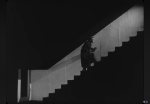
On the edge

The stream fords towards Rough Canyon were completely dry from the drought, but there were pools of water in Rough Canyon itself. This was where I performed my first falling body experiment of the day. I’d left my trekking poles behind on this long warm walk and paid the price when bushwhacking in the aptly named canyon. I tripped on a large stone covered by leaves and fell headfirst. I escaped with a small scrape on my left forearm and a tiny bleeding wound on my left thumb; my dignity remained intact, since the only fellow I’d seen on the trail was far to the south, heading the other way.

Rough Canyon

Hours had passed, with me enjoying my usual QuikTrip turkey sandwich along the way. I didn’t want to walk all of the way over to the cave area, so I turned off on the Yellow Bridle Trail, following it to the stable. I followed the road along the other side of Lake Wayne Wallace, admiring the remains of autumn gracing the hillside. I found bright berries at the lakeshore campsites and shot the view from the Glenn Bridge before heading across the long high earthen dam toward the high bluff lookout.

I’ve clambered up the slope many times for the great views up top, but this time I accidentally conducted another falling body experiment up there. I used my GorillaPod flexible tripod to secure my Canon SX260 HS superzoom camera to a tree so I could shoot a timed self-portrait. But as I walked toward the cliff edge to strike my pose, I saw a movement out of the corner of my eye. I turned and no doubt my eyes widened and mouth dropped open as I saw the tripod break in two, sending my camera tumbling to the ground. There it bounced in a perfect parabolic arc (naturally, said the physics teacher) and was projected right off the edge of the cliff!

I can tell I’m growing mellower with age, since instead of cursing, I only muttered, “Oh, dear.” I blinked and edged over to the cliff edge to see if I could spot the camera on any ledges below me. It was gone, and I envisioned a shattered camera body awaited me below. I figured I would have to extract the memory card as part of the unit’s final rites.

My camera tumbled off this cliff

I decided to document the experience and share it on Facebook, posting a shot of the cliff edge I took with my iPhone 5, a caption noting how my camera had taken a tumble. I then sat on the cliff and enjoyed the view for a bit before venturing down to hunt for the Canon camera.

I didn’t find it on the scree below the cliff, so I widened my search and spotted the camera, lying face up with its lens retracted, dozens of feet from the cliff base. I was surprised to find it intact and working just fine. Recently I’d shown my students a video clip on how a fellow survived falling from a smokestack because he had struck rubble, which absorbed some of the kinetic energy and distributed the forces more evenly across his body; here was an example of the same beneficial effects.

The damage consisted of minor scuffs on the edges of the body and nicks and dings on the retracting barrel. Those dings are a reminder of why I carry a pocket superzoom rather than a fancy digital SLR camera; I doubt I would have been as calm, and the results as painless, if I’d sent a fancier camera off the cliff.

I trudged back to Lake Carlton along the park road, completing a 8.22 mile loop with a burst of autumn leaves by the lake shore. With a couple of hours of daylight left, I decided to drive over to the cave area for some shots, adding another 0.63 miles of walking and climbing to my day.

The familiar huge rock at the front of the formation greeted me and I slithered between the rocks on the old CCC trail, climbing and shimmying up to a lovely scene near the Stone Corral, where the late afternoon sun was backlighting one of the trees. Up top the scene was equally lovely, with the trees framing a vista of the Sans Bois Mountains. Two black vultures alighted on a tree, surveying the area.

I followed the wide slope of tilted rock to Robbers Cave itself, the sun silhouetting me at the entrance. Back out on the rock slopes, the panoramic view was a rewarding end to my hiking day.

Robbers Cave

As usual after a visit to Robbers Cave, I had dinner at Patron Mexican Grill in McAlester, enjoying the thick handmade tortillas, before driving to my childhood home for Thanksgiving. I’d spend Thanksgiving Day feasting on Mother’s cooking and catching up with the folks before heading out on Black Friday…not to shop, but to hike.

Click here for a slideshow from this day hike

Posted in day hike, photos, travel | 1 Comment

Seeking a Sunset

November 17, 2012

I wanted to hike today, spending more time walking than driving. So after lunch I ventured north to Elk City Lake for another hike on the Table Mound Trail, timing my hike so I could see the sunset at its conclusion.

On the Table Mound Trail (click image for slideshow)

The sun was at the wrong angle for the camera view southwest across the lake, but I did capture a shot of one of the trees projecting above the top bluff. In the distance I saw several small tents pitched near the playground by the dam, and later in the day I’d see the troop of kids marching along the road whom I presume they represented.

Descending the bluff, I took a shot of myself in one of the big cracks in the bluff. Most of the leaves have fallen, making the invasive cedars quite prominent, but I did get one shot of some lingering autumn color. I sat for a shot at the big overhang on the bluff and then bushwhacked down the bluff to what I suspect is an old roadway. I then clambered back up to the bluff and posed under the huge ledge supported by a single column of rock.

Deer

When the Table Mound Trail approached the Post Oak Trail, I deviated upward and then bushwhacked off the Post Oak Trail along a dim path leading to a rocky promontory. Then I bushwhacked eastward back to the Post Oak and left it at a large field by the road, spying a deer as I walked south along the top of the mound to see if I could look into the quarry. All I gleaned was a very old sign announcing a future past: the quarry it promised already came and went.

I followed the road all the way down to the camping area and then took the Table Mound Trail back north along the lake shore until I crossed the road and then bushwhacked my way back up to the promontory. I wasn’t satisfied with the view and was concerned that they might lock up the overlook drive, although I hadn’t seen a sign at the gate indicating hours.

I was wise to abandon that post, because just after I returned to the overlook a couple drove up and told me they were going to lock the gate, just in time to ruin any shots of the sunset. (Aargh.)

So I drove down the hill and pulled over so I could stand on a guard rail to capture the sunset. I got one decent shot of the rays crossing the water and used the Toy Camera filter on my Canon Powershot SX-260 as the basis for a vignette shot before the sun went behind a bank of clouds. Back at home I played around with both shots in Photoshop to get what I wanted.

My sunset

I closed with a full zoom shot of the crescent moon and then drove to downtown Independence, Kansas, through an immense smelly natural gas leak along the way. Downtown is dressed up for the holiday season and I enjoyed delicious baked meat ravioli at Brothers Railroad Inn.

I didn’t track my hike today, but I’d estimate I walked six miles. Hopefully good weather next week will allow me to go on some hikes over Thanksgiving Break.

Click here for a slideshow from this day hike

Posted in day hike, photos, travel | 2 Comments

Cro-Magnon Classroom Tech

November 17, 2012

Old school – how I made presentations back in 1993

As I approach a quarter century of teaching, I’m making yet another shift in how I present videos in class, and that led me to ponder the ways classroom technology has changed since I began teaching physics at Bartlesville High School in 1989.

Back then the only videos were on VHS tape and shown on a television wheeled into the room on a cart, and if I wanted to display a pre-made visual, I used an overhead projector like the monster shown at right (the projector, not me!).

The only computer in the high school science department was an Apple IIc, reserved for the science building rep. Some students had scientific calculators, but Texas Instruments had not yet produced a graphing calculator. My students had to graph their data by hand with hand-drawn best fit lines, all record-keeping was on paper, and attendance was on paper slips clipped to the door each period. As for lab equipment, the school had just bought a few air tracks, but not enough to outfit six or seven lab groups. So we were still using springs on metersticks to pull old wooden dynamics carts across the floor for several of our labs.

I’ve been known as the computer whiz at work for decades, but I’m actually rather conservative in my use of technology. I still keep a paper gradebook, since it never goes offline and is easier than the computer for tracking accumulated tardies and absences, although of course I transfer the grades into the online system. I prefer a dumb whiteboard to an electronic one and rarely use PowerPoint, I’d rather have students make hand gestures for feedback than use remote ‘clickers’, and so forth. But my classroom technology has certainly evolved since my early Cro Magnon days.

Graphing/Computers

Science teachers and the donated computers and printers back in 1995

I’ve had graphing calculators for years, but have never used their graphing functions outside of training classes since I found them too cramped and limited. Instead, as the years went by I worked to build up a collection of used computers for student lab groups to use with Vernier’s Graphical Analysis software. By 1995 I was trying to interest other science teachers in this approach, with me arranging for Phillips Petroleum to donate a bunch of old IBM AT machines and dot matrix printers for the science rooms in grades 6-12.

Eventually each station in my lab had an old IBM PS/2 Model 25 floppy-disk-based computer for graphing, with a primitive print-only network of telephone cables linking them to a few slow and noisy old dot matrix printers with fanfold paper.

My classroom evolved to having old hard-drive computers at the stations, linked in a daisy chain 10BASE2 network of thin coax cable which I wired up from one station to the next, all linked to a single laser printer. What a breakthrough that was, since I could finally transfer files and everyone could print to a single fast printer with high-quality output. A few years later I led NetDay at our school, with volunteers helping me install the first Ethernet wiring and wall ports in the science labs.

By then the use of classroom computers was not all that different from what we do today – we’re still using a version of Graphical Analysis after all these years – although fat CRT monitors have been replaced with flat LCD panels and the desktop machines are smaller and more capable with each generation. We also now have enough laptop computers that I can provide each student, not merely each group, with a computer if needed for in-class data collection and lab report creation via wireless networking, but it is still such a big hassle to get enough computers wired up and running properly that I only do it once per year to give them the experience. I presume eventually we’ll have convenient tablet computers for this sort of thing, but we’re a long ways from getting there with our pitiful state funding for public schools.

Presentations

Well, I still have an overhead projector and I actually use it in class, although only for a few demonstrations, such as Fleming’s Law and electromagnetic induction, where an apparatus on the overhead can project a huge visual. Until we built the science wing in 2003, I either used a large CRT monitor to show visuals or a portable LCD projector on a cart. Here’s what my classroom technology looked like in 2001, minus the portable LCD projector and a SMART Board I never used much:

My classroom technology in 2001

Thankfully the lab stations in the new wing are MUCH larger

You can see why we needed the new wing, with its large student lab stations with built-in network ports, ceiling-mounted LCD projector, etc.

With the permanent LCD projector at my disposal, I shifted even more to computer presentations for visuals and now have an Elmo document camera for some demos and papers. But I use PowerPoint sparingly, relying much more on the chalkboard (now a whiteboard) since it gives me plenty of space to write and leave things visible for the slower students. Writing everything out each period also helps me pace myself more to the speed students need and encourages me to be succinct. I use PowerPoint only when there are many visuals and/or video clips to integrate into the lesson, not for regular note-taking.

1991 vs. 2012: whiteboards instead of chalkboards, but not much difference

Promethean Board (no, that’s not me; I don’t like them)

I wrote grants for a SMART Board over a decade ago and later a Promethean Board, but neither electronic white board worked for me since the long solutions to some examples took up more than one screen and I wanted the earlier work to remain visible, something I can readily do with my multiple traditional white boards. So I gave both electronic boards away for others to use.

I’m sure there are clever interactive things I could have students do on a Promethean Board, but it just doesn’t suit my style of instruction. Similarly, although some teachers make effective use of them, I don’t want a “clicker system” of student remotes for feedback, instead relying on observation, questioning, and simple student hand signals. But if we ever equip every student with a tablet computer, that might prompt me to change.

Video Clips – VHS to DVD to the computer

Format Transitions

And after all that discursion, we get to what prompted me to think back on classroom technology: classroom video clips. In the old days I had to pop in a VHS tape to show a clip and then painfully rewind it. Later I could burn clips onto a DVD for use in class with the ceiling LCD projector and that also allowed me to extend the life of good clips beyond their pitiful VHS origins. I have been fighting the DVD player again this year, waiting for it to boot up and wrestling with it to show a clip I’ve burned off, or show a bit from a larger video.

But showing a clip from the computer is far more efficient than wrestling with the stupid DVD player. What held me back until this year was that the old laptop computer on my teacher desk simply didn’t have enough storage space for all of my video clips and I’ve learned not to rely on the school’s network for instructional components – I can’t stand for the internet or the network to go down and leave me high and dry.

But this year I planted a new desktop computer under the desk, angled a not-too-large LCD monitor on it, and thus gained plenty of disk space and processing power to switch to only using computer-based video clips. I’ll keep the DVD player handy for full-length videos when I miss school, since most substitute teachers can’t handle lab work and simply copying physics notes isn’t very helpful. If I can let students work on an existing assignment I always do that, but sometimes a video related to the objectives is the best substitute.

The problem is that the dozens of short clips I’ve collected were mostly burned to DVDs (with backup discs at home) and not retained on a hard drive. So I’ve been slowly ripping them back off my own DVDs, editing them if needed, and throwing them into my DropBox directory. That way they sync up to the cloud as well as onto any computer I designate, giving me several backups and making it easy to get them onto the computer at school.

I’ve been using HandBrake to rip the video clips off my DVDs on my desktop Windows 7 machine. The default Windows Media Player I use at school won’t reliably play the ripped clips, so if I want to play them with the DivX player, I have HandBrake rip them in MKV format.

But if I want to edit them, I can’t use the free Microsoft Movie Maker to edit the clips HandBrake produces. Instead, I rip them off in MP4 format, copy that over to my MacBook Air and convert the file into a form iMovie can edit with MPEG StreamClip, edit the file in iMovie, and then export it back out.

Frankly, it has been tedious, but now that the job is done I should have all of my video clips at my fingertips in class. No more mucking about with the DVD player, thank goodness. Welcome to the 21st century, Mr. Meador!

Posted in technology | 1 Comment

Tour Along the Talimena

November 10, 2012

Talimena Drive (click image for slideshow)

The forecast called for a warm and windy Saturday followed by a rainy Sunday. The fall colors are fading and the leaves are shedding, so I decided to drive three hours south to the Talimena Skyline Drive (now called the Talimena National Scenic Byway), which follows a crest of the Ouachita Mountains in southeast Oklahoma over into Arkansas, to see what colors of autumn remained. I’ve been on the Skyline Drive between Talihina, Oklahoma and Mena, Arkansas many times, the views more often than not obscured by fog. But this day promised to be warm and sunny with decent viewing. I decided I’d stop and see the vistas rather than take a long hike, having made two previous hikes along the Old Military Road at the west end in April 2011 and April 2012 and, 40 miles to the east, a hike in January 2011 along the Ouachita Trail between the Arkansas-Oklahoma state line and Queen Wilhelmina Lodge. I’ve also been on hikes in the vicinity at Cedar Lake in September 2009 and Lake Wister in December 2010.

The Skyline Drive was built between 1964 and 1969 by Arkansas and Oklahoma, connecting two truck trails originally built by the Civilian Conservation Corps in the Great Depression. The 54-mile drive along an east-west ridge of the Ouachita Mountains, one of the highest mountain ranges between the Appalachians and the Rockies, varies in elevation from 1,150 to 2,681 feet.

It took me 90 minutes to get out of town since I needed to get my trusty car’s tires rotated, its oil changed, and a breakfast in my belly. So I did not arrive at the west end of Oklahoma Highway 1 until 12:30 p.m. My first stop was Panorama Vista, where one can see the highway winding along the ridge. Autumn colors were on display at Deadman Vista, and Lenox Vista provided a nice view of the sharp long ridgeline to the south.

Deadman Vista

I followed the winding ribbon of highway eastward to where I could see Cedar Lake tucked into the woods to the north, and then stopped at Horse Thief Spring. It was supposedly once used by outlaws back in the days of Hanging Judge Parker of Ft. Smith, and the Indian Territory parts of the novel True Grit are set in this area, although the movie versions were filmed elsewhere in less authentic environs. The CCC built a stone enclosure for the spring, which I approached to find the lid pulled aside a bit to reveal some water, although I wasn’t tempted to drink.

My next stop was Shawnee Vista, followed by Winding Stair Campground and Sunset Point Vista, where the clouds were more impressive than the foliage.

I pulled over at Castle Rock Vista, even though the view to the south was not great. The online guide had mentioned a short trail to a rocky promontory. I found the Dwarf Oaks Trailhead and the dim trail led westward through stunted trees. The trail rapidly faded out, obscured by the fallen leaves and no trail maintenance. I bushwhacked my way eastward toward the promised promontory 0.3 miles ahead.

Castle Rock

It was apparent few took this trail any more, but eventually I spotted a ridge of white rocks and climbed to find myself on the mountain’s long backbone, its rocky vertebrae projecting out of the thin soil. I was straddling one of the highest points in the Ouachitas and posed for a self-portrait. I then bushwhacked my way south down the ridge to the Skyline Drive to walk back to the parking area for a miniscule hike of 0.65 miles for the day.

I reached the state line, stopping to revisit the 1935 survey marker I’d hiked to from Queen Wilhelmina Lodge almost two years ago. I drove on to Queen Wilhelmina State Park, finding the lodge and restaurant closed, although the store was very busy.

I made a quick turnaround and headed back west along the scenic byway for a brief stop at Big Cedar Vista to take in the views, and then diverted onto faster roads so I could meet some friends for dinner in Tulsa.

Although the trees were too shorn of leaves for the full beauty of fall, I’d enjoyed the drive along the Ouachitas, if not the long trek there and back. I’m growing weary of long highway drives, so I may stick closer to home for a bit, waiting until I can make an overnight trip which will allow me to spend more time hiking than driving.

Click here for a slideshow from this trip

Posted in day hike, photos, travel | Leave a comment

11 Miles at Pea Ridge

November 3, 2012

Pea Ridge (click image for slideshow)

Last weekend I stayed near home, despite the inviting fall weather, needing some recovery time after my somewhat exhausting Fall Break. But this weekend I knew I had to hit the trails to enjoy some fall color, so I drove three hours southeast to hike 11 miles at the Pea Ridge National Military Park in northwest Arkansas. I’m not a fan of Civil War battlefields, but here’s a synopsis of the action there 150 years ago:

Brig. Gen. Samuel R. Curtis’s 10,500 Federals had driven the pro-Confederate Missouri State Guard, led by Maj. Gen. Sterling Price, south into Arkansas and had dug in above Little Sugar Creek a mile southwest of the later battlefield. Price’s force was combined with Brig. Gen. Ben McCulloch’s Confederates into a force of 16,000 led by Maj. Gen. Earl Van Dorn. On March 7, 1862 Van Dorn swung north behind the Federal line, which wheeled about to fight across the fields and woods just south of Elkhorn Mountain on the Pea Ridge Plateau.

Van Dorn split his force in two. The west arm, led by McCulloch, came under fire near the hamlet Leetown and McCulloch was killed and his men scattered. To the east, Van Dorn and Price pushed the Federals back until the Rebels held Elkhorn Tavern and Telegraph and Huntsville Roads. But on March 8 Curtis’s two-hour artillery barrage crippled the Confederate line and there was a concerted infantry attack. Running low on ammunition, Van Dorn withdrew eastward along the Huntsville Road.

Battle of Elkhorn Tavern

The battle saved Missouri for the Union and was the only major battle in which Indian troops participated, consisting of about 1,000 Cherokees who routed two companies of Union cavalry but were forced to take cover in the woods by Union cannon fire and then held in reserve for the rest of the battle.

I arrived at 11 a.m. and paid the $5 entry fee at the visitor center and, leaving my car parked there, set off on foot to make a large clockwise loop around the military park. There is a 7-mile loop road, mostly one-way, with hiking and horse trails paralleling much of it.

My hike

Telegraph Road

I began my walk along Telegraph Road. The eponymous wires had been strung three years before the Civil War battle along this road, which was built in 1838 and linked Springfield, Missouri and Fort Smith, Arkansas. It was inaugurated in sorrow as one of the major routes of the Trail of Tears: the forced removal of thousands of Cherokees and other American Indians from their homelands. The same road was part of the Butterfield Overland Stage line from 1857-1861. I walked a portion of that line a year ago in Devil’s Den.

I made this trip specifically in hope of autumn colors, and the trees along Telegraph Road did not disappoint. I left the road to find the bridle trail, which led beside the wide expanse of Pratt’s Field, demarcated by long lines of split rail fencing. Far across the field was the long low rise of Elkhorn Mountain, and to the side some trees were decked out for fall.

The trail led through the trees and when it turned to follow an old road northward, I turned south, heading for Leetown past more nice trees. The trail crossed the loop road and bridged Lee Creek, the only bridge I recall along my hike. There is nothing left of Leetown besides a cleared field.

Fences of Pea Ridge

I followed the hiking trail north as it crossed the loop road toward the Leetown Battlefield where the Confederacy’s western flank was broken with two generals killed and the ranking colonel captured. Some recumbent bicyclists passed along the asphalt road ahead of me. I was grateful for the parallel old dirt road the hiking trail followed, covered in soft leaves.

There were some lively signs, telling of how the soldiers fought all afternoon amid a hail of musket fire in Morgan’s Woods to the northeast after Union cannon forced the Indian troops to seek cover from the heavy fire.

Rather than follow the hiking trail eastward along the gravel road to Ford’s Field, I opted to head northwest to follow the much longer bridle trail route. I immediately reached a pond, grateful I was hiking rather than driving, since those trapped on the road had no idea such a pleasant spot for lunch was sheltered nearby.

Many fish swam up and gazed longingly at me as I enjoyed my typical QuikTrip turkey sandwich. A couple of riders greeted me as they passed by. The trail led northwest to the far corner of the park, where it turned east to follow the boundary up through the forest of Elkhorn Mountain before turning southeast.

Fall Colors

This section of trail was what I’d been hoping for: a nice stroll through the autumn woods. Frequent gunfire in the distance made me glad I was secure in a no-hunting zone. I passed a tree with a high burl and then saw the first sign of fire.

At the visitor center I’d been told I could not hike the trails in the far eastern section of the park past Elkhorn Tavern due to prescribed burns. As I reached the eastern part of Elkhorn Mountain, I encountered a solitary smoldering log. Hmmm…it didn’t look like a campfire, so perhaps it was from a prescribed burn before the pyros moved eastward past the tavern?

The trees were on fire, but only with autumn reds, as I climbed up the mountain and then saw how the trail was the edge of an obviously recent prescribed burn. Logs were still smoldering in the distance. As I reached the high edge of the mountain, a tiny break in the trees gave a glimpse of forested hills beyond. The trees still sheltered me with their dying leaves.

Another pair of trail riders passed by and I walked under a high canopy of carotenoid leaves. A pile of huge rock dominoes shed from the nearby ridge prompted me to pose for a self-portrait. After more trees with high colors, I passed a felled burning log and then two hikers crossed the trail ahead. I had reached the turnoff for Elkhorn Tavern.

It was a short walk eastward to the only remaining Civil War structure in the park, although it actually is an 1865 reconstruction after bushwackers burned the original. The name came from elk horns, from an animal shot nearby, which adorned the roof. I noticed that the park keeps a set of horns up there to this day.

Tourists were lined up, listening to a history talk by costumed volunteers. Nearby was the Reunited Soldiery Monument, Angel Aloft, erected in 1889 by Union and Confederate veterans. I found its blocky form less than ideal.

Living History

I returned to the hiking trail, which climbed the ridge, up steps through a crack in the bluff. I walked along a smoky trail with the view opening up, revealing a vulture gliding across the fields beyond. I reached the east overlook, with a high view of Cox’s Field. (There is a west overlook, but it is not along a trail, and when I drove to it later, I found trees had obscured its views.)

Overlook

The overlook was busy and I was glad to return to the quieter trail. It was burned over and hard to follow for a bit as I descended the ridge to the gravel Ford Road, which I followed eastward to the main loop road. Along the way I admired the leaves, long rail fences, and a cannon.

I reached the line where the Federals stretched across the fields as they drove toward Elkhorn Tavern. The overlook was visible up on the ridge. A last burst of vivid color bid me farewell as I returned to my car, a bit footsore from my 11-mile trek. The sun blazed my westward trek homeward, with me refreshed by the long autumn hike.

Click here for a slideshow from this day hike

Autumn Leaves

Posted in day hike, photos, travel | 1 Comment