Lava Tubes, Cinder Cones, and Sisters: Day 8 of the Oregon Trails

Exploring the Lava Tube (click for slideshow)

Exploring the Lava Tube (click for slideshow)

I began July 24 driving north from Yachats to Newport for a Sausage McMuffin with Egg at McDonald’s.  Thus fast food fortified, I drove east up and over the high northern Cascades through the Santiam Pass.  Naturally I got stuck in a line of cars behind a double-trailer fuel truck crawling over the pass, but near the peak I was able to pass on the pass (follow me?) and barrel down into the dry lands east of the range.  Annual rainfall plummets from 77 inches in the impressive forest at the Santiam Pass to only 14 inches in Sisters – you quickly realize you’re descending into a desert.

This region had 90,000 acres (roughly 140 square miles) burned up in the B&B Complex Fire back in 2003.  The damage was apparent although it certainly made it easier to see Mount Washington.

The road leading through the Deschutes Forest (or partially burned-out wasteland, if you prefer) was only two lanes and cars piled up quickly behind me as I descended at the speed limit.  No doubt they celebrated when we entered the town of Sisters, where I turned off for some tasty pizza at Papandrea’s.  The lady at the counter was quite friendly and later began cackling like a deranged witch back in the kitchen.  I had suspected two boys working in the place were her sons, and that was confirmed when one of them, taking a break in the eating area, started yelling, “Mom, what are you doing?!?” as her cackles continued to cascade.  My fellow diners and I had to chuckle, although we never found out what potion she was cooking up back there in her pepperoni pot.

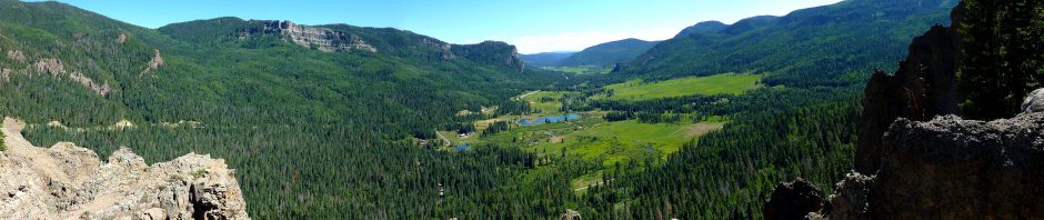
Sisters is an odd name for a town, but easily explained because just north are The Three Sisters, three volcanic peaks which are the 3rd, 4th, and 5th highest in Oregon.  Early settlers had named them Faith, Hope, and Charity, but that didn’t catch on.  Myself, I haven’t found Oregonians lacking in those three qualities.  East of town was a pullout where I snapped a panorama of The Three Sisters and Mount Washington to boot.

I then drove through Bend along Highway 97 to the Newberry National Volcanic Monument.  I had done very little research about this part of the trip, so I was surprised at how well it went.

First I turned off at the Lava Lands, paying my day use fee, and was directed to drive up to the top of a 500 foot tall cinder cone.  Lava Butte was formed in an eruption 6,160 years ago and covered nine square miles with lava.  A trail circumnavigated the crater rim with great views of the crater.  Newberry Volcano itself is the largest shield volcano in the state, atypically spewing not only basaltic but also andesitic and rhyolitic lava.  At 20 miles in diameter, the cinder cone I drove up is only one of many on Newberry’s flanks.

The summit was infested with chipmunks (later I learned these were golden-mantled ground squirrels, which are slightly larger than chipmunks and lack the strip to the top of the head), with plenty of signs urging patrons to please not feed them.  The little rodents were good little beggars, but I was just as unyielding to them as to the beggar who tried to accost me at a McDonald’s earlier in the day at a pit stop.  Speaking of pits, I’ve spent so much time hiking that I suspect a third of the toilets I’ve used on this trip have been pit toilets.  And that’s the pits.

Surprised that the nearby visitor center wasn’t smart enough to sell ice cream or even drinks (it was 59 degrees Fahrenheit on the coast this morning, but 86+ at Newberry), I disgustedly drove on to what would prove to be the strangest hike of my trip.

The Lava River Cave is the longest known lava tube in Oregon, and you can hike over one mile down it, deep underground.  And there is no lighting along the tube – you either bring your own flashlight or rent a lantern.  So I had a great time strolling through the tube today with a Coleman lantern.

The entrance looks much like any other cave, and the interior does vary in diameter but the trend is clear.  This thing has no forks and gets smaller and smaller toward the “end”.  There are no loops on this trail: you stroll down the tube, which has a somewhat uneven but quite walkable floor, until it narrows to a crawlspace.  Then you turn around and go to the light, which is over a mile back.  I didn’t make it as far as a couple of small children who had gone ahead a few dozen feet after my stopping point.  I could see their light burning away down there, and I left them to their fate.  Oh, their mother was with them – I heard her screams.

Just kidding, although noticing some of the fissures in the tube and knowing this area had earthquakes did make the long dark tube a bit spookier.  But it was a fun and unique experience, and inside the tube it was so cold you can see my breath in several of the photos.  A 44-degree temperature drop on a hot summer day out in fields of lava is most welcome, especially when the Lava Lands Visitor Center does not provide ice cream nor drinks.  I’m talking to you, Forest Service!

The lava tube tacked another 2.2 miles to my trekking total for the trip.  I added another mile to the count farther south at the Lava Cast Forest.  Here an eruption spilled lava through a pine forest, flowing against the upstream side of the trunks and forming a mold as the tree burned within.  Today the area is covered not only in rough lava and ash, but is peppered with odd vertical cylindrical hollows that are the tree molds.  I shot some video footage down a couple of them.

Oddities along the trail included horizontal tree molds and nature’s attempts to undue the damage of 6,000 years ago with butterflies, trees, dead trees, weird dead trees, and even a flowering plant or two.

I then drove on to the Newberry Caldera, which has two lakes in it and a large obsidian flowTiny Lake Paulina was charming and seemed far more hospitable than the immense Crater Lake I visited in 2006.  But I was more fascinated by the huge black glassy chunks of obsidian at the immense flow formed by rhyolitic lava.  A mile-long trail winds up and around the flow, and I posed not once, but twice, and was still not satisfied until I shot a couple of kids posing.

But perhaps the best thing about the Newberry Caldera was, yes, they sold ice cream and drinks there at a little store at Lake Paulina.  All is forgiven, Forest Service.

It was a long drive today, something I finally noticed when I was driving out onto the Newberry Caldera with the nearest gas station 15 miles away and the car gas gauge steadily sinking towards E.  Not wanting to take a chance at being mocked for running out of gas on the caldera of a dormant volcano, I turned off the air conditioning to conserve fuel and as I left the area noticed the Saturn displaying “LOW FUEL” on its computerized readout.  Okay, I get it!  I told Trixie the GPS to find the nearest station pronto.  When the gas attendant asked me whether I flew the car from Hawaii or brought it over on a boat, I resisted saying, “Yes, I flew it, just like in Chitty Chitty Bang Bang.”

Yelp steered me up through Bend to the La Rosa restaurant for absolutely delicious fajitas.  Dare I say they were even better than my old favorite, El Chico?  Yes, I’m afraid they were.  Bend is an interesting city.  It was only 52,000 back in 2000 but has reached 82,000 today with 216,000 in the metro area.  This immense growth has created an odd place where the cute downtown has many small pricey-looking upscale buildings and there are some more typical neighborhoods surrounding it, but the outer areas are models of new urbanism.

There are roundabouts everywhere, which studies show are good traffic calmers.  They’ve even stuck them into older neighborhoods when they could.  And I didn’t see hardly any of the big mile-grid streets like we have back home.  Instead you have to wind your way around on narrow streets everywhere, but traffic even on a Friday night in the busy areas was pretty light and easy to manage.

Highway 97 running north-south through Bend is a model of new thinking.  They didn’t let it clog up like highway 75 in Bartlesville.  It is mostly restricted access with ramps or stop lights only at mile intervals, gliding you along at 45 miles per hour.  They avoided ugly frontage roads but instead have a very broad “green strip” along the sides, although in this climate there is little green besides pine needles.  The green strip is broad enough that you can’t see the neighborhoods or businesses off the highway, and in other areas they use high walls to block it all off.  So you can drive clear through Bend and only see brief glimpses of the city around you, instead enjoying distant vistas of volcanic mountains and short green forests.

There are oodles of sidewalks and other pedestrian-friendly features around the town.  This sort of modern development is most appealing and is in stark contrast to the absolutely horrid urban planning (or sprawling urban madness) ones sees in Tulsa and Oklahoma City.  Just think if Owasso or Moore had taken this route instead of becoming horrid soulless abominations.

Well, as I post this and today’s slideshow, it is past midnight.  So I am LONG overdue for that hot tub that awaits me here at the Quality Inn.  I can’t neglect it, since after today it is just Motel 6 for the weekend.  I don’t have much of a plan yet for tomorrow other than to drive north so that I arrive at The Dalles by nightfall.

Happy trails…or should I say lava tubes?

[Next post: Deserts and Rivers: Day 9 of the Oregon Trails]

Posted in day hike, travel | 4 Comments

Cape Perpetua and Smelt Sands: Day 7 of the Oregon Trails

Cummins Creek Overlook (click for slideshow)

Cummins Creek Overlook (click for slideshow)

The day began with a big breakfast of French toast, scrambled egg, and bacon at the Adobe Inn Restaurant a bit south of my motel.  I knew I’d be snacking at lunchtime, so I was glad to take some leftover bacon along to complement my “Fiber Fit S’Mores” on the trail.

I drove over to the Cape Perpetua Scenic Area, paid my day use fee, and headed out for another long hike.  I traveled ten miles in about five-and-a-half hours, starting out on the Oregon Coast Trail southward for 1.3 miles to the Cummins Creek Trail, which rose gently but steadily for several miles.  Then it narrowed considerably with a steeper ascent and, after another couple of miles, I was beginning to wonder if I’d missed a turn since I hadn’t seen another soul and the trail was becoming overgrown.

But then a sign told me I was still doing fine as the trail turned north and became steeper still, ascending to an overlook hundreds of feet above the ocean about five miles out with a nice panorama.  This high section of the trail had bald knobs, allowing more wildflowers to bloom.  I took shots of a daisy, common yarrow, self-heal, foxglove, thistle, and a pollinating bee.  I was struck by the enormous leaves on one plant at a particular section of trail, taking a shot comparing one to the size of my hand.

I’ll confess it took many internet searches to identify those botanical specimens.  On the trail I was only confident they were plants.  Quite confident.  And I could positively identify trees covered in moss.  Can you believe I’m certified to teach botany?  Plant identification was never an interest of mine, despite my parents’ and teachers’ best efforts.

Then I began the long descent back to the coast along Cook’s Ridge Trail, which rides the ridge between Cape and Gwynn Creeks.  This part of the trail was prettier with a nice breeze, and I was glad I took the Cummins Creek trail on the ascent, as Cook’s Ridge was far less steady in its elevation change.

For the first 4.5 hours of this hike I never saw another person and there was no cell phone service, so my iPhone GPS couldn’t provide a map to orient me.  Finally on the lower part of the Cook’s Ridge Trail I encountered two couples, but that was it for the entire day.  Clearly almost all of the visitors to Cape Perpetua stick to the coastal trails and their stunning vistas, but I took those in back in 2006.

I completed the hike around 2:30 pm and drove back to my motel room for a shower, then drove south toward Florence so I could take some snapshots of Heceta Head Lighthouse and the nearby beach in the afternoon light with sunning sea lions, as well as the sandy beach stretching south to Florence.

In Florence I bought some supplies and drove to its tiny harbor before dining at Pomodori Ristorante, which supplied some delicious cheese and spinach ravioli and salad.  Then I headed back north to my motel at Yachats and walked the 804 trail.  This trail is an old county road that local citizens saved for the public after much litigation and runs by my motel and is yet another part of the Oregon Coast Trail.  The Hypomesus pretiosus, or surf smelt, arrive along here annually to lay eggs in the gravelly sands.

There are the remnants of native American shell middens here.  The Alsi and Yahute Indians formed huge piles of clam, oyster, crab, and mussel shells when, after a seafood feast, the diners threw sand over the shells to lessen the odor. Some middens reached over 100 feet high, but the material was later used to build roads in the area so now there are only small nubs of shell material left with some hardy plants.

Today’s slideshow wraps up a week in Oregon.  Tomorrow I leave the coast behind with a long drive inland to the Newberry National Volcanic Monument south of Bend.  Goodbye, Pacific!

[Next post: Lava Tubes, Cinder Cones, and Sisters: Day 8 of the Oregon Trails]

Posted in day hike, travel | 1 Comment

Waterfalls: Day 6 of the Oregon Trails

Alsea Falls (click for slideshow)

Alsea Falls (click for slideshow)

I woke up today and had a hearty breakfast at the Agate Beach Inn’s Starfish Grill.  Lots of driving today, since I headed over 70 miles inland to visit Alsea Falls and Green Peak Falls.

I drove east on Highway 20 until I reached Burnt Woods and, despite that fearsome name, turned off onto forest roads towards Mary’s Peak, the highest peak in the Oregon Coast Range.  I saw almost no one for miles, making me a tad nervous as Trixie, my V7 GPS navigatrix, guided me from one gravel road to another.  But the mountains gave Trixie fits and I hadn’t brought my Oregon Gazetteer (cursed airlines and their luggage weight limits), so I wound up on the wrong side of the peak facing a signpost that warned me I was on corporate land (as if I couldn’t tell from all of the ugly clear cuts) and could not continue without permission.  Being a good little boy, I retreated, muttering to myself that it was too cloudy for good views anyway.  At best I was being respectful of property ownership, but in fact it was a failure of courage.  There was no phone service out there, but later I reconstructed my wanderings with Google Maps.

Trixie steered me onto the Tum Tum Road, which reminded me that it was approaching lunchtime.  So I drove back onto Highway 20, past Philomath and into Corvallis.  My breakfast had been so large and late that I wasn’t all that hungry, so I used Yelp to steer me to Le Patissier, a French bakery owned by Didier and Trinidad Tholognat.  With names like that and my only French being a week of instruction in the fifth grade, I wasn’t surprised that I could barely decipher what was on offer.  But the Pain Au Chocolat in the display case beckoned and I was relieved to discover that it was a variant of the croissant with a chocolate strip in the middle.  I’d navigated to Yum Yum Road.

I drove on to the true goal for the day, the Alsea Falls Recreation Area.  This is a remote location with few signs and several wild drivers with the Bureau of Land Management who careened by me on the curves in their pickups.  What with my Hawaiian car license tags I’ve been saying “Aloha!” to other drivers, but with these guys all I could manage was “Whoa!” before they disappeared into the dust.

Alsea Falls drops perhaps 100 feet along the south fork of the Alsea River, although that is broken up into multiple smaller falls at this time of year with swimmers taking advantage of the reduced flow.  I took a shot of the upper falls and then went downstream where I could move out into the flow, courtesy of my waterproof hiking shoes, for a snapshot or two and a panorama.

I hiked about five miles around the area, including up along Peak Creek to Green Peak Falls, which drop about 50 feet.  A couple and their dog were out in the middle of the downstream flow from Green Peak Falls, so I followed their lead although I missed my trekking poles.  I’d left them in the car since the trail was so gentle.  Feeling pleased that my shoes were still keeping me dry, I promptly slipped on a mossy rock and fully immersed both shoes in Peak Creek.  My SmartWool Light Hiking Socks, thinking I was suddenly sweating profusely, attempted to sop up the entire creek.  They failed, but I got the shot.

I squished my way back to the car, where I changed my shoes, socks, and shirt.  Trixie urged me to go back to the coast via “Alsea Deadwood Highway” and “Lobster Creek Road” and “Unnamed Road” and the like through the Cummins Creek Wilderness of the Siuslaw National Forest.  But, tired of forest roads of dubious quality, I insisted we backtrack to Monroe and take state highways from there.

Highway 36 spun me right round, baby, right round like a record, baby, right round round round.  My apologies to Ratt, but 36 was a bit tedious as it wound its way slowly toward the coast with hardly another car in sight.  I was glad to finally hit 126 where the road improved (and of course the traffic increased) as it paralleled the Siuslaw River to the coast.

Highway 101 rides the coastal cliffs from Florence north to Yachats.  One magnificent mile upon another flew by and I passed Cape Perpetua, which I visited briefly in 2006 and will be hiking all day tomorrow.  North of Yachats I reached the Fireside Motel, where I had reserved a room for two nights.  This was the only reservation I couldn’t fully complete online, so I wondered what I’d find.

Only the best room with a view on the trip, I dare say.  I’m sitting here in my room a few feet from the ocean next to a big window that looks directly out on the Pacific.  I’m leaving the drapes open tonight so that I see the ocean first thing when I wake up in the morning.  Well, after I put on my glasses.  Sigh.

Yelp tried to lead me to the Drift Inn for dinner, but there was nary a parking space to be had there.  So I drove to Le Roy’s Blue Whale, where I had a serviceable fish and chips and a slice of chocolate cream pie.  Now it is dark, I am tired, and you have a slideshow of photos and even a movie of the waterfalls to view.  Enjoy!

[Next post: Cape Perpetua and Smelt Sands: Day 7 of the Oregon Trails]

Didier and Trinidad Tholognat
Posted in day hike, travel | 1 Comment

Cascade Head and Newport: Day 5 of the Oregon Trails

Yaquina Head Lighthouse (click for slideshow)

Yaquina Head Lighthouse (click for slideshow)

I loved this road sign at the Cascade Head trail today, for I did indeed have pedestrain by the time I finished hiking 6.2 miles and going up and down 1200 feet.

The day began with a ho-hum breakfast at the Pig ‘N Pancake at Lincoln City…nice building, but the food was nothing special.  But Motel 6 doesn’t offer continental breakfast, so whatcha gonna do?  It was chilly and foggy today, which didn’t bode well for the views on my hike.

I drove north a few miles to the Nature Conservancy’s Cascade Head area which they preserve for some butterflies as well as hiking enjoyment.  The trail was an interesting mix of forest and grassland with what on a clear day would be a spectacular view of the Salmon River and Lincoln City down below.  But today I could only snap a cloudy shot of the river from the trail well below the summit, although the panorama was still impressive.

After that, my ascent was fog-bound and the views were non-existent.  But I still enjoyed reaching the summit, snapping some of the plant and animal life, and happily the trail then re-entered the forest and was quite beautiful.  I refrained from listening to my iPod on the ascent, enjoying the sounds of the ocean and the grassland.  But for the long descent I indulged in some more fun lectures by OU’s Professor Rufus Fears courtesy of the Teaching Company.  I met him back in 2004 when he won the Oklahoma Medal for Excellence in university teaching while I received the one for secondary teaching and since then have enjoyed many of his wonderful lectures on great books, history, and classical Greece and Rome.

By one o’clock I was back at the car and truly weary.  So I drove into town and had a memorably bad French dip sandwich at McMeniman’s Brewpub.  Yelp.com did me wrong this time!  ‘Twas a dry sandwich, which the incredibly salty au jus could not put right.  Their decision to call it an “American” dip should have warned me off, for Americans do love salt.  I was on the upper floor of the restaurant where one poor waitress struggled to service too many tables, both indoors and outdoors, dragging food up from the floor below.  But the part that bothered me most was how the floor and table shook every time anyone walked by – I prefer my meals without tremors.

I then drove south to Newport and took in the Oregon Coast Aquarium.  Nothing new – I’ve been to so many aquariums I can predict all of the exhibits by now.  But I did take some cursory shots of a pigeon guillemot and tufted puffin in the aviary and a sea otter.

I checked into the Best Western’s Agate Beach Inn, which I recalled from 2006 had a lovely view of Yaquina Head.  Today the view is misty, but as I write my room’s window wall’s sliding glass door is open so I can hear the ocean and see the Yaquina Head lighthouse beacon pulsing through the dusky air.

Dinner was at Izzy’s smorgasbord, so I cobbled together salad, corn, peas, green beans, and other sautéed vegetables with a bit of fried chicken, a tiny slice of mushroom pizza, and dessert.  Methinks I was overcompensating for lunch.

It was still light, so I paid the day use fee to revisit Yaquina Head, which I toured extensively in 2006.  I had left my usual camera in the hotel room, so I snapped not one, not two, not three, but four different odd shots of the lighthouse using some of the iPhone filters.

Then it was back to the hotel for a dip in the pool to relax and then today’s blog posting and slideshow.

I’ll try to sleep in tomorrow, although I note that 12 people just filed into the room next door and they are suitably noisy.  Egad, I hope they will disperse to other rooms or that will be one crowded bed!  Sounds like a night for ear plugs and Ambien.

The plan for tomorrow is to take a scenic drive inland two hours to hike at Alsea and Green Leaf Falls (if my poor feet don’t rebel), then drive back out to Yachats on the coast for the night.

[Next post: Waterfalls : Day 6 of the Oregon Trails]

Posted in day hike, travel | 2 Comments

Neahkahnie Mountain and Two Haystacks: Day 4 of the Oregon Trails

Atop Neahkahnie Mountain (click for slideshow)

Atop Neahkahnie Mountain (click for slideshow)

After another continental breakfast, I checked out of the Microtel and drove south.  I made a brief stop at Cannon Beach to photograph their Haystack Rock, which is 235 feet high and proclaimed the world’s third largest coastal monolith.  However, later in the day I would photograph another Haystack Rock at Pacific City, and that one is 100 feet higher, but is not proclaimed as the first or second largest coastal monolith.  Perhaps they went by volume, or it’s all tourist twaddle.

From there I drove down Highway 101 to Neahkahnie Mountain.  Rising 1634 feet above sea level, the mountain features a trail with a 700 foot elevation gain over a 1.5 mile hike and rewards the climber with a spectacular view south over the coastal town of Manzanita.

After traveling along a rough gravel road a mile or two off Highway 101 I reached the trailhead.  A group of bicyclist adventurers were there for the ascent, although they had to hoof it rather than pedal it.  The main trail wraps around a ways below the summit, but my handy Hiking the Oregon Coast
book told me about a very steep and rocky side trail that went to the summit.

The view from the top was as spectacular as promised, and one of the bicyclists was kind enough to take a photo of me at the summit.  I had to descend the way I came up to reach my car, whereas the bicyclists were able to go on down the other side of the mountain where their van would be waiting.

I then drove in to Manzanita to catch a glimpse of it from ground level and thought about grabbing lunch, but several restaurants were closed on Monday in this tourist town.  So I drove on down Highway 101 to the Tillamook Cheese Factory.  There were scads of people there!  I can only imagine the madhouse it must have been over the weekend.

I ordered the “Centennial Grilled Cheese Sandwich” with fresh cheese from the factory and honoring the founding of the area dairy farmer cooperative in 1909, which has grown to 110 farms.  The wait was 30 minutes and for most of that there were no free tables in the place.  But one finally opened up and I welcomed two other fellows who were also waiting for a table.  My sandwich came with a good salad, but they forgot the dressing.  No doubt a misguided effort by the waitress to make the lunch a tad healthier.

One of my lunch companions was a fellow from Portland who was the caretaker for the other older gentleman, who had a speech impediment and other handicaps from some past accident.  Revealing I was from Oklahoma prompted the man being cared for to reveal he had previously lived in Nebraska and Missouri before his accident.  When I mentioned enjoying the Ozark lakes, he said he used to do some slalom water skiing there.  So I’m certain he was grievously injured when he fell off a single ski at high speed.  Note that if he claimed otherwise, I would naturally ignore his protests.  No dirty little facts should get in the way of my beautiful theory.

Bidding my table companions farewell, I headed to the ice cream counter, a primary draw at the factory, for a delicious treat.  Then, deciding to further enrich the cooperative, I bought a T-shirt proclaiming my love for the Oregon coast.

It was a short drive on into Tillamook where I turned off Highway 101 onto the Three Capes Scenic Drive, which hugs the coast.  The first part west out of Tillamook is the best since it literally runs along the shore, with the ocean a few feet below the edge of the road.  Later one reaches Cape Meares, which I visited in 2006 and skipped today since it was cloudy along that stretch of the ocean.

My progress along the Three Capes drive was greatly slowed by paint trucks as they worked on the roadway’s center stripes and shoulder lines.  I followed the white striper for so long that I began to worry some paint spray might be coating the rental Saturn, but a later inspection laid that to rest.  But it did point out how dirty the car had become, so I ran it through a car wash when I filled up in Lincoln City.  Well, to be accurate, someone else filled it up.  Oregon doesn’t allow you to fill your own car – you have to let an attendant take care of it, although since 2001 motorcyclists have been allowed to fill their own tanks.  Go figure.

After passing Cape Lookout, I decided to drive out onto another sand spit, the Bob Straub State Park at Pacific City, which occupies the Nestucca sand spit.  So the beach is a huge expanse of sand bounded on the north by the taller Haystack Rock.  The park has trails and I briefly tried one.  But while I don’t mind climbing short mountains and hiking 13 miles along the coast, I am utterly defeated by a trail made of sand.  It was such a slog that I soon realized there were better ways to spend my time.

Which brings me to winning $8 off the Siletz Indians.  My day ended in Lincoln City, where I had a nice halibut dinner with salad at the Dory Cove restaurant.  Then I wandered through the Chinook Winds Casino, operated by the aforementioned Indians.  I avoid casinos for the most part, but decided to try some “nickel slots” and when I finally received a $20 payout on a 20 cent bet, putting me $8 ahead, I cashed out.  And promptly spent 1/4 of my net winnings at the Motel 6 vending machines.  Easy come, easy go.

So another day ends with this blog entry and today’s slideshow.   Tomorrow I’ll hike some of the trails at Cascade Head.

[Next post: Cascade Head and Newport: Day 5 of the Oregon Trails]

Posted in day hike, travel | 2 Comments