
On the Osage Trail (click for a slideshow)
I spent the first weekend of Winter Break on activities that were predictable yet enjoyable. On Saturday I drove to Tulsa to eat and shop. The day began on a sad note, as I drove to 51st and Lewis for lunch at my favorite El Chico, only to discover it had been demolished. I had eaten there since childhood and am sad to see it go. I have known for a few years that it would be a victim of the widening project for the section of I-44 which was once known as the Skelly Bypass. Thankfully that project has spared, barely, the Marie Callendar’s restaurant farther east. And there are still three El Chico locations in Tulsa, so I drove to Promenade Mall for my El Chico fix.
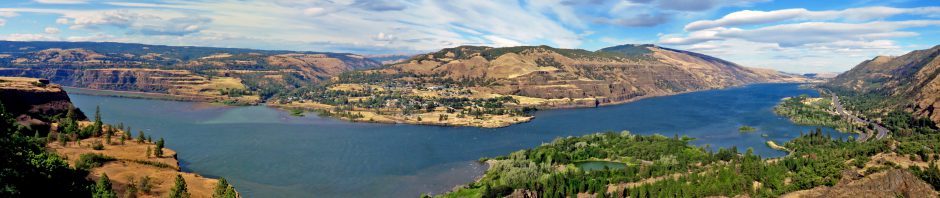
The holiday crowds were just right – the mall was busy and boisterous without being annoying and I had no trouble parking. I finished my Christmas shopping in the festive atmosphere, including wasting some money on an absurd Snuggie, and watched a group of young girls do a rather loose imitation of tap dancing in the noisy food court. Having imbibed enough noisy fun, I drove over to Woodward Park for a quiet stroll in the chilly overcast afternoon and took a photograph of Appeal to the Great Spirit.
Sunday lived up to its name with a bright sunny afternoon in the 50s, so I of course set out for a day hike on the final day of autumn. I drove to Osage Hills State Park after lunch and parked by the office. I first trooped up the Tower Trail to the observation tower, noting that its view remains mediocre even with the trees bare of leaves. So I quickly clambered on up to the old CCC camp site, past the clattering stripper well, and over to Lookout Lake, where I took one shot of the rippling water beyond the trees. Farther along the Lake Trail I took a side trip to a seamed bluff, admiring a tree hanging onto the edge above.
Popping out onto the main road, I spied a red metal trail marker on the signpost for the next section of the Tower Loop, and similar red markers on another signpost pointing to a nearby clearing. I’d wandered over there once before, but had only noticed an old storehouse with barred windows and a sturdy door. There were vehicles parked there today, so I figured there must be some sort of trail there, although it is not documented on the park map. Sure enough, there was a sign for three mountain bike trails, and my iPhone informed me that one of them is over three miles long. I’m certainly going to hike it some day. But those bike trails lacked the red circle marker which I associated with some sort of pedestrian trail.
I then located a nearby gap in a fence with a wide trail leading down to a stream. The only sign indicated it was a game preserve and no hunting was permitted. There was no red marker, but I decided to scout ahead. Scout is a most appropriate term, for later I would discover I had indeed found the trail of the red markers – the Osage Trail. It leads about three miles southeast out of the park over to Camp McClintock of the Boy Scouts. This trail is marked only by those red metal signs, which are infrequent in Osage Hills State Park but show up more prominently as you approach McClintock. Now that I have seen a map of where I was going, I realize I should have obtained permission from the Cherokee Area Council of the Boy Scouts of America to travel the southern portion of the trail once the bike trail heads northeast from it. The Osage Trail was registered as an historic trail with the Boy Scouts of America in 1999, and reportedly is part of the path taken by the Osage Indians back in the 1800s when they travelled from the Bartlesville area to modern-day Pawhuska.
But I was ignorant of all that as I embarked down the path, soon fording a stream and then ascending and turning south to follow the trail through grassy woodlands. I could tell some mountain bikes had been in use, and there were recent boot prints and the paw prints of a large dog which I thought might be from a party on the trail today. I was growing quite curious, since the trail was in good repair and clearly used about as much as the properly marked and mapped hiking trails elsewhere in the park. What was this thing, and where did it go? Surely it wasn’t just for mountain bikes.
After leaving the grassy area the trail forded another stream, with a pretty watery grotto, and then ascended to follow a ridgeline southeast out of the park. I knew I might be approaching the park boundary, although there was no fence blocking my path. Along some bluffs, with Sand Creek winding past me far below, a bike trail veered eastward from the main trail and at the junction I encountered a father, mother, daughter, and Great Dane. Aha! Maybe I should have been a Boy Scout, since I had correctly interpreted those trail prints. I asked them if the trail looped, and the father informed me that the trail went to the Boy Scout camp. That explained it – many a scout troop has helped keep this trail up. I thanked them by taking a group picture of them on the bluffs and then forged ahead.
UPDATE: I belatedly realized that not far beyond this point is the currently unmarked park boundary. To hike the rest of the Osage Trail requires permission of the Cherokee Area Council of the Boy Scouts of America. So it is best to just hike the red mountain bike loop – that way you’ll stay in the park. Here’s my version of the park map.
I didn’t know how far it would be to the park boundary towards Camp McClintock, but I still had over two hours of daylight left. Following the red trail markers, which had become more frequent, I travelled along the ridge and forded another small stream. I finally ascended into a grove of cedars and was reassured to see a small power line overhead – that must be powering something at the Boy Scout camp. Sure enough, it wasn’t long until I spied a large rock building looming overhead on a nearby bluff. It turned out to be the Cub Cabin, a large bunkhouse with a nice view of the countryside. I never did see a posted boundary to the state park.
So I had stumbled my way out of the park onto private land to Camp McClintock, the first time I recall being in a Boy Scout camp. I’ve slept overnight at a Girl Scout camp, but it isn’t as lewd as it sounds, since it was for a faculty retreat one summer at Camp Wah-Sha-She near Woolaroc. I didn’t even explore the countryside on that retreat, since it was blazing hot and only the scorpions roaming the area felt at ease. I didn’t explore Camp McClintock, either, since I had clearly entered private land, although I did make use of the pit toilet before taking the Osage Trail back to the state park.
On my return journey I paused to take a self-portrait on the bluffs above Sand Creek and later took a shot of the creek shimmering off in the distance down below the trail. Upon reaching the stream near the rock storehouse in the park, I wandered down its slick bed and found where a big piece of the overhanging bluff had broken off and fallen into the stream. What a noise that must have made! I went on downstream until I could spot Sand Creek far ahead. With the sun rapidly setting, I took the Tower Loop trail back to my car at the park office.
So I closed the autumn with yet another great day hike, and on a newly discovered trail to boot! As for the coming winter, Osage Hills still has some unexplored trails that beckon to me – when the weather cooperates you’ll find me on those mountain bike trails, although I’ll be afoot rather than pedaling.
UPDATE: A Flickr contact found an interesting online map of the Osage Trail layout.


You make every trail look gorgeous!