February 21, 2014
I’ve been swamped for the past month with work on a corporate grant proposal and design work on the high school expansion, and the weather was quite wintry for much of that time. But Wendy and I did manage two lake hikes which I finally have time to document, the first at Kaw Lake in late January.
An Imposingly Impassable Trail, or Possibly Passable?

The seasons impact the Eagle View Trail (click image for slideshow)
The Eagle View Trail at Kaw Lake, a few miles east of Ponca City, is not maintained well by the Corps of Engineers. The trail is about 12 miles long, open to equestrians, and winds along the south shore of the lake from Osage Cove to Burbank Landing.
Over 3.5 years ago, in early June 2010, I discovered it was terribly overgrown at both ends, but tried to hike it from the Osage Cove trailhead. I struggled for ten minutes northwest toward the lake shore before giving up, having struggled my way through chest-high grass and other overgrowth.
My frustration at never making it to the lake along that trail festered for years. So when Wendy and I wanted to escape town on a late Sunday in January 2014, I proposed that we have lunch in Ponca City and then see if the trail was passable in the winter when the overgrowth would be minimized.
She was game for the 90 minute drive 75 miles eastward along US 60, but I needed to find an alternate for my usual restaurant choice in Ponca City, Enrique’s Mexican restaurant at the airport, as they are closed on Sundays. TripAdvisor led us to have lunch at Zino’s Italian restaurant, which turned out to be a great choice. I thoroughly enjoyed my meal and plan to return to dine there if we ever make use of our reciprocity option for concerts at the nearby Poncan Theatre via our season membership in the Bartlesville Community Concert Association.
A Successful Day Hike

A 4.7 mile in-and-out hike
Trying the trail in mid-winter turned out to be a good choice; the trailhead was much clearer than what I’d found in late spring years earlier. We’d manage a 4.7-mile in-and-out hike this day until the trail faded noticeably.

Wendy’s shot of the field
A pickup with a horse trailer at the trailhead warned that we would have to be wary of droppings along the trail, and it wasn’t long before we starting dodging them. Soon we reached the edge of the large field where I’d abandoned my quest years ago. I think looking across the rising expanse of grass was one of Wendy’s favorite parts of the day. The trail hugged the fence line here, soon turning due west to make a straight shot to campsite 73 at Osage Cove, which is a preferable trailhead to use when accessible.
There was a play area, where I slid down the slide. The adjacent amphitheater had been tagged by the dreaded Ice Cream Cone Gang, but that did not deter us from proceeding north along the trail toward the curving lake shore. The trail eventually diverted from the fence line path, something we would likely have not noticed, given the poor trail maintenance, were it not for a large marker.
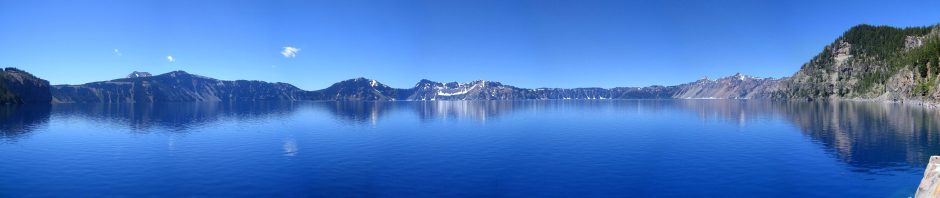
We finally reached the rocky south shore of the lake, where we found sheets of ice and snow still shrouding the more sheltered faces of the rock near the cool lake waters. This was my favorite part of the hike, other than the trail living up to its name when we spotted one eagle along the trail, which was so fast I could only grab a fuzzy shot of it in flight.

A Jutting Prow
Trees along the shore framed lake views as we walked northeast. At one inlet, a slab of rock jutting out from the water made me think of the prow of a sunken vessel. Rim rocks showed previous lake levels and one trailside stump was striking. Invasive cedars lined one section of shore, and we passed some unwelcome trailside beer cans as well; some people just don’t get it.
We found a fire ring at the most significant promontory along this section of shore and then the trail began to fade noticeably. There had been occasional yellow blazes on rocks here and there, and some plastic markers, but after the next inlet the trail became quite hard to trace. I think most people hiking from the campground turn around here, and we decided that we would follow suit.
While retracing our route we encountered a young couple on horseback, with one horse slipping and sliding around on the wet rocks. I was glad Wendy and I had followed trail etiquette and stood far back from the trail to give them passage.

A Welcome Glare
The sun glared across the water as we returned, a welcome sight in January. A lone boat zoomed past us as we left the lake behind, happy that we had escaped town for a Sunday stroll.


On 9/13/2014 Adam Freel reported that the Ponca City Mountain Bike Society (http://facebook.com/poncacitymountainbikesociety) had trimmed up the trail and folks should come out and enjoy it!
When I was a kid, our Boy Scout troop helped blaze the original trail, and subsequently performed trail maintenance. I plan to get up there in November and do some hiking / camping. Do you know if they allow primative camping along the trail? Would love to get 20-25 miles in on a weekend!
I do not know if they allow primitive camping along the trail. You can try contacting:
ceswt-pa@usace.army.mil
US Army Engineer District, Tulsa
1645 South 101st East Avenue, Tulsa, OK 74128-4609
918-669-7366