Beavers Bend (click for slideshow)
Deciding to take advantage of somewhat cooler weather on this late Labor Day, I opted to travel to Oklahoma’s Little Dixie for some day hikes. I’ve been in the Ouachitas many times, but had never made it all the way to the state’s southeastern corner to visit Beavers Bend.
I drove the Indian Nations Turnpike all the way to Hugo, which has been the winter quarters for various circuses over the years. I visited Showmen’s Rest, the portion of the Mount Olivet cemetery set aside for circus performers and owners. I especially liked the circus tent tombstone of Jack Moore, the photo of trapeze artist Grace McIntosh, and appreciated the poignancy of Ted Bowman’s epitaph:
There’s nothing left but empty popcorn sacks and wagon tracks – the circus is gone.
Hugo itself is obviously struggling economically, with many empty storefronts and a distressed look overall. Things weren’t much better on east in Idabel. The big businesses I could see from the highway were a paper plant, a chicken processing plant, and Choctaw casinos. There are big divided highways with little traffic – no doubt politicians promised they’d bring jobs and economic development. I suppose it helps speed the 60 million cubic feet of lumber that is harvested annually in McCurtain County to the processing plants. But it also leaves them with big empty highways that bypass the abandoned downtowns.
Most of the restaurants in this poor area are fast food chains, which I was determined to avoid. A parking lot full of cars led me to lunch at the Roma Italian restaurant, which appeared to be a family-run business in a fairly new building. The food was tasty, plentiful, and cheap.
Then I drove up to Beavers Bend State Resort for my day hike. Back in 1977 then-governor David Boren dedicated a series of hiking trails here. I pulled into the only free spot at the Forest Heritage Center, which features a “totem pole” carved by Hungarian artist Peter Toth. He spent nearly twenty years carving giant Indian busts – one for each of the fifty states. Ours is The Trail of Tears – seems fitting for this perennially struggling area.
I didn’t have the patience to stride all the way through the seven-sided Heritage Center with its quirky exhibits and musty smell. But I had to take a shot of a wooden sculpture of a woman. I suppose she is meant to be a free spirit, but in the shot it looks to me like she’s running from that ax-toting guy in the background!
I booted up, immersed myself in Deep Woods Off, and headed down an old CCC trail. A youngster at the trailhead took a look at my boots, hat, and pack, and asked me if I was an explorer. I told him I was, and showed him my trail map with trails winding the many miles around the Mountain Fork River. He gazed up at me with wide eyes and asked if I was coming back. His grandfather chuckled and said, “If he isn’t eaten by a bear!”
The only animals I spotted along the trail, however, were spiders and beetles. After traversing the easy Nature Trail I climbed the more challenging Lookout Mountain trail. The lookout, however, was overgrown by trees and offered no real view. Sigh.
I then strode onward along the Deer Crossing Trail, clearing many cobwebs. I didn’t see much in the way of pretty plants, only snapping shots of one lonely flower and some berries. At that trailhead a guy had lumbered out a big tripod and set off down the trail ahead of me. Later he came back by me, looking rather disgusted. I think he envied my tiny point-and-shoot.
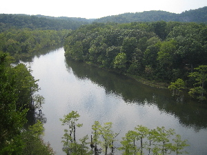
Happily that trail eventually ran into the Cedar Bluff Trail, which led to an overlook of the Mountain Fork River, where I watched canoes and kayaks gliding by below. One floating fellow yelled up at me, saying I must have a great view. I silently waved back, thinking he should be grateful not to be up here since I was very sweaty and smelly after hoofing it over four miles up and down watersheds. I had foolishly forgotten to bring a bathing suit, or I would have happily clambered down and joined the folks on the river.
I had hoped to hike onward for part of the Skyline Trail, but it had two footbridges washed out by flooding a few years ago and then private cabins were built requiring that it be rerouted. So now it is closed and I couldn’t locate the trail blazes that would lead me along the first section which is supposedly still passable.
So I retraced the Deer Crossing Trail, encountering fellow hikers who did not know to thank me for sparing them from so many cobwebs. Then I took a final section of the Lookout Mountain Trail back to the Forest Heritage Center.
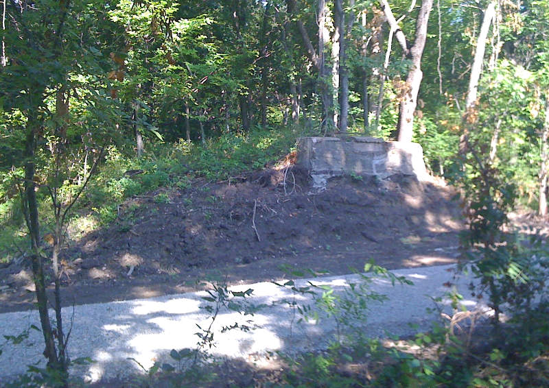
I drove over to a nearby campground, hoping to see the little train that chugs around that area – I heard its whistle a couple of times along the trail. But by then it was past the depot’s closing time and I couldn’t catch even a glimpse of the train, only the rails. So I drove over to the Broken Bow Lake Dam. There was a pullout with lots of rock walls for what turned out to be the power inlet, but the area was neglected and overgrown, with only a sad memorial plaque and forlorn gate.
I drove over the dam and on to the separate spillway section, where I again pulled off and walked down to the shore. There were a few power boats zooming around, but that was it. I decided I’d had enough of Beavers Bend, so I drove back south to my Microtel in Idabel. It wasn’t in the database for my GPS and Google Maps said its address didn’t exist, but I did eventually find it just north of a bypass on the northwest side of town. There is little traffic here and there were only a couple of cars in the parking lot – business is very bad, but that did save me some money. A room here is less than $60 with tax – if only Oregon hotels had those rates!
Along the drive back through Idabel I’d spotted a Mexican restaurant, Papa Poblano’s, that had a full parking lot. So after a much-needed shower I drove back across to the east side and had another cheap but very tasty ethnic meal, again served by a waitress of appropriate extraction. Then it was back to the Microtel to post photos and compose the blog.
Tomorrow I plan to drive north along highway 259, which John Kennedy dedicated back in 1961 as a north-south road that would finally link the Ouachitas with the rest of Oklahoma. I won’t revisit the nearby Heavener Runestone, but will drive west to Cedar Lake deep in the forest. Back in high school my friend Jeff Silver and I camped there, and I’d like to again take the trail circumnavigating the small lake.
There is a slideshow of photos from this day’s travels.
Here’s the route of this two-day trip.

 unit, but grabbing its gyroscopic mouse to navigate and also trying to balance its accompanying keyboard is a pain. Since the only real use I’ve made of the Apple TV hack has been to watch








 Meador Manor