Roaring River Remodels

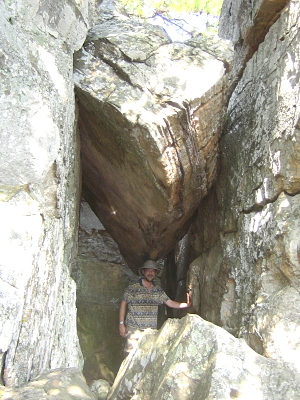
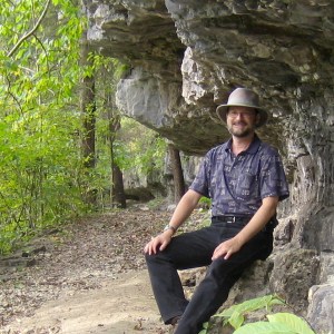
On the Trail at Roaring River (click for slideshow)

On the Trail at Roaring River (click for slideshow)

A cool fall weekend was perfect for a day hike in Roaring River State Park in southwest Missouri.  I’ve been exploring its trails for almost four decades and was surprised to find some new trails on this outing.

I headed east along Highway 60 from Bartlesville around 9 am so that I would arrive in Neosho, Missouri in time for lunch.  I decided to revisit the El Charro restaurant at the big highway junction, and then followed good old Highway 86 to Cassville and then took 112 down into Roaring River.

I parked near the Sayman monument in front of the great old CCC Lodge.  But I was unpleasantly surprised to find that the park store, which has occupied its second floor for decades, has relocated.  They’ve built a big new store out at the junction of Highways F and 112, on the site of the old park hotel and restaurant (which was demolished some years ago when the grand new Emory Melton Inn was constructed).  I’m sure this decision makes economic sense, but the new building has none of the character and history of the old lodge.  However, I also miss the sound of the pinball machines that used to be out on the lodge balcony in the 1970s, so my judgment is questionable.

I trotted over to the spring and climbed Deer Leap Trail so I could hop onto the Firetower trail, the longest trail in the park.  Deer Leap is a steep climb of rock stairs and the Firetower trail is quite steep at first as well.  I discovered a passel of urban youths strewn along the way.  Their adult leader, staying below, asked me if they would be coming back down the same way they went up.  It was apparent to me that they had no plan to hike several miles to the other trailheads, so I assured him he could wait them out.  Sure enough, I quickly zipped past the group on my ascent and they chose not to follow my lead.

Up top I followed the ridge to the pathetic old firetower.  It is a puny structure that is now dwarfed by the trees that have grown up around it.  I knew I could drive a few miles south to the impressive real firetower on the Sugar Camp Scenic Byway, but today my focus was to make a big day hike loop around Roaring River.  So I followed the trail on towards its trailhead near the old stables on Highway F, a part of the trail I had not taken in years.  Along the way I saw some flowers and two amorous walkingsticks, and then came upon a change.

I remember some years back when the park cleared off one hillside of invasive red cedars and other species so that other plants could thrive.  They still maintain the area with selective cutting and controlled fires.  The Firetower trail runs through the upper part of that glade and then terminates at the Highway F trailhead near the old stable.  For decades you then had the choice of either reversing course back to the spring or hoofing it down narrow Highway F to campground 3, which was built in the 1970s at the former site of Bass Lake.  Here the park has made a great improvement: a “Loop Trail” that neatly solves the problem.  You now can cross to the south side of Highway F and take this new trail back to the campground.  Strangely, this Loop Trail is not mentioned on their website and lacks good signage for folks headed east out of the campground.

The Loop Trail runs several feet south and below Highway F for a bit and then ducks down a bluff to run alongside the north bank of Roaring River.  This is a quite pretty stretch of the trail system, especially where there is a side channel of the river which makes a nice turn alongside the trail.  Further west there is a trailhead east of the Nature Center (former CCC kitchen), right at the sharp curve where Highway F used to turn to climb steeply northward before it was rerouted near Camp Smokey higher up.  I was then out in the grassy area east of campground 3 and wondered if I would have to trudge through the campground itself.

But no – I found another stretch of trail (not named, so I’ll call it the Loop Trail Extension) which followed a new bridge across Roaring River to its south bank and then intersected the Eagle’s Nest Trail.  Perfect!  So I climbed the upper loop of Eagle’s Nest towards Highway 112.  Near the old homestead site of the Mountain Maid I encountered a huge spider web across the trail (as opposed to the numerous tiny webs I had broken elsewhere).  An enormous spider with a bright yellow body and orange striped legs stood still for a flash photo before scurrying away.

This time there was no new trail to help me descend Highway 112 (the Seligman Road hill), but at least it has big wide shoulders.  Arriving at the Emory Melton Inn, I took the short loop of its new Spring House trail (and wandered up to the water tanks on the hill) and then descended to the new park store.  I refused to enter, since I dislike their abandonment of the old lodge.  Relying on the G2 bottles and trail mix in my small backpack to sustain me, I decided not to take the short roadway back to the lodge, since the fishermen lining the bridges over the river are known to sometimes hook unwary pedestrians.

So I strode back south through the pretty picnic shelter area on the west side of the river.  All of the shelters were in use by big groups and one group was serving hot food at 4 pm that smelled mighty good.  But I resolutely strode onward over the Highway F bridge, noticing several wading fishermen and a crew weedeating the guard rail struts on either side of the bridge.  Wow!  I’ve never seen that in Oklahoma.  Then I took the good old CCC River Trail back north along the river’s east bank.  I remember walking this 0.7 mile trail again and again as child, enjoying the view of the river and the bluff they blasted out for the trail back in the 1930s.  Back then the trail seemed very long, and I used to rest on the bluff even though I was frightened of the daddy-long-legs that populated it.  I didn’t spot any of them today, so my dignity is intact.

Arriving back at the CCC Lodge, I stripped off my damp shirt, cleaned up, and put on a fresh shirt for dinner.  Planning to eat in Eureka Springs, Arkansas I drove down there and discovered that the motorcyclists who had the run of the place on my last trip had been replaced by Corvette owners.  There were beautiful sleek cars prowling the crazy old town and one was kind enough to pull out and leave 55 minutes on its parking meter for my use.  I dashed into the Two Dumb Dames Fudge Factory to stock up on essentials and then drove up “topside” onto Highway 62 to find the Yelp-recommended Cafe Soleil.  But it had changed to Sparky’s Ultra Lounge and was already busy when I drove past.

So I decided to drive five miles west out of town along Highway 62 to Inspiration Point, which offers a great view of the White River valley.  Years ago I toured “The Castle” there, and it is still the site of Opera in the Ozarks.  There was no spectacular sunlight today, but the view was still quite beautiful.  Spotting a traditional couple who were struggling to snap of photo of themselves at arm’s length, I intervened and took the shot for them.  After I took my own snapshot of the view, two ladies in their twenties drove up.  Eureka Springs is very gay friendly, so I wondered if they were just friends or a couple.  I couldn’t tell.  Then two young guys drove up – I thought they might be meeting the girls, but no, the guys were definitely a couple.  I was going to offer to snap their picture as well, but the gals came to their rescue.  Feeling very much like a fifth wheel and with my stomach rumbling, I pondered my options.

I didn’t relish driving five miles back to Eureka Springs to compete with the Corvettes for a table at a good restaurant.  So I opted to just head on west and south to the good old AQ Chicken house in Springdale.  Arkansas Quality Chicken has been pan fried there since 1947, although they long ago moved out of the old house I recall from my youth into a more spacious restaurant.  Their food these days is a bit better than Kentucky Fried, but not nearly as good as the wonderful Stroud’s of Wichita and Kansas City.  A rapid four-lane haul back to Bartlesville brought an end to a satisfying day trip.

Photo slideshow of this day trip

Posted in day hike, photos, travel | 2 Comments

Daytrip Southeast of Town

Daytrip Photos (click for slideshow)

Daytrip Photos (click for slideshow)

Earlier this week I decided I had to go for some long walks this weekend to enjoy the beautiful weather we’re having.  I debated various choices until my Tulsa friend Carrie suggested I explore the shores of Lake Oologah, where I could meet her and her roommate Trish to see their sailboat and then have lunch in Claremore.

I first tried to walk the Skull Hollow nature trail in the Hawthorn Bluff area of the lake, but it was too overgrown. [Later I found out the overgrown portion was a trail leading to the park gazebo; the actual Skull Hollow Trailhead was farther along the road.] And the noise from the nearby power plant, which is featured in the electricity slideshow Lynne Shaw and I made back in 1995, was irksome.  I wondered at how the area could be full of campers with all of that noise pollution – perhaps they boat out onto the lake to escape it?  I fled the scene and drove to the south end of the lake to attempt the Will Rogers Centennial Trail to Kite Hill.  But equestrians had turned the trailhead into a churned morass of mud, so that was out too.

A bit discouraged, I took the county roads over to the Blue Creek Park on the lake’s eastern shore.  There was no trail, but I did enjoy walking down the southern end’s quiet picnic area, where I snapped a shot of the high water inundating the trees and enjoyed watching large birds wheeling by and landing on the lake, although they were too far away for a good snapshot.  Then I walked back to the car to contemplate my options, since my lunch rendezvous was still a couple of hours away.

I spotted the nearby town of Foyil on the iPhone’s map and recalled that it is the site of a highway tourist attraction, the crazy Totem Pole park built by Ed Galloway between 1937 and 1962.  The strange “totem pole” is being restored by the Indian Territory Questers, who are reviving its lively colors.  A Boy Scout troop had built a small nature trail in the park six years ago, and I enjoyed wandering through it although there was very little to catch the eye or the camera lens.

I zipped back to the south end of Lake Oologah to join my friends, see the sailboat, and indulge in a classic Oklahoma meal at the Hammett House in Claremore – chicken-fried chicken with mashed potatoes and gravy and a big slab of chocolate cream pie for dessert.  Urp!

Bidding my friends farewell, I decided to see what I could find in Claremore.  I drove by their lake, but the sunny concrete exercise trail there was not my cup of tea.  So I crossed 66 and drove onto the campus of Rogers State University to see if I could find some snapshot subjects.  I discovered their Conservation Education Reserve, a 120 acre outdoor classroom that is open to the public and features a number of paved trails reminiscent of Bartlesville’s Pathfinder Parkway.  That’s the ticket!

I followed the path over to their wetlands area, where I saw a deer across the water, and trekked through the grassland and on through the forest until I finally arrived at their butterfly garden.  I saw few butterflies, but other insects liked the prettiest flowers, and I took snapshots of red, orange and yellow, and white and yellow blooms.  Yes, my mastery of plant taxonomy is quite amazing, I must agree!

It was now mid-afternoon and I was determined not to head back to Bartlesville too soon.  So I meandered over to Owasso, finally happening upon the tiny “downtown” of this sprawling bedroom community where so many Bartians like to shop.  I drove over to look at its Elm Creek Park, later discovering that Owasso’s original name was Elm Creek, but the park was small with little to offer.  Owasso has almost doubled in population since 2000 and is now larger than Bartlesville, but it has little of interest for me.

With the afternoon fading away I decided another long walk was in order and drove to Turkey Mountain in south Tulsa.  They’ve built a nice big new parking area there and will be adding a much-needed restroom facility.  The mountain runs north-south with a large number of bike and hiking trails.  I started out on the long yellow loop trail, walking along the low eastern edge of the mountain.  My walk sped into a jog since it was getting late in the day and I wanted to get to the north end in time to shoot the view of downtown Tulsa in the evening sunlight.

I “changed lanes” a couple of times, shifting westward to higher trails, until I reached the crest and made it to the north end.  The view there is okay, but marred by power lines and you really need a powerful zoom lens for a good shot.  So I did the best I could with my limited pocket shooter and later cropped and “melted” the image a bit in Photoshop Elements to get a shot I could live with.  I took the blue trail back south toward the parking area, coming across a few brightly colored mushrooms at one point and also snapping a nice flash image of a plant.

I made it to the car with the sun still up in the sky (and no unwanted advances from the cruisers who purportedly haunt that mountain) and happily drove downtown for a dose of the Spaghetti Warehouse.  ‘Twas a nice day for early autumn, perhaps my favorite season in Oklahoma.

Click for a slideshow of today’s daytrip

Posted in day hike, photos, travel | 1 Comment

Trapper Kindle

Regular readers know I love my Kindles, but here’s a possible improvement from lunchbreath: The Trapper Kindle.

Trapper Kindle

Trapper Kindle

Posted in funny, technology | 2 Comments

Remembering Mary Travers

Remembering Mary Travers

If you miss the train I’m on, you will know that I am gone
You can hear the whistle blow a hundred miles,
A hundred miles, a hundred miles, a hundred miles, a hundred miles,
You can hear the whistle blow a hundred miles.

Lord I’m one, lord I’m two, lord I’m three, lord I’m four,
Lord I’m 500 miles from my home.
500 miles, 500 miles, 500 miles, 500 miles
Lord I’m five hundred miles from my home.

Not a shirt on my back, not a penny to my name
Lord I can’t go a-home this a-way
This a-way, this a-way, this a-way, this a-way,
Lord I can’t go a-home this a-way.

If you miss the train I’m on you will know that I am gone
You can hear the whistle blow a hundred miles.

Posted in music, video | Leave a comment

Hiking in Little Dixie, Day 2

Something hangs over me... (click for slideshow)

Something hangs over me... (click for slideshow)

Woke up in the Idabel Microtel to find a depressingly bland continental breakfast which sent me off to McDonald’s for their largest breakfast platter, most of which was edible.  The large breakfast was to carry me through my morning hike at Cedar Lake up in the Ouachita National Forest.  I drove north out of Idabel and up through the Kiamichi Mountains, winding my way down them to re-enter the forest and then drive a couple of miles west to Cedar Lake.

I remembered camping here over twenty years ago.  Back then my friend Jeff Silver and I were visiting out of season and pretty much had the place to ourselves.  It seemed quite lonely and isolated.  Visiting over Labor Day weekend it had plenty of campers, swimmers, and fisherfolk both on the shore and puttering about in small fishing boats.  I paid my day use fee and parked around 11 am on this Sunday morning by a shelter which had a congregation of Mennonites.  As young ladies in long dresses strode by I changed into my hiking boots and annointed myself.  Having no oil handy, I made do with Deep Woods Off.

Heading south to follow the three-mile CCC trail clockwise around the lake, I rapidly encountered the Old Pine Trail (or Old Piney Trail, as one sign put it).  It meandered up around a feeder stream and featured interpretive signs I found quite boring and subsequently ignored.  A tiny toad and I bounded along the stream and then I was back on the main trail, headed up one of the several arms of the lake.  Each arm features a footbridge, and I enjoyed the picturesque views back toward the lake from the southern and northwestern arms.  The trail eventually crosses along the top of the dam on the north end of the lake, and I snapped a shot of a boy fishing from a nearby dock.

After a brief clean-up and fresh shirt, I drove on north to Poteau.  Today turned out to be a chain restaurant day, with me opting for the Mazzio’s, where the server was fascinated by my Kindle.  He said it was much smaller than the one a local veterinarian brings in, so I suppose the vet has a Kindle DX.

I then drove west to the Sans Bois Mountains and good old Robbers Cave.  I knew it would be hot work clambering around the rocks, but hoped to get some good shots.  The view from the ground was quite familiar, and I enjoyed scrambling into the lower “cave” with its double entrance and back exit.  Young folks were rock climbing at various spots, but I felt I did enough climbing taking on the old CCC trail which the signs said was now “nearly impassable.”  The fault was a slide that nearly blocked one section, but I was able to crawl my way through.  I revisited the “stone corral” where the outlaws kept their horses and found one strapping young fellow and his girlfriend rapelling down into the corral even though there were no horses to steal.

After visiting the real cave, which isn’t very large, I clambered on upward off the trail and couldn’t resist using the photo timer to get a shot of me with something big hanging over my headAtop the formation I found a striking graffito and enjoyed the view.  To gather all my shots, I actually clambered clear around the formation about three times so I could make sure I saw all the sights along the old CCC trail, the kinder and gentler rim trail, and off trail to boot.   At one point I was atop the “Devil’s Slide” – which is truly steep from above, and was startled to see a young boy slowly inching his way down the slide.  I kept waiting for him to tumble and crash, but he made it safely with nary a parent in sight.  So he is still convinced that he is indestructible.

After clambering around the steep rocks for a couple of hours in 87 degree weather, I was tuckered out and happily wiped off and put on a fresh shirt for the drive home.  I chose to cross Lake Eufala, which was the big flat boating zone I remembered it to be.  I pulled off in Muskogee for a Weight Watchers meal at their Applebee’s, where the waitress was also fascinated by my Kindle.  I’ve had servers across the country asking about my Kindle and saying they want to buy one.  If I were a better salesman I’d sell them one from the table and earn a commission on my Amazon Associate’s account!

It was then a speedy run from Muskogee back home.  Labor Day beckons.

There is a slideshow of the photos from this day hike.

Here is the route of this two-day trip.

Posted in day hike, travel | 2 Comments