Return to Chandler Park

HIKE DATE: October 25, 2015; SLIDESHOW | MOSAIC

Meador PostIn late October, circumstances prevented Wendy and me from going out on our typical Friday evening date, and we were unable to attend a former student’s marriage reception. But we were able to reunite on Saturday afternoon for a return to Chandler Park in west Tulsa to explore more of the trails along its bluff above the Arkansas River. We ended up walking a total of 2.1 miles along the bluff and then through the park’s frisbee golf course along its south perimeter.

We parked at the Lost City trailhead and descended from the top of the bluff to return to the various rough trails connecting rock outcroppings along the bluff. It was great to be out for a walk, and I deliberately led us down the bluff away from the main path to roam amidst the eroded rock walls, forking along new pathways.

Rock Face

Some graffiti gave a literal meaning to rock face. Wendy posed on its nose, and we speculated that if someone added spectacles these could be our own eyes of oculist T.J. Eckleburg looking over the valley of the Arkansas rather than the valley of ashes. The somewhat dark analogy was reinforced when we discovered that the eyes looked down toward a trail where I found a bag of white powder and a pamphlet on substance abuse services. Wendy was suitably amused, mentioning how they reminded her of the syringe we found in the vacant lot in Russellville back in June. Our travels don’t solely focus on romantic surroundings.

Arkansas River

Bluff

We went down the bluff far enough to get a clear view of the sandy bed of the Arkansas River and the Highway 97 bridge across it. We climbed back up to the rock walls of the Lost City and admired an unusual plant. A short bluff had grass growing on top and spray paint heiroglyphics on its face. Wendy spotted a small hole in a rock wall’s projection, and we had fun setting up a shot of her looking through it. Another wall of the Lost City included a low niche.

Eye see you

We reached the end of the trails and doubled back along the loop at the west end to explore the trail segments there before ascending to the Community Center. We enjoyed a break at a nearby picnic table before threading our way around the park lagoon and past the ball fields entrance to explore the north perimeter of the park.

I was curious if there might be any social trails on that side down to its bluff, but we just found a few very short and overgrown loop trails along the sides of the park’s long frisbee golf course, where several parties were out enjoying that pastime. I got a shot of some long and droopy red leaves of autumn and enjoyed the contrast between the steep and wild trails of the bluff and the very tame picnic forest up top.

SLIDESHOW | MOSAIC

Posted in day hike, photos, travel | Leave a comment

Roamin’ at Roman Nose

Trip Dates: October 17-18, 2015; SLIDESHOW | MOSAIC

Meador PostFor the weekend of Fall Break 2015, Wendy and I stayed and hiked at Roman Nose State Park at Watonga, with a stop along the way to see my folks in Oklahoma City.

Trip Map (click map for slideshow)

I last visited Roman Nose five years ago, circumnavigating the park which I remembered from my youth. I wanted to show it to Wendy, not least because I figured she would enjoy the rocks along the trail. This time, however, we would stay at the lodge, which had a $5.1 million renovation between 2007 and 2011. I last stayed there back in the early 1980s, when my friend Jeff and I got so cold at our campsite that we gave up and rented one of the small rooms at the lodge. Wendy has made it clear to me that camping is not in our future, and, frankly, I don’t mind leaving my tent unused up in the closet.

We spent much of Saturday in Oklahoma City, visiting my parents. They treated us to lunch at Swadley’s, a BBQ joint, and then I set up my old TiVo Series 3 to replace theirs, which was crashing frequently. Later it turned out my efforts were in vain, as my old TiVo kept crashing as well. So they are giving up on the venerable TiVos and seeing if they can cope with only live broadcast HDTV for awhile.

Wendy and I departed west along I-40 and then angled northwest to Watonga, where a few miles to the north the Roman Nose canyon nestles in the Gypsum Hills. We drove to the lodge and checked in. The renovations are respectful of the lodge’s original mid-century style. I prefer National Park Service rustic over Mid-Century Modern for park lodges, but in this case it probably made sense to stay true to the lodge’s origins, with some much-needed improvements.

Renovated Entry

Roman Nose Lodge Renovations

Chief Henry Roman Nose

Chief Henry Roman Nose

The 1956-era entry used to be truly pathetic, except for the large head of Chief Roman Nose, and the lodge had several poor additions over the years, with some falling into disrepair. Studio Architecture created a dramatic raised entry for the registration areaThat leads to a high and large room used as both lounge and dining room. A patio at the end of the dining room invites you outside for a glimpse of the lake. I think some trees should be taken out to improve the view; a high shot shows it has more potentialThe row of 22 small rooms is off to the side. The hallway now features lots of nice historic photos of the park’s construction. The rooms are necessarily small, due to the original construction, and you have to choose between a king size bed or a queen with a single. The restroom is too small for a tub, so it only has a shower. But the colors, fabrics, and finishes are carefully chosen, often featuring a fancy new RN logo.

We arrived at Roman Nose in the early evening. After checking in and relaxing in our room, we decided that we didn’t want a late night meal in the lodge restaurant. Instead, we drove south to the north edge of Watonga to pick up some things at a Wal-Mart Neighborhood Market. The moon was out, and the lodge entrance was lit nicely upon our return.

Sunday morning breakfast at the lodge was buffet only. I didn’t care for it that much, but it was fuel for our trek. We headed out across the long bridge that leads across the ravine separating the lodge area from the trails. The trail intersections are not always clearly marked, but this important one to take you back to the lodge had a marker I would appreciate later. The state website has an online map of the park’s trails.

Trail Tracks

Wendy wanted some elevation changes for this hike, so I steered us south along the Black Loop Trail at the south end of the park. Another nice feature of that trail is that, unlike most of the other trails, it bans horses and thus their manure. The trails take you down into the Blaine Formation at the park, with its layers of gypsum. This area was under an inland sea over 220 million years ago, and when the sea water evaporated, it left behind thick deposits of salt, gypsum, anhydrite, or dolomite. You can get all of the details about the park’s geology, botany, zoology, and early history via an online copy of the 1959 guidebook for the park published by the Oklahoma Geological Survey.

As soon as we started walking across the exposed gypsum layers, memories from my youth began trickling back. Some memories are more welcome than others. The sight of prickly pear cacti reminded me of when my friend Jeff and I went bushwhacking down a hillside here decades ago to take a shortcut, paying for it with plenty of cactus needles.

My sweet rock hound

Berries

The different layers of gypsum and other deposits erode in interesting ways, and the glinting layers had Wendy the rock hound sniffing out pretty rocks all along the trail. We caught a peek of the adjacent golf course. There were some blooms along the trail with autumnal colors and a plant with big clumps of red berries. I’m no botanist, so I’ll leave the identification to others, but I could easily identify the prickly pears!

A welcome sign directed us to the Switch Back Trail, which I suppose is what the state webpage on these trails calls the Black Loop Trail; the online map notes the switchback, but they need to get their act together on this. As an aside, at this time my Google Chrome browser refuses to open the +More sections on the state website’s descriptions and often won’t follow links. I have to load the site in, gasp, Internet Explorer to get it to work. I don’t know if this is due to yet another annoying Google edict to terminate support for some old web code, but it is certainly annoying.

South trail vista

The views we began to get across the canyon were anything but annoying. Wendy and I both noted deposits on the trail which resembled the cross-sections of a bone. We began to see more plants with long, droopy, red leaves. It was fun to climb up layers of gypsum deposits. We saw vertical columns which might have been the sides of the bone-like deposits. I really liked a set of pink blooms that had long strands erupting from their pistils.

Seed tangle

We’d started the hike wearing jackets, but it was warming into the 70s and we were grateful for the shade when the trail climbed into some cedars. We passed yellow flowers, and a flowering plant with striking white and green striped leaves. We saw better exposed layers of the white minerals amidst the red oxide soil one associates with much of central Oklahoma. Across the canyon we could see how thick some of the white mineral layers got.

Chunky

Pretty flower

The trail zigzagged through boulders of eroding minerals, and we admired more flowers, tangled blooms, and cedar berries. The trail provided an expansive panorama as it zigzagged along the edge of the canyon.

Expansive view

We were headed back north toward the lodge and took the opportunity to walk the canyon loop. Despite the rising heat, we opted to take the loop for high views of muddy Lake Boecher and the larger Lake Watonga.

Lake Watonga

We walked down to the hidden side outlet where Lake Boecher feeds into Lake Watonga. A father and son were in a tiny boat fishing in the lake near that outlet’s small waterfall.

Happy hikers

Easing into an Eames Chair

As we approached the end of our trek, we traded shots with another couple before climbing back to the lodge. We cleaned up and had lunch; my burger was quite tasty. Then I enjoyed relaxing in the nearby Eames Lounge Chair.

For our trip home, I drove north through Hitchcock to Okeene and then west through the grasslands to Stillwater, to take the Cimarron Turnpike through the hilly cross timbers of Keystone Lake to Tulsa, and then north to B’ville.

Roman Nose was a great conclusion to a much-needed Fall Break. Wendy and I would make one more outing before Thanksgiving, spending other days building a new raised bed in the backyard for her Social Climber rose. Our next big trip will be a stay at the renovated Queen Wilhelmina Lodge atop Arkansas’ Rich Mountain in late November.

Photos: SLIDESHOW | MOSAIC

Posted in day hike, photos, travel | 2 Comments

A Break at Bennett Spring

Trip Dates: October 15-16, 2015; SLIDESHOW | MOSAIC

Meador PostWendy and I would spend the last half of Fall Break 2015 in central and northwest Oklahoma. But for the first two days of our respite from work, I returned to Bennett Spring State Park in Missouri for a personal getaway to hike and take my mind off a stressful start to the school year. During Spring Break 2011, I hiked 8.7 miles at Bennett Spring on the Natural Tunnel Trail, following that with 1.5 miles on the Bridge and Bluff Trails.

I was less driven on this return trip, more focused on relaxing and getting some photographs than racking up trail miles. In the end, I hiked a little over four miles on this trip. After the 3.5 hour drive to the park, I hiked 2.35 miles on the River Trail. I started at the deep hole of the spring itself, and enjoyed the autumn leaves.

Bennett Spring (click photo for slideshow)

I passed the iconic pump house along the River Trail, watching the water tumble over the rocks. When I reached the bridge, I got a high shot of the fishermen below. One fellow strode out onto the spillway to fish.

Spillway

The hatchery was next, so reminiscent of the one at Roaring River, where workers were weighing fish. The park store was dressed up for the season, and I passed the entrance to the dining lodge when thunder bellowed, and a light rain began. That led me to circumnavigate the dining lodge and return to the shelter of the store’s eaves, hoping the showers would cease. I phoned Wendy and gave up on hiking when my iPhone’s RadarUS app showed the rain would last quite awhile.

I decamped to my hotel in nearby Lebanon, returning the next morning to tour the Nature Center at the park and head out on its Hickory-Oak trail. A steep but beautiful climb led to the Bridge trail.

A climb up the Hickory-Oak Trail

That eventually led back around and down to the creek to intersect the Bluff Trail, which lived up to its name and required a strenuous climb up the side of the hill at one point. The last trail was the Whistle Trail, named for the shape of the pipes under a bridge. I returned to the Nature Center by the park roads so I could enjoy watching the stream and the fisherfolk one last time.

Goodbye, Bennett Spring

Then it was time to bid the park’s beauty adieu and return to the beautiful woman awaiting me back in Bartlesville. Wendy and I were both ready to set out for the rest of the break on a short trip to a state park I enjoyed in my youth.

Click here for a slideshow from these day hikes

Posted in day hike, photos, travel | Leave a comment

Consoling Ourselves at Lendonwood Gardens

Day Trip Date: October 11, 2015; SLIDESHOW | MOSAIC

Meador PostA week after we explored the Keystone Ancient Forest & Chandler Park, Wendy and I scouted the shores of Lake Spavinaw and Lake Eucha, and we enjoyed a lovely walk in Grove’s Lendenwood Gardens. That walk was a nice consolation prize for our failed quest to hike some trails near Grand Lake.

I’ve long been disappointed and puzzled by the lack of hiking trails around Grand Lake O’ the Cherokees, the large serpentine lake built in northeast Oklahoma during the Great Depression for hydroelectric power. The Grand River Dam Authority administers Grand Lake and its cousin, Hudson Lake. (The latter should not to be confused with the tiny Hudson Lake northeast of Bartlesville.) They are the only two large Oklahoma lakes where one can build directly on the waterfront. That plus the relatively stable lake level equals extensive development along the lakeshore. Lake of the Ozarks in Missouri is even more extreme, with an endless succession of boathouses and docks along its perimeter.

Boathouses line the shores of Grand Lake

Boathouses line the shores of Grand Lake

When I was a teenager, my folks had a small boat on Table Rock Lake in southwest Missouri. But I happily abandoned boat ownership in my 20s. While I enjoy the occasional boat ride, the pastimes of boating and fishing that so many love at Grand Lake have little appeal to me. But I do love hiking trails. So I’ve scoured the internet for trails around Grand Lake, but the state parks along its shores have little to offer. The only trail the Oklahoma Water Resources Board’s map of Grand Lake calls out is the paved one at the Bernice area, which I’ve walked and don’t wish to revisit. I’ve confirmed there are no trails at Twin Bridges, while Honey Creek and Disney seem to be similarly bereft of designated trails.

So I turned my attention to two other nearby lakes, both built by and for Tulsa: Lake Spavinaw and Lake Eucha. Tulsa dammed Spavinaw Creek back in 1922 and built a 50-mile gravity pipeline to what is now Mohawk Park near the north edge of the city. 30 years later, it added Lake Eucha along the same creek to enhance its water supply. There once were state parks at both lakes, but the one at Eucha was taken over by the city of Tulsa back in 2011. Both parks mentioned hiking in their online descriptions, and the Audubon Society said there was a North Shore Nature Trail at Eucha. That was good enough for me, so Wendy and I set out to see both lakes, with me planning a return to Lendenwood Gardens in Grove if we could not find suitable trails at the two lakes.

Day Trip Map (click map for slideshow)

Lake Spavinaw

We drove east out of Bartlesville for an hour along the mostly shoulderless two lane highway US 60 to Vinita. That’s a drive I often make to reach the northern Ozarks, but I cannot say I enjoy it. We made our typical pit stop at the Woodshed in Vinita and then, instead of heading northeast on I-44 (the Will Rogers Turnpike), for once we continued east on 60 (aka 66 aka 69) for four miles to then turn south for over 16 miles down Oklahoma 82 to Spavinaw.

Little Spavinaw, like many small towns in Oklahoma, is shrinking. It was the birthplace of baseball great Mickey Mantle. He was born in the new town, which had to shift when Tulsa dammed the creek and created the lake. Wendy was fascinated by the odd surroundings. Its proximity to a lake brings in a trickle of business, but nearby Grand Lake is too dominant for Spavinaw to thrive.

Lake Spavinaw

Spavinaw Spillway

We drove through the south campground of the tiny state park, which hugs the creek below the long, low dam. Then we stopped at the dam itself, walking up to the crest where some motorcyclists were enjoying the view across the lake. We walked over to the control house, noting the 1923 dedication plaque. Wendy got a shot of a dragonfly, while I shot views of the spillway and the dam outlet. Each of us posed atop the dam, not tempted to walk down to the neglected fishing dock.

I honestly had not researched the park as much as I should have, so I failed to realize that there is a Red Fox Nature Trail on the north side of the dam at the end of Lake Street. I later found the sign for it in Google Street View, and there is a hiking icon for it at Beaty Cove on one online map, but there is little else online to describe it. Someday we will venture back and try to walk it. But this time we gave up too soon and headed east to Lake Eucha, since my online researches had assured me there was an obscure nature trail on the north side of the small park there.

Lake Eucha

Closed trail at Lake Eucha

The state park at Eucha was closed in 2011 as part of our state’s ongoing series of budget cuts. The city of Tulsa took it over. We drove into the small campground west of Highway 10 on the north shore of the lake and actually found the trailhead. But then we were chagrined to see the trail was marked closed for hunting season. Drat! I’m not sure when it will re-open, but someday I suppose we shall try again.

We followed a road eastward along the lake’s north shore, noting various gravel road turnoffs leading south toward the lake. I finally took one which turned out to lead to the junction of Spavinaw Creek and Beaty Creek. A family was parked there, with small children playing in the creek. We didn’t want to disturb their fun, so we wheeled about and headed back to take Highway 10 north through Jay to Grove. It was time to implement my backup plan to go for a walk at Lendenwood Gardens.

Lendenwood Gardens

Located in Grove along the road to the odd but entertaining Har-Ber Village Museum area, Lendonwood Gardens was once the home of retired dentist and rhododendron aficionado Leonard Miller. He established the gardens in 1995, and they expanded in 2001 when the remainder of his property there was added to the Gardens in 2001 after he and his wife moved to some land she owned on the Elk River about twelve miles away. They established Elk Ridge Garden at their new home, which is open for group tours by appointment. Lendonwood Gardens, however, is open to the public year-round during daylight hours and is free of charge, although a donation box asks for your help as you walk in. The Gardens are quite beautiful, with a blend of Asian and American gardening cultures.

I first visited Lendonwood Gardens back in 2009 and have returned a couple of times since, including a visit in April 2013. Wendy and I didn’t expect too much from the Gardens in early fall, but they were quite lovely. We enjoyed snapping shots of one bloom after another, including ones that were quite unfamiliar to us.

Blooms at Lendonwood

The afternoon sun was great for shots of the wide variety of leaves on offer, along with berries and more blooms. There was a nicely carved tree trunk and shaded walkways, but Wendy found a skull lying on a table in the Japanese Pavilion, a stark contrast to the sun-streaked trees surrounding the island of the adjacent Koi Pond.

Japanese Pavilion and Koi Pond

More leaves and flowers beckoned as we strolled along the shaded paths. I fear that I am not fond of the Angel of Hope in the separate western area of the garden, but I do love these Gardens and appreciate the hard work that goes into maintaining them. I am always happy to donate when I visit.

Lendenwood Garden blooms

After our walk, we were ready to eat. TripAdvisor led us to La Casita de Martin in downtown Grove for some Mexican food, including some spicy salsa. Then we tried to head back home through Bernice, but a bridge was out, and that diverted us north back up to I-44 for the dash down to Vinita and then the long road west along 60 back home.

The Bridge to Nowhere

The Bridge to Nowhere

Speaking of bridges, there is an oddity in Grand Lake near here…the Lost Bridge or Bridge to Nowhere. Several bridge spans sit out in the middle of the Horse Creek arm of the lake just north of where Fly Creek comes in from the west. They don’t connect to either shore, which must seem rather peculiar to new boaters on the lake, although there is an explanation for this oddity.

Lendonwood Gardens was a lovely consolation prize for this outing, and Wendy and I looked forward to hiking the following week over Fall Break.

Click here for a slideshow from this day trip

Posted in photos, travel | Leave a comment

An Ancient Forest & A Lost City

DAY TRIP DATE: October 3, 2015; SLIDESHOW | MOSAIC

Day Trip (click map for slideshow)

Meador PostYou can walk through an ancient forest and visit a lost city…both just west of downtown Tulsa. Three weeks ago I had recovered sufficiently from my respiratory ailment, and the weather had cooled enough to lure Wendy and me back out onto the trails. I wanted to show her something she had not seen before and explore some trails new to me as well. I checked online and noted that the Keystone Ancient Forest trails west of Sand Springs would be open. So I decided we would make a day trip to Tulsa for a few hikes and late lunch. I happily realized I could actually find some novel trails, despite my 250 day hikes since mid-2009, by driving west to Chandler Park, high above the southern bank of the Arkansas River, to enjoy some short trails on the bluffs there above Avery Drive.

Keystone Ancient Forest

Back in 2007 the Nature Conservancy helped open the Keystone Ancient Forest Preserve in Sand Springs, a few miles northwest of Tulsa. This 1,360 acre plot overlooking Lake Keystone has never been forested nor farmed, so some of its trees date back hundreds of years, including a red cedar more than 500 years old and a post oak over 400 years old. Unlike the ancient redwoods of California, these old trees never grow very large, given the poor soil conditions of the Cross Timbers. That ancient post oak, for example, is only 20 feet tall, about 5% of the height of the tallest redwood.

I wanted to take a more scenic route to the preserve, so we turned off US 75 onto Highway 20 at Skiatook and followed it across Skiatook Lake. Then we turned south to follow county roads across southern Osage County, passing through fields before winding our way through slopes dotted with trees and stripper oil wells. New Prue Road by Lake Keystone featured a growing number of homes on large tracts, and then we reached the ancient forest.

Three trails in the ancient forest

You have been warned

The uselessness of this rugged terrain for typical development is what preserved it for so long, and I’m glad the Nature Conservancy was successful in saving it for the public’s enjoyment. Be aware that you always need to check online to see which Saturdays it is open for hiking, and it is best to arrive in the morning so you have plenty of time to explore before it typically closes at 2 p.m.

I first visited the preserve with John and Betty Henderson back in February 2013. It was interesting to note the differences between a walk here in late winter vs. early fall. In 2013, the Hendersons and I had walked along part of the paved Childers Trail and then taken the entirety of the Frank Trail over to a lake overlook and back. This time, Wendy and I followed the same path until, about a mile into the hike, we reached the newly constructed Wilson Trail. That is a loop which is rated ‘difficult’ since it makes a rather rugged descent of almost 200 feet down a hillside carved by a stream. The trail runs below some bluffs before climbing back up alongside the stream bed to the Frank Trail.

Along the Wilson Trail

The Canon PowerShot SX700 HS

The Canon PowerShot SX700 HS

You’ll note the paucity of shots from this hike. Well, the truth is that I have managed to lose not one, but two different Canon PowerShot cameras in recent weeks. Back in June, I bought a new Canon PowerShot SX700 HS to take on our July vacation. Sometime in September I misplaced it, perhaps permanently. I still had my older Canon Powershot SX260 HS, and it was still limping along despite falling off a cliff at Robbers Cave back in 2012. Well, on this day trip I managed to leave that spare camera in the restroom at the Tulsa Garden Center, and it was not recovered. It wasn’t in great shape, so that’s not too disturbing, but I do wish I had its shots from this day trip.

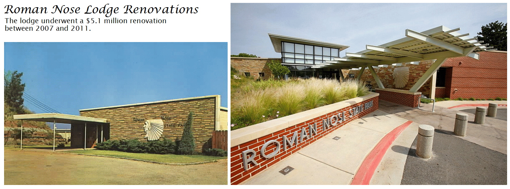
So the only photos we have from the first half of October are what Wendy and I shot with our respective iPhones. The iPhone 6 takes great photos, but lacks the 30x optical zoom of the latest Canon superzooms. So, before a visit to Roman Nose over Fall Break, I gave up and ordered another Powershot SX700 HS. I opted for that older model over the newer SX710 HS, even paying a price premium for the older model, because a review said the new camera lagged its predecessor in picture quality. We’ll see if I can manage to hang onto it!

I was excited to find the new Wilson Trail at the preserve. It is very rugged, making it a nice contrast to the gentler Frank Trail. The newer trail is named after Chris Wilson of the Nature Conservancy, who was instrumental in creating the preserve. The main trail is named after Irv Frank, the landowner who sold the original property that became the preserve. Returning to the car, Wendy and I veered onto the north side of the Childers Trail loop. That short paved trail is named after another original landowner, Sam Childers.

Food and Flowers

By the time we finished our hike, it was warm and we were both hungry. So we took highway 412 east to the Spaghetti Warehouse, a favorite of mine in downtown Tulsa. After enjoying some pasta and delicious sourdough bread, we needed another walk, but we were not ready for another hike just yet. So we drove over to the Tulsa Municipal Rose Garden at Woodward Park. Wendy loves roses, and gleefully examined everything on offer, snapping photos of various blooms. She is excited about transplanting her own climbing rose to my house this fall, and we’re planning on constructing some raised flower beds next year for the roses she’ll be growing after we are married next summer.

Chandler Park’s Lost City

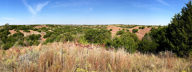
After we toured the rose garden and took a restroom break at the Garden Center, we drove over to Chandler Park in west Tulsa. Situated just west of the refineries along the Arkansas River, this high bluff above the Arkansas was once called “Lost City” because of its rugged cliffs. Perhaps early settlers thought cliff dwellers once lived there, or the cliff formations resembled a city as viewed from the river below. There have also been persistent rumors through the years that outlaw Jesse James once buried money, wrapped in a leather cloth, among the rocks. I doubt there is any money to be found here, but it is rich in outdoor recreation.

100 acres of this terrain is now Chandler Park. It was donated to Tulsa County in the late 1950s by Claude Chandler, president of Chandler Materials Company. Below the park run three routes: old Avery Drive from Tulsa to Sand Springs, the Burlington Northern Santa Fe railroad, and the Arkansas River itself. Avery Drive is a nice route dating back to 1914, when Cyrus Avery, who was an influential road planner and father to famous Route 66, built what was then called the South River Road along the west bank of the Arkansas River using convict labor from the prison at McAlester, Oklahoma.

My former colleague and dear friend Carrie Fleharty introduced me to both Avery Drive and Chandler Park back when she was living west of Tulsa in Prattville, and the Hendersons once took me to the Scottish Games at the park back before those were relocated to River West Festival Park. But I’d never walked the trails along the bluffs on the park’s northern edge. There are two small signs along the road announcing the “Lost City Trail” and “Rock Room Trail“, and the cliffs down there are popular with rock climbers, while cross-country runners like to zoom along the corridors between the large slabs of rock.

Chandler Park Trails

I didn’t remember where the trailheads were located, so we just parked at the eastern edge of the bluff area above Avery Drive. Just as we were about to take a stairway down to a lower area of the park, I realized I had left my camera back at the Garden Center. A call confirmed they were closed, and Wendy left them a message asking them to call me if they found my camera, but we never heard back from them. So we knew we would be relying on our iPhones to document this hike.

The road for the lower section of the park was closed, presumably to reduce usage and maintenance. Parks around here are always underfunded, and Tulsa County has gone through multiple rounds of closing park pools and the like. We located the eastern terminus of the trails and headed into the Lost City.

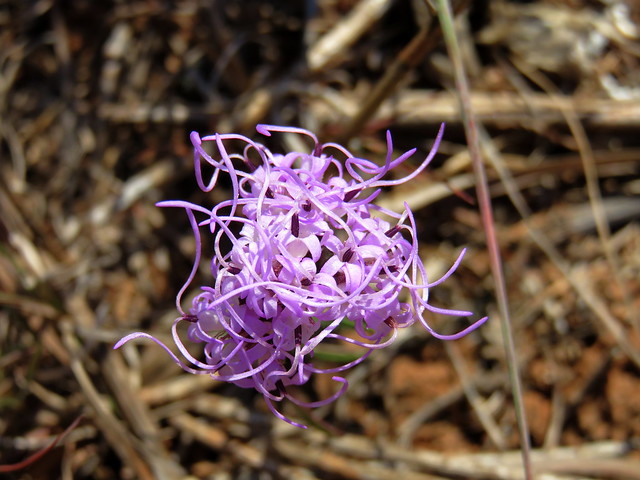
Soon we found ourselves zig-zagging through corridors of stone which were reminiscent of the Table Mound Trail at Elk City up in Kansas. A maze of rough trails gave us high and low options as we made our way west along the bluff. I had feared the trail would be marred, and there was some graffiti but thankfully little trash. The layered rock was interesting, although only the uppermost trails were wide and accommodating. There were few flowers, but some fungi.

A lost city?

Rock Room

Tree-covered slabs did somewhat resemble the ruins of lost buildings, and farther west we reached the rock room, a long stretch of broken bluff that formed a corridor of stone. So both trail names were apropos. Along the way we saw a few groups of rock climbers with their ropes and climbing shoes and other paraphernalia. At the lonely western end of the bluff I took us down a steep loop which wound around to the western terminus behind the park’s 16,000 square foot community center.

We were tired and hot from threading our way along cramped trails and took the park road back east to our car. But we plan to return to Chandler Park in late October to further explore this trail system. It is always fun to explore novel trails, and those are increasingly hard to come by close to home.

SLIDESHOW | MOSAIC

Posted in day hike, photos, travel | 2 Comments