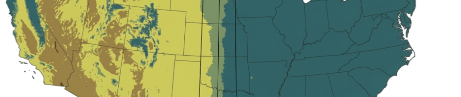

Oklahoma has an unusual amount of geographic diversity. Contrary to ignorant images of a giant dustbowl, the state has low rolling mountains and dense pine forests, cypress swamps, and tall grass prairies, as well as the expected flat and arid high plains. Something that interests me is how climate change is gradually shifting across Oklahoma the divide between the humid, rain-fed East and the arid, drought-prone West of the continental United States.
Our state contains many distinct ecological regions, offering more varied terrain per square mile than any other state as it transitions from the Rocky Mountain foothills and high plains in the northwest to the forests, swamps, and mountain ranges in the southeast.
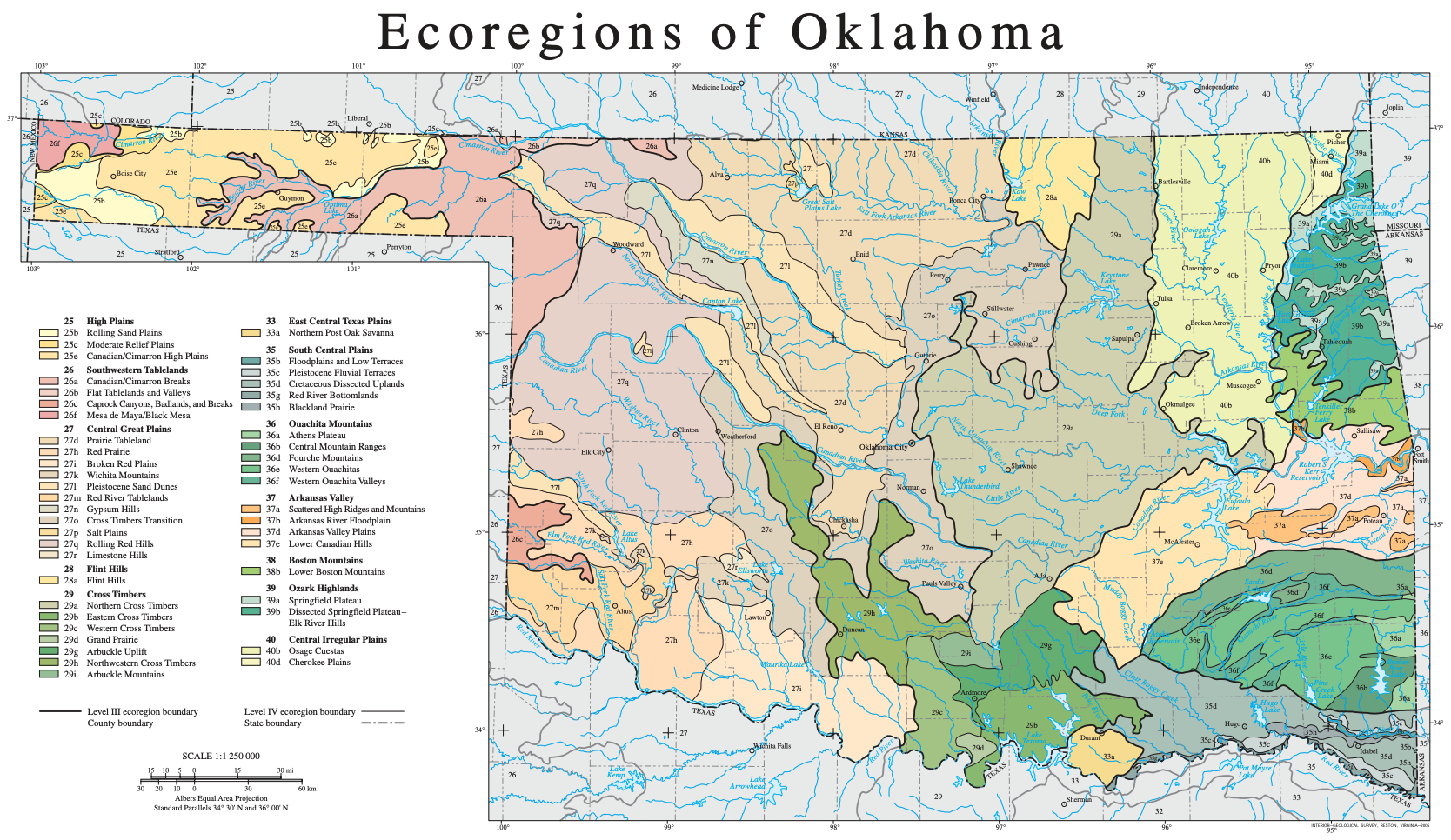
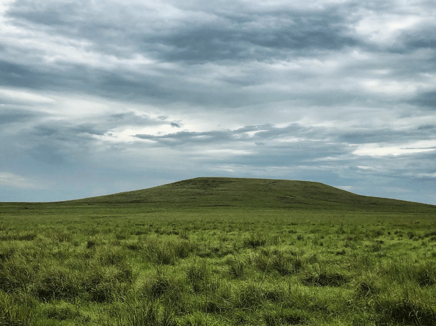
I grew up in Oklahoma City in the Cross Timbers Transition ecoregion, but I’ve lived more of my life in Bartlesville, which lies in the Osage Cuestas just beyond the eastern edge of the Northern Cross Timbers. You can tell the difference if you compare the Cross Timbers of Osage Hills State Park to the undulating plains east of Bartlesville, which in their natural state would be tall grass prairie.

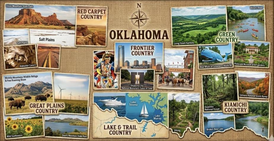
Back in 1960s, the state’s tourism department began taking advantage of its ecological diversity to promote six different “countries” within the Sooner State.
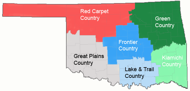
- Red Carpet Country has massive mesas and expansive prairies and is associated with the Cheyenne, Arapaho, Ponca, Pawnee, Otoe-Missouria, Tonkawa, and Kaw tribes and nations.
- Great Plains Country has wheat and cotton, stretches of mesas, and granite mountain ranges. It is associated with the Comanche, Kiowa, Apache, Wichita, and Caddo tribes and nations.
- Lake & Trail Country has multiple artificial reservoirs, the remnants of the ancient Arbuckle Mountains, and it is associated with the Chickasaw Nation.
- Frontier Country is a transition zone with sweeping short-grass prairies changing into woody, hilly terrain from west to east. It is associated with the Absentee-Shawnee, Citizen Potowatomi, Kickapoo, Sac & Fox, and Iowa tribes and nations.
- Kiamichi Country has miles of evergreen forests and multiple mountain ranges. It is associated with the Choctaw Nation. Culturally, we know it as Little Dixie.
- Green Country has lush rolling hills and lakeside resorts. It is home to the Cherokee, Osage, Muscogee (Creek), Delaware, Quapaw, Modoc, Ottawa, Seneca-Cayuga, Shawnee, and Wyandotte tribes and nations.
Bear in mind that few of those tribes and nations were in the area before white settlement and forced relocations. The region’s prehistoric peoples included the Wichita, the Caddo, and maybe some Osage and Apachean-speaking people.
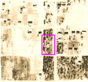
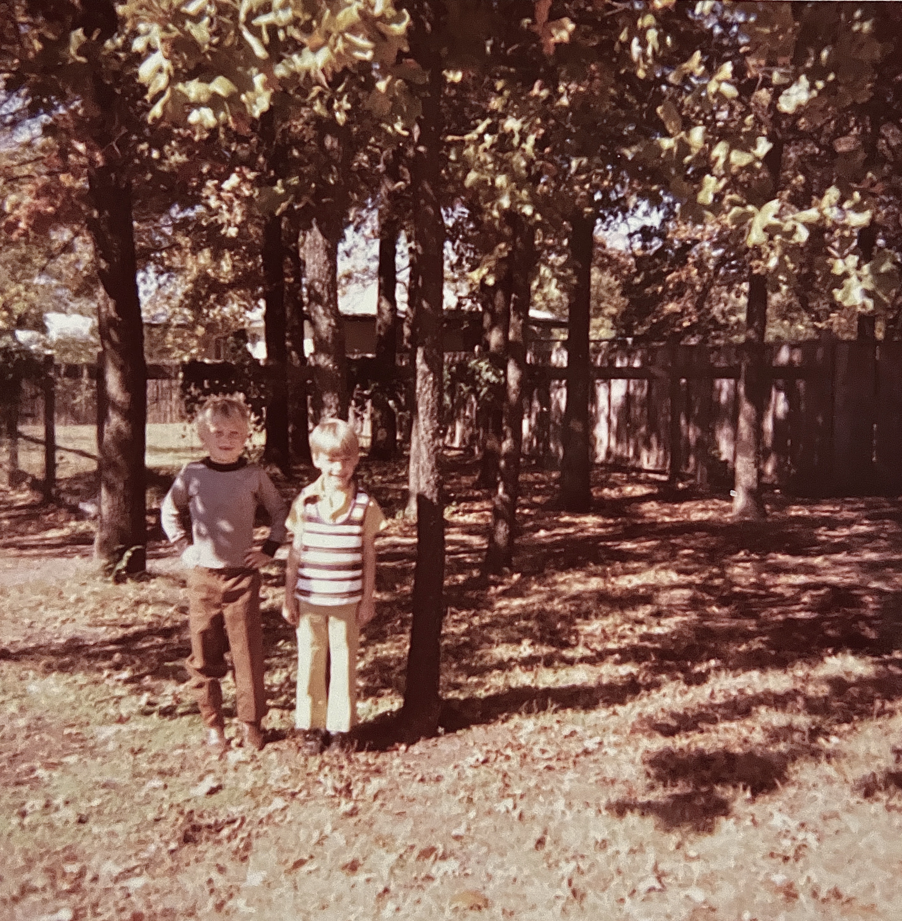
I grew up in Frontier Country in what was once Oklahoma Territory, spending my elementary school years living in the Cross Timbers where rugged post oak and blackjack oak grew on coarse, sandy soils. Our home sat on the middle of three city lots which back then were still filled with 70 blackjack oaks, surviving uncut within the 3.5 square mile Council Grove Military Timber Reservation established in 1874 to construct Fort Reno.
In 1884, barracks in Council Grove housed soldiers who cut timber for the fort. Council Grove was omitted from the 1889 Land Run that opened white settlement in the area, its opening being delayed until December 1899. The older part of our house had been constructed a half-century later.
My best friend and I reveled in raking up the tens of thousands of oak leaves, creating race courses for his Big Wheel and my pedal car. We would catapult ourselves into immense leaf piles. My father had a riding lawnmower and a dedicated leaf shredder to deal with it all, and eventually the dust, mites, and allergies from all of the trees led my parents to relocate.
Whenever we headed west from Oklahoma City along I-40, such as to piano contests at Weatherford or to camp at Red Rock Canyon, I was struck by how the flat grasslands contrasted with the hilly and rugged Cross Timbers along the Turner Turnpike when we would drive northeast from OKC toward Tulsa.
I love hiking at the Wichita Mountains and Quartz Mountain Resort in Great Plains Country. Red Carpet Country offers Roman Nose State Park, the Little Sahara sand dunes, and the high distant Black Mesa at the westernmost end of the panhandle. Kiamichi Country’s beautiful forests offer splendid hikes at Robbers Cave and in mountain ranges like the Kiamichi and Winding Stair. In Lake & Trail Country, I enjoy Turner Falls and the Chickasaw National Recreation Area amidst the ancient Arbuckle Mountains. Finally, I have spent 37 of my 60 years living in Green Country in what was once Indian Territory.
Oklahoma’s position near the center of the continental U.S. leads to discussions about whether or not it is truly a southern state as well as whether it is part of the nation’s east or its west. There are no definitive answers, as it straddles various dividing lines, but culturally it is certainly more south and west than north and east.
Back in 1878, geologist and explorer John Wesley Powell proposed that the 100th meridian west line of longitude demarcated the difference between the humid and arid regions. That happens to be most of the western border of Oklahoma.
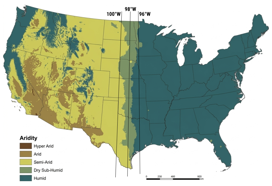
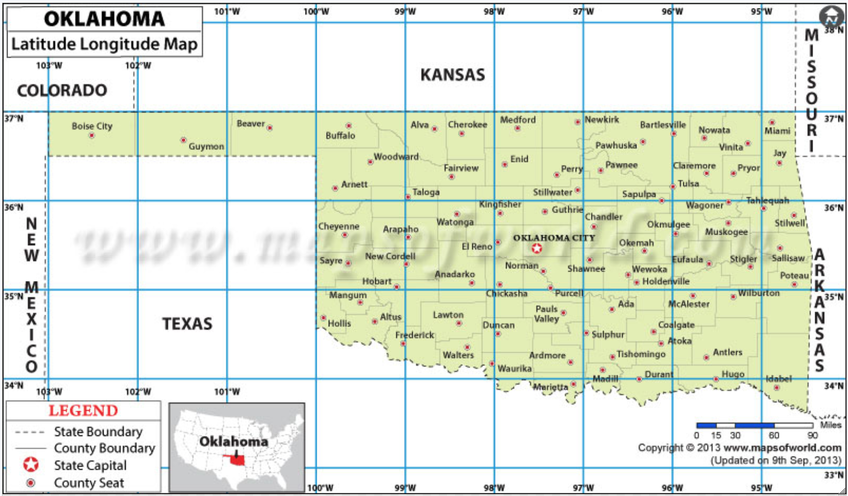
However, when researchers plotted the aridity index across the US from 1979 to 2016, they found that the aridity gradient had shifted to center on the 98th meridian. In Oklahoma, that aligns with Kingfisher, El Reno, Chickasha, Duncan, and Waurika.
By 2100, that gradient will have shifted to the 96th meridian which forms the western edge of Bartlesville and aligns with Tulsa and Okmulgee. In the 22nd century, Osage, Pawnee, and Creek counties will no longer be part of Green Country. The shift in climate is apparent in the droughts that imposed water restrictions in Bartlesville in 2001-2002 and again in 2022-2023.
Thinking about this led me back to a nifty interactive, based on research by the Rhodium group, that models how the continental US might fare with climate change over the coming decades.
They modeled the human climate “niche” to identify regions where temperature and precipitation have been most suitable for humans to live over the past 6,000 years. Bartlesville is currently very suitable, although I find our summers rather miserable.
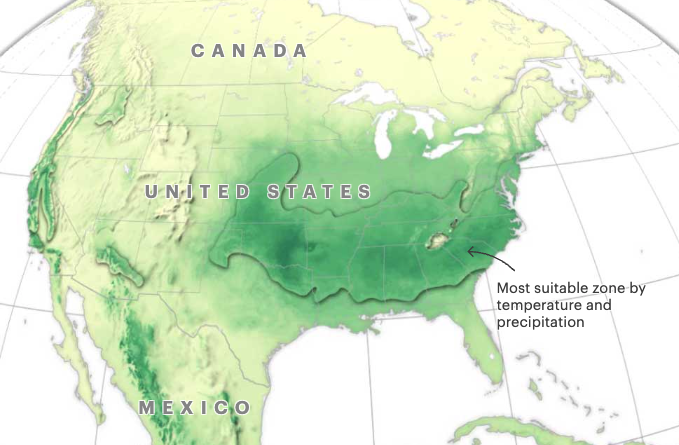
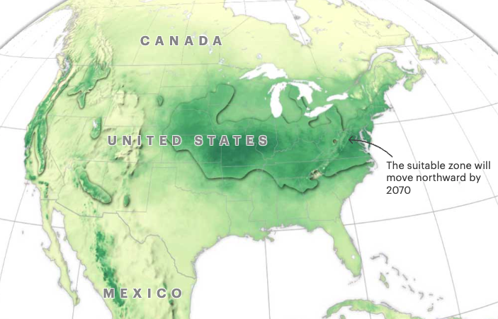
Here is what the niche looks like by 2070 in a moderate carbon emissions scenario. Bartlesville would remain in the zone, but Oklahoma City would not. That shifting aridity zone is more of a problem for the southern latitudes.
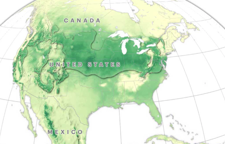
In the case of extreme global warming, which I consider more likely, Bartlesville would be near the southern boundary of the suitable zone. I find it interesting how northern and western New Mexico would become more suitable, along with the area south of the Great Lakes plus North Dakota and much of Montana.
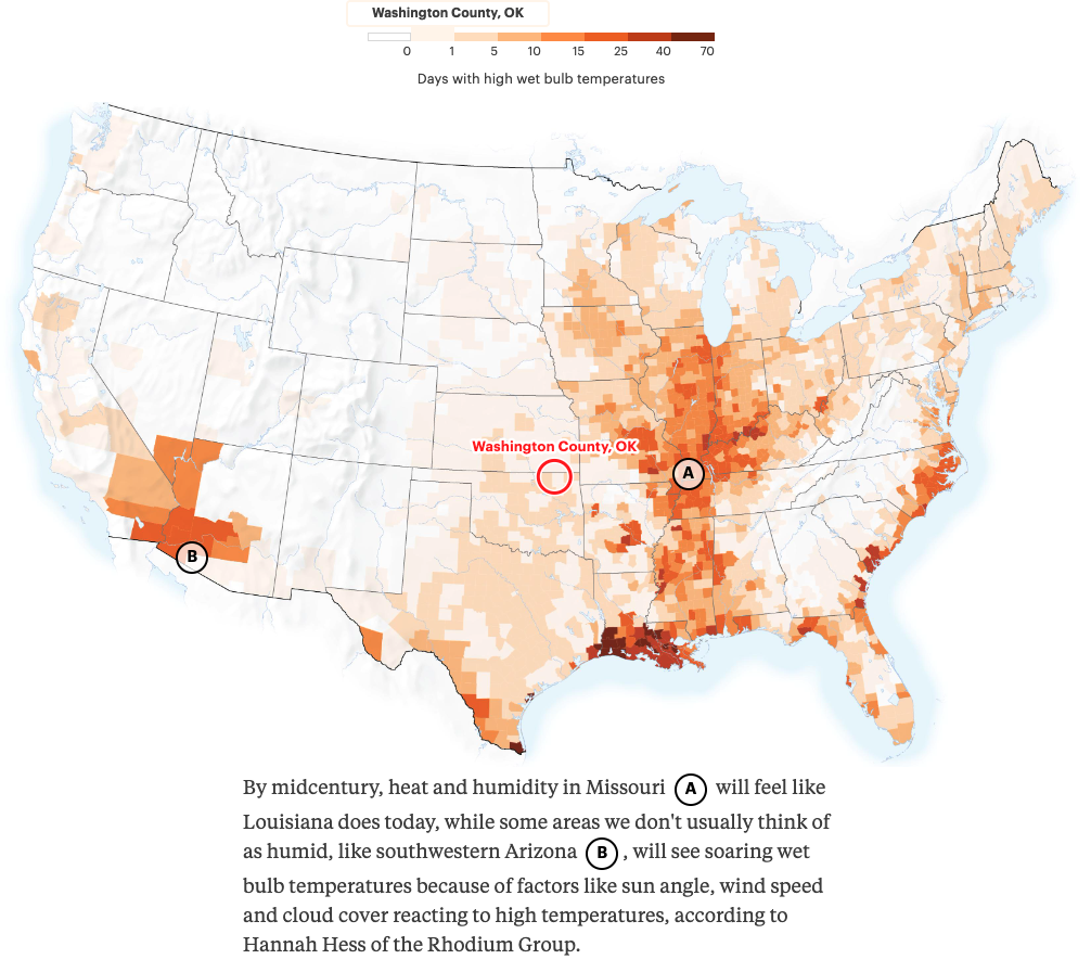
In the high emissions scenario, by mid-century Bartlesville would still only have one wet bulb day per year on average, when the body can no longer cool itself by sweating. So while we’ll have many more days of high temperatures, at least the humidity won’t make it as miserable as it will be in the states east of us.
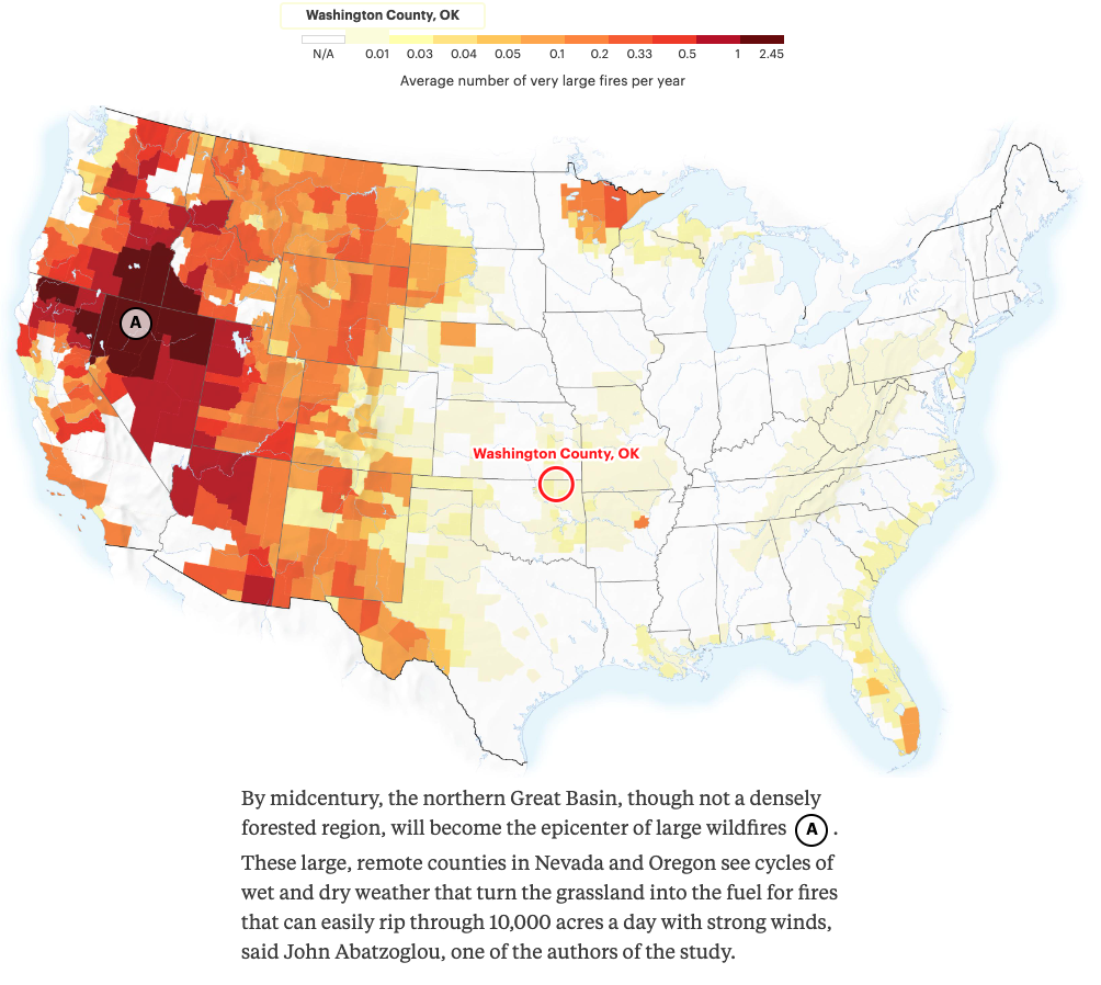
Washington County would only average a very large fire once per century, while northern Nevada and California, southeastern Oregon, and southwestern Idaho would become a wildfire zone.
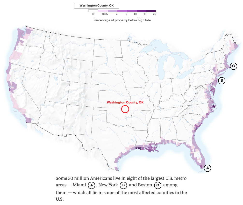
Sea level rise, of course, will not be an issue here, but the Chemical Coast of Texas and Louisiana, where 84% of US plastics are produced, will be in trouble, as will most of the eastern seaboard.
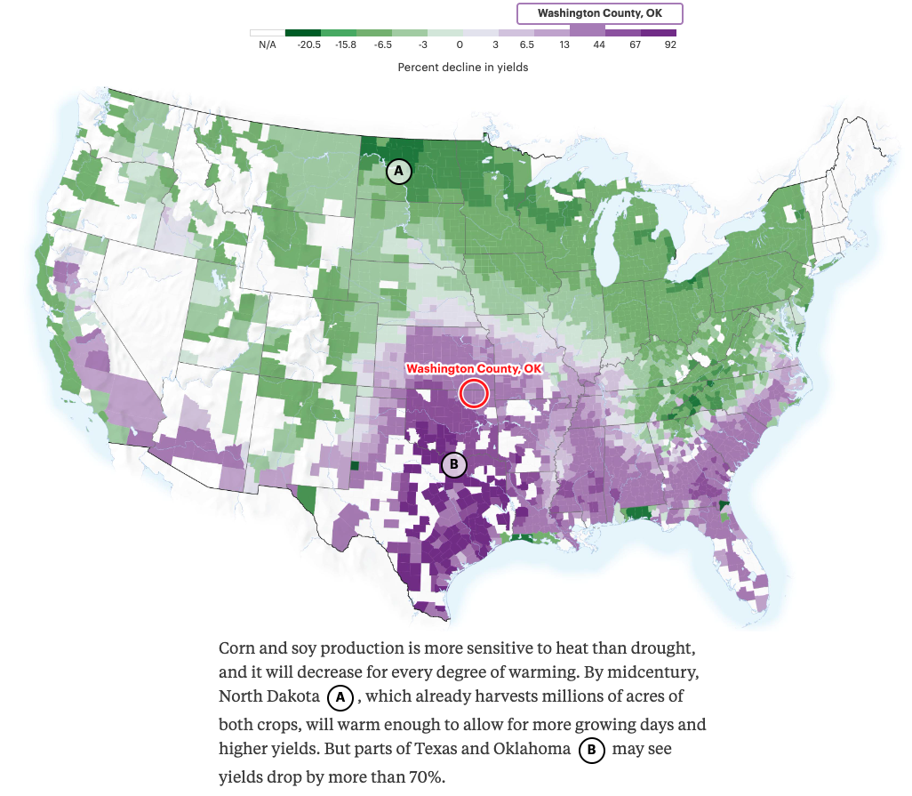
Farm crop yields will take a big hit around here while improving in the upper midwest, around the Great Lakes, and surrounding the Rocky Mountains.
Happily, Oklahoma is projected to have little economic damage, unlike our neighbors to the north and south.
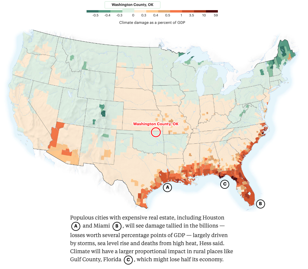
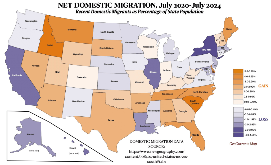
Domestic migration patterns show some people moving to areas that will become more livable over time, but the sun belt continues to attract many people, despite the inevitable and difficult adaptations to climate impacts they will face.








 Meador Manor
