Time for a break

October 18-20, 2018

Mid-October’s Fall Break in Oklahoma doesn’t coincide with our autumn colors, which don’t peak until late October and November. But it is still well-timed for us school folks, as we are ready for a respite after completing a quarter of a new academic year. Supporting and troubleshooting new technology services and helping with core curricular assessments has kept me scrambling, while Wendy and her Student Technology Support Team have ramped up to help dozens of high school students each day with their various Chromebook issues.

Home Improvements

On the home front, we had to shift most of our belongings earlier this month for new carpet to be installed. Meador Manor still featured its original 1981 salmon-colored saxony carpet. I didn’t have the money to replace it when I bought the house in 1994, and later put up with its traffic patterns, worn out pad, and even some torn seams to avoid the expense and disruption of replacing it. This fall’s hard-earned pay raise finally prompted me to take Wendy shopping for something better. We opted for a busy frieze carpet that disguises dirt and feels luxurious. Sooner Carpet installed Dreamweaver Stratosphere Leather carpet with new padding, and we are delighted.

Now that we finally have carpet worth saving, we have invested in protective mats for our rolling chairs, put down a tarpaulin and moving blanket to protect it in Wendy’s painting area, and moved our shoe rack to encourage us to change them when entering and thus avoid traipsing in dirt.

The consequent shifting of items and furnishings led us to purge some things we no longer used. I still read a book or two each month, but mostly using the Kindle app on my iPad or my Kindle Voyage. So after selling off 200 books in 2010 and donating over 700 to the public library in 2016, I boxed up even more of my books for donation. I’m now down to about 200 books on my shelves, having shed about 85% of my original collection.

Other home improvements this month include a new headboard, lamps, and nightstand for the guest room and installing an exhaust fan in the office window for Wendy to use when she is applying resin to protect her paintings.

With work and home improvements dominating our days of late, we planned our break to emphasize our hobbies.

Monarchs in Wichita

Slideshow | Photo Album

I took off Thursday in more ways than one since I took a vacation day and headed out to Wichita, Kansas while Wendy relaxed and painted at home. I was drawn there to the Botanica community gardens, which were started in 1987 by the Wichita Area Garden Council and the City of Wichita. They have grown to almost 18 acres and feature a butterfly garden, so migrating Monarchs were feasting there as part of their annual migration to central Mexico.

Monarch feeding in Botanica

I got various shots of them feeding on asters and resting amongst the mums.

Monarch in the mums

I enjoyed seeing a cute little ladybug and of course took some shots of roses for Wendy, including a bud and bloom of Fired Up.

Fired Up rose

Lake Leatherwood

Slideshow | Photo Album

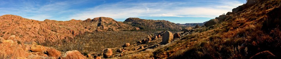
Wendy loves painting at home, but also was ready to get away. I knew she would enjoy hunting in the Ozarks for rocks with crystals, so we headed there for a short getaway.

It rained steadily throughout the drive eastward, so we stopped to see the exhibit Art for a New Understanding: Native Voices, 1950s to Now at Crystal Bridges in Bentonville. We both liked the vivid colors of The Storyteller: The Artist and His Grandfather by Norval Morrisseau, in which a Mayan influence was evident. His grandfather, the figure on the left, was a member of the Mideiwiwin Society who taught Norval traditional Anishinaabe religious doctrines and practices.

The Storyteller: The Artist and His Grandfather by Norval Morrisseau

The break wasn’t long enough nor had I planned ahead sufficiently to book a cabin at our preferred resort of Sugar Ridge at Beaver Lake. So I booked us for one night at a nearby hotel. The view was the best thing about that place, enough said.

Beaver Lake view

But at least it put us close to Eureka Springs’ Lake Leatherwood, where we could hike to a stream and Wendy could hunt for rocks while I took some shots by the dam.

The weather cooperated by turning bright and sunny on Saturday. After a nice breakfast at the Sweet-n-Savory Cafe, we drove over to Lake Leatherwood and hiked up the Beacham Trail. While Wendy hunted rocks, I ventured over to the dam and down to its base.  I got shots of the flowing water and sunlight streaming through leaves which had begun to show traces of fall color.

Lake Leatherwood Dam

The recent rain meant West Leatherwood Creek was flowing well. Folks were out on the water in paddleboats and canoes, and I always enjoy the powerful perspective found at either end of the linear dam.

Perspective

Luna moth caterpillar

Bugs were minimal this time of year, and butterflies were enjoying wild asters. As we were making our way back to the car along the Fuller and Fishing Trails, a large caterpillar inched across our path. Someday it will become a Luna moth.

It was great to be back on the trails after months of avoiding them in prolonged summer heat. We needed the break and now can make it through the next four weeks of work until we get a week away for Thanksgiving.

Posted in art, day hike, photos, roses, travel | Leave a comment

A Historical Trivia Challenge


September 23, 2018

Bartlesville is the seat of Washington County in northeast Oklahoma. The county is a north-south strip that is only about 10 miles wide and 40 miles long. The smallest county in the state, it lies along the eastern border of Osage County, the state’s largest. Named after George Washington, the county was formed at statehood in 1907 on land that had once been controlled by the Caddo, served as buffalo-hunting grounds for the Osage from 1760-1825, and then was part of the new Cherokee Nation after their forced relocation from Georgia.

Washington County is the smallest in Oklahoma

The first verified school in the county opened in 1874 at Silver Lake, one of the few natural lakes in Oklahoma, just south of modern-day Bartlesville, back when it was still Indian Territory. These days, the county is dominated by four school districts which serve 8,300 students. So how many one-room schools do you think operated in the county from 1874 through the closing of the last ones by the 1950s?

That was the first of a series of trivia questions I posed earlier this month when I was asked to share some history of the rural schools with the Washington County Retired Educators Association. Their request was prompted by my presentation to them a year earlier on the history of the Bartlesville schools.

School history can be a bit dull, even to an audience of retired educators! So my preparation including hunting for unusual things to highlight. The Bartlesville Area History Museum has a great book called Over a Century of Schools in Washington County: Gone But Not ForgottenThat was extremely helpful, but I also consulted the vertical files in the History Room at the Bartlesville Public Library.

Among the tales I accumulated were:

  • In 1912 a district saw its expensive school, which was less than two years old, burn up with the fire department forlornly looking on, unable to spray a drop of water on it.
  • The two largest oil tank farms in the world once enabled two county districts to build four rather fine school buildings, only one of which is still standing a century later. One of those districts had a fellow build the first school buses in the state, but they were all horse-drawn.
  • A tornado flattened one school in the 1930s while its two teachers and 70 schoolchildren sheltered in a ditch across the road.

That spiced things up, and I threw in additional trivia questions designed to confound my audience. If I have successfully whetted your appetite, dig in with my Google Slides presentation:


You can find much more information on Washington County at my long-standing history site of BartlesvilleHistory.org.

Posted in history, photos | Leave a comment

Arid Adventure, Part 5: Moab

TRIP DATES: June 13-15, 2018 | Slideshow | Photo Album

After completing our tour of Antelope Canyon and having lunch in Page, Arizona, we had a five-hour drive to reach our trip’s penultimate hotel in Moab, Utah. Although Moab is only 155 miles northeast of Page, and they both lie along the Colorado River, the highway route is 270 miles. One has to travel east for hours across the arid landscape of the Navajo Reservation before turning north. We turned off at Kaibito for a restroom break, but I allowed our TomTom GPS to guide us along a bumpy dirt road to return to the highway, something Wendy did not appreciate. She declared a moratorium on unpaved back roads for the remainder of the trip.

Sandstone Buttes

We passed sandstone buttes that reminded us we were passing within a dozen miles of Monument Valley, made famous in the westerns of John Ford. I’d originally planned to divert to see it, but couldn’t make that work out given the availability and timing of our slot canyon tour. So we only admired small buttes in passing as we journeyed to Moab.

Wilson Arch

We were both weary and hungry by the time we reached Wilson Arch, 24 miles south of Moab. It spans 91 feet and rises 46 feet above the desert floor and was the largest arch we saw on the trip, having decided to forgo Arches National Park just north of Moab to concentrate on other less popular attractions. Soon we were driving northwest up Spanish Valley towards Moab’s downtown at its far end.

Arriving late, we pulled into a Wendy’s for dinner. While driving back through town to the Best Western Plus Canyonlands Inn, we passed a truck that someone had converted into a hiking boot. In addition to hiking and mountain biking, the area also offers kayaking and boating along the Colorado River and four-wheeling across the desert mesas.

The small town’s catering to tourists comes after a uranium mining boom that began in the 1950s and lasted until the 1980s. The Christian Bible tells of Moab, lands located east of the Dead Sea. However, early residents of the Utah town were uncomfortable with the name, as the Bible claims the Moabites descended from a titular ancestor conceived when Lot’s eldest daughter, sheltering with him and her sister in a cave after the destruction of Sodom and Gomorrah, got him drunk and they incestuously conceived a son. Much earlier in its history, there were petitions to change Moab’s name, but those failed.

The next day we enjoyed lunch at Sweet Cravings Bakery & Bistro, and would return for lunch the following day as well. Their paninis were fresh and delicious. I had them put turkey and swiss with mayo and lettuce on sourdough, while Wendy ordered their Adventure Inn panini, substituting cranberry sauce for the mayo and adding jalapeño jelly and cream cheese.

After lunch we headed north past the Colorado River and turned west on Highway 313 towards Dead Horse Point. I’d read online that the free state park offered spectacular views of the Colorado and surrounding canyons and was a closer and free alternative to Canyonlands National Park.

Dead Horse Point Aerial View

The name was a bit offputting, arising from a legend that the point of the mesa high above the Colorado was once used as a corral for wild mustangs. Cowboys rounded them up, herded them across a narrow neck of land, and then fenced that off with branches and brush. Horses were selected from the herd corralled by the steep cliffs falling off on each side. The sad part of the legend is that the remaining horses were left to die of thirst, trapped on the point 2,000 feet above the Colorado.

Smaller mesas

Along the way, we paused to take in the panoramic view of Big Mesa to the north. Two smaller mesas were visible to the northeast.

The views from the Rim Trail as we approached the visitor center were impressive, with rugged eroded canyons in the foreground and background mountains.

Rim Trail at Dead Horse Point

Bright blue colors visible on the distant floor in the panoramic shot were not the Colorado River, which is quite green, but instead potash evaporation ponds lined with vinyl and partially filled with tinted water. Potash is potassium chloride and used in plant fertilizer. A mine pumps water down into the Paradox Formation to dissolve the potassium chloride salt. The water is then pumped up into the ponds to evaporate, leaving behind the salt to be harvested by twenty-ton scrapers.

At the park’s visitor center, we took in the sweeping view to the east. The Colorado River meandered by 2,000 feet below. We enjoyed shopping at the gift shop, which was well stocked with interesting items. It was a short drive south from there to the point itself, where we passed through an example corral fence at the neck.

Panorama from Dead Horse Point
Selfie at Dead Horse Point

There was an overlook of a gooseneck bend in the Colorado at the point, with a large structure offering welcome shade. We had come prepared for the harsh ultraviolet assault and posed for a selfie in our wide-brimmed hats. Then we took in the view of the basin to the west. Thousands of feet below we could spot rafts cruising on the Colorado.

Basin view at Dead Horse Point

That evening we drove to the south end of Moab and circled back along its east side, climbing the valley wall toward the sand flats for panoramic views to the south towards the red cliffs of the valley’s opposite wall and the peaks of the La Sal mountains 20 miles to the southeast.

East Side of Moab 2

The terrain was rough and varied as we climbed towards the sand flats. Enthused by the views in the golden hour of the evening, we decided to drive north to the Colorado River and drive east along Highway 128 along its south bank.

Highway 128 along the Colorado
West toward Moab

Sheer vertical cliffs, stained with desert varnish, rose to 900 feet above river as we meandered 15 miles upstream to the northeast.  It was another stunningly beautiful scenic drive in Utah and a wonderful end to the day.

The next day we packed up for the return to Salt Lake City. We stopped in at Sweet Cravings again for lunch, and Wendy enjoyed shopping at Lin Ottinger’s Rock Shop. Then we drove northwest for 4.5 hours to the airport in Salt Lake. We saw rain falling across the landscape and odd yellow gaps in the storm clouds.

Storm as we headed to Salt Lake

Eventually we were headed north on I-15, managing to hit rush hour traffic as we drove north along the Wasatch Range. Trixie the TomTom GPS app guided us along, warning us about impending traffic jams and how long it would take us to clear them. It steered us onto the I-215 beltway to finally arrive, road and traffic weary, at a Courtyard by Marriott. We checked in and walked over to Roberts Restaurant for a delicious dinner. Wendy enjoyed some salmon, while I feasted on an excellent steak.

The next morning we checked our Ford Fusion in at the airport and flew back to Tulsa. After so many days in the arid high desert, we both were struck by how green the landscape appeared as we descended. We were back in Green Country and glad to be home.

I suspect that we will aim for a cooler area of the country for our June 2019 getaway. But we enjoyed some truly spectacular scenery looping across the high deserts of Utah and far northern Arizona on our arid adventure.

Slideshow | Photo Album

< Arid Adventure, Part 4: Antelope Slot Canyon

Posted in photos, travel | Leave a comment

Arid Adventure, Part 4: Antelope Slot Canyon

TRIP DATES: June 13, 2018 | Slideshow | Photo Album

The anchor for our trip was one of the shortest, yet most beautiful, hikes we will ever enjoy: a walk through the Upper Antelope Slot Canyon. Its popularity and location in the Navajo reservation require one take a guided tour with a licensed operator. Months ahead of time I opted to book with the company founded by the late Ray Tsosie. I knew we would prefer a mid-day tour so that hopefully sun rays would penetrate into the narrow canyon for memorable photographs.

Upper Antelope Slot Canyon Aerial View

At 10 a.m. we dutifully showed up at the tour store, a converted gas station in downtown Page. We checked in and waited to board one of the old pickups outfitted with passenger benches in its bed for the ride from downtown Page. Our guide was Leonard Nez, a tall Navajo with a dry wit. He took our tickets as we boarded with a group of German tourists and told us to hang on.

He meant it. We cruised the 4.5 miles to turn off Highway 98 at a wide and dry section of Antelope Creek’s bed. Then we had a very bouncy and fun three-mile ride along the sandy creek bed to where the creek cut a 500-foot long narrow slot the Navajo call Tsé bighánílíní, which means ‘the place where water runs through rocks’. When we pulled up at the entrance to the canyon, Leonard got out, and with black humor, silently pointed and counted his jolted passengers to see if anyone had fallen out along the way.

Entrance to Upper Antelope Slot Canyon

Rainwater, especially during monsoon season from mid-June to late September, collects in the Antelope Creek basin above the slot canyon sections. Its velocity and sand load increase as it rushes into the narrow slots, eroding passageways. Another similar short section of canyon farther downstream, the Lower Antelope Slot Canyon, can also be toured. That part is longer than the Upper Canyon, and narrower in spots, with some uneven footing and has five flights of stairs, while the Upper Canyon is a smooth and level walk with more frequent sunbeams.

Leonard ensured we had no packs. Some folks in the past spread cremation ashes in the canyon, requiring that it be closed so a medicine man could bless and cleanse it. Flash flooding also closes the canyon, of course, and a 36-hour flood in 2006 kept the Lower Canyon closed for months; 11 tourists died there in 1997.

Our visit, however, was sunny and hot with no rain. It was a relief to enter the canyon’s shadows, with Leonard rapidly taking and setting each of our cameras for better shots.

Near the entrance

The beautiful smoothed sandstone walls rose high above our group, and Leonard began stopping and using a laser pointer to help us imagine bears, famous profiles and faces, and other animals from the undulating shapes and projections. We passed a tree limb that had been stranded high up on the walls for many years after it was deposited by a flood.

Leonard enjoyed taking clever shots for us, such as the eye and the wave, and threw sand high into the air when we encountered a sunbeam, making its track through the air visible.

Sunbeam

Expertly herding us along, giving directions and guidance in various languages, Leonard led us through the sinuous passage. When needed, he redirected inconsiderate tourists who got lost in their own little world. The colors shifted with the angle of the rays and the width of the slot, until we reached the far end of the twisting passage.

Far end

There we relaxed before reversing our path. As some oblivious Asian women chattered away, Leonard sat and played the triple flute for us, prompting a crow overhead to caw loudly.

On the rapid return through the canyon to the truck, I took Leonard’s advice to silently and discreetly duck behind one of the photography tour groups so I could get a nice shot of one of the light shafts.

Light shaft

Our group of Germans with a couple of Okies boarded the truck to bounce our happy way back to Page. This brief but memorable experience was Wendy’s favorite part of our trip.

We returned to Gone West for lunch before heading out on a 4.5 hour 270 mile journey east and north to Moab, Utah where we would visit Dead Horse Point and drive along a beautiful stretch of the Colorado River.

Slideshow | Photo Album

Arid Adventure, Part 5: Moab >

< Arid Adventure, Part 3: Down the Grand Staircase to Lake Powell

Posted in day hike, photos, travel | 1 Comment

Arid Adventure, Part 3: Down the Grand Staircase to Lake Powell

TRIP DATES: June 11-12, 2018 | Slideshow | Photo Album

The highlight of our trip would come at the lowest point in our looping journey: a walk through the Antelope Slot Canyon near Page, Arizona. So we needed to make our way south out of Utah down to the Glen Canyon Dam which impounds Lake Powell. The terrain meant we would have to drive a long arc west, south, and then back east.

Scenic Highway 12 continued to impress as we traveled west toward Bryce Canyon. A few small towns dot the arid Bryce valley. After we found that Foster’s Family Restaurant in Bryce was now the UpTop Steakhouse and only open in the evenings, we backtracked to Tropic for lunch at Rustler’s Restaurant.

Tropic was named by pioneers seeking to promote it as a more temperate location than its competitors. In the late 1880s, the Mormon farmers in the area diverted water from the East Fork of the Sevier River into the often-dry Paria River drainage to irrigate their fields. They dug, mostly by hand, a 15-mile ditch which still runs today. We saw the Sevier River’s water flowing through the Tropic Ditch near the Mossy Cave Trail at the north end of Bryce Canyon.

Tropic Ditch near Mossy Cave Trail at Bryce Canyon

The surrounding hillsides had the characteristic look of the famous eroded amphitheaters of Bryce Canyon National Park a few miles to the southwest, which nature carved out of the pink Claron limestone of the Paunsaugunt Plateau. Unlike the Grand Canyon, Bryce was not carved by flowing water, but instead by frost-wedging and chemical weathering.

Bryce Canyon erosion

For 200 days a year the temperature cycles above and below freezing in that area of Utah. During the day, melt water seeps into fractures only to freeze at night, expanding by 9%. The ice exerts a tremendous pressure of 2,000-20,000 pounds per square inch. Over time this “frost-wedging” shatters and pries rock apart. In addition, rain water, which is naturally acidic, slowly dissolves the limestone, rounding off edges and washing away debris. This creates fins of rock jutting out from the cliffsides, which then erode into free-standing hoodoos.

Red Canyon formations
Road Arch at Red Canyon

We shopped for trinkets in Bryce and then continued our journey west. A dozen miles across the northern end of Bryce Canyon, Highway 12 runs through Red Canyon, the western edge of the valley, with its own erosion of the Claron limestone. The road passes through two manmade arches in the rock, which were fun to drive through.

Too soon we left Highway 12, and the rest of the drive to Page was uneventful. We followed highway 89 down the Grand Staircase, a term Clarence Dutton coined for the steady descent, layer by layer, through the sedimentary rock formations from Bryce Canyon south to the Grand Canyon. The pink cliffs of Bryce give way to grey, then white, and eventually the Vermilion Cliffs we had driven by the previous summer, ending in the chocolate cliffs that form the top layer of the Grand Canyon.

The high desert we drove through heading back east in far southern Utah towards Lake Powell was quite inhospitable. It became even more desolate as we dipped south into Arizona. It would never occur to one to stop and stay in Page, Arizona were it not for the formidable Glen Canyon Dam and associated natural and man-made wonders.

High Desert of Southern Utah

The 710-foot high dam was built by the U.S. Bureau of Reclamation from 1956 to 1966 and has always been controversial. Edward Abbey wanted to wreck it in The Monkey Wrench Gang, and Marc Reisner delineated its downsides in his superb history Cadillac Desert. The level of Lake Powell fluctuates considerably, but it has never recovered from a drought in the first years of the 21st century. While its full capacity ranks it as the second-largest man-made reservoir in our country, global warming and the increasing demands on the Colorado River mean it could eventually become a “dead pool” that can no longer generate hydroelectric power.

Lakes Mead and Powell have not recovered from the drought of 2000-2005

We were glad to arrive at the Days Inn in Page, where we had a nice dinner at the Gone West restaurant. The next morning we drove to the Wahweap Marina for an Antelope Canyon boat cruise. Wahweap is a Paiute word meaning “bitter water” and dates back to when the mineral-laden trickles of water in the area were unattractive. Now all that and much of Glen Canyon is subsumed under the cool clear waters of the lake.

There was quite a crowd in the marina waiting to board the boat, hiding from the brutal sunlight outside. We sat on the upper deck by a retired couple from New Jersey. They were fun to visit with and in the middle of their own adventure out west with some other retirees. I wore my Tilley hat, of course, but made the mistake of wearing shorts and forgetting to protect my legs with sunscreen. The heat and sunlight were intense, leaving me with an itchy sunburn by the end of the 90-minute cruise.

Castle Rock on Lake Powell

Our boat took us past the dam and Castle Rock. All around us were the red cliffs of the uppermost layers of Glen Canyon and the “bathtub ring” of mineral deposits from back when the lake was actually full decades ago.

Walkers above the bathtub ring

We zoomed by the cliffs and eventually headed up Antelope Canyon. Our massive vessel cruised up the winding canyon, following a much smaller boat. I was surprised at how far we could make it up the winding and narrowing canyon formed by Antelope Creek.

Our course up Antelope Canyon

Desert varnish stained the walls of the canyon, reminding me of the stains at Echo Amphitheater near Ghost Ranch in New Mexico. This natural patina is primarily clay particles with iron and manganese oxides.

Desert Varnish at our further penetration of Antelope Canyon

The weathering in some places exposed the layers of sedimentary rock, created hoodoos, and in spots yielded bright orange sand. There were quite a few houseboats on the lake, although for me the intense heat and sunlight, with little vegetation, left me with little desire to linger.

Sediment layers

We returned to the marina and struggled to cool off inside the resort before heading back to Page. That afternoon we laundered clothes, and I bought some aloe vera gel for my sunburned legs. The next day we would revisit Antelope Canyon via a guided walking tour through its upper slot canyon.

Slideshow | Photo Album

Arid Adventure, Part 4: Antelope Slot Canyon >

< Arid Adventure, Part 2: Escalante

Posted in photos, travel | Leave a comment